There is no question that it has been a mild January so far, and all signs continue to point to a warm month overall. Any storm systems that we get along the coast or interior will likely be all rain, with some ice or wintry mix in the mountains such as today (Sunday).

But what about later this month and early February? Much of January is looking above normal so we are not optimistic that we will get any kind of sustained cold or winter storms. There could be some storm systems later this month, and there will likely be. But they are looking like mainly rain. Lots of brown ground and mud, as there is now. But it will be more noticeable later this month since all the rain will create more mud.
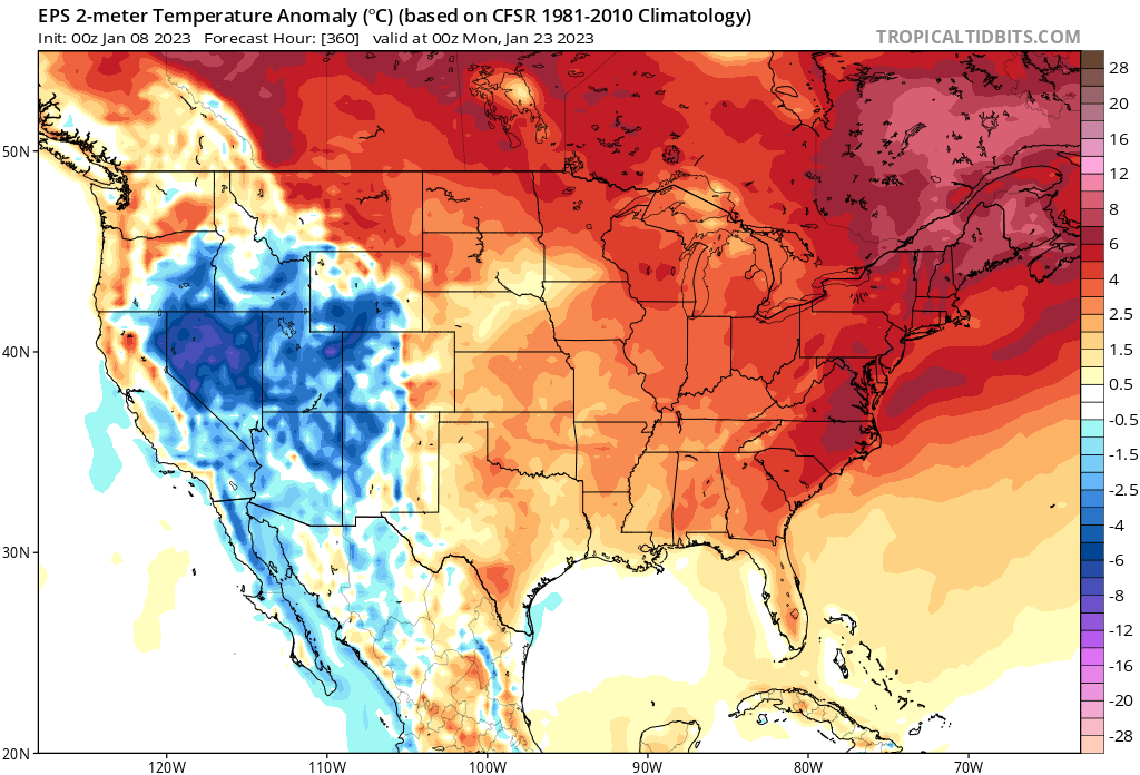
If we fast forward to the 23rd, we see at the end of the Euro ensemble run, it is still warm:

However, after this timeframe the Euro Weeklies and the GFS Weeklies are indicating a cooldown back to normal from the 25th or so into the 31st, and to start February.
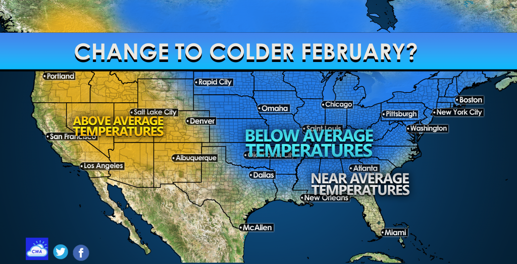
Then, the Euro weeklies have us below normal from the 6th to the 13th, but the GFS weeklies have us near normal. But around 2/6 is when we see some more cold air moving back in on the Euro.
So if we go between these two models, we can say that after the first week of February we will transition to slightly below average to near average of what your typical temperatures are for that time of year. But this can change as we get closer and the pattern becomes more clear.
Typically February is the snowiest month for the Carolinas, so this makes sense that we could have a shot at a winter storm in the first half of February. And by that we mean your typical sleet south of 85 and snow north. But hey, at least it won’t be a snowless winter, as it’s usually not here.
Share this article using the buttons below if you like these long-range forecasts!


You must be logged in to post a comment.