
WARMUP WITH RAIN AND THUNDER, THEN COLD
Through the end of the week, we can expect a gradual warm-up to continue. As each day passes, the chances for rain go up. There will be a weak cold front moving through the Northeast, which will touch of showers and even thunderstorms into Friday. This front moves through and high pressure takes charge for the Mid Atlantic and Northeast, but then more rain is possible on Sunday or Monday. Another cold front will push through, however the rain will be ahead of it, and possibly even severe storms. It won’t be until next week when we get another pattern change to colder.
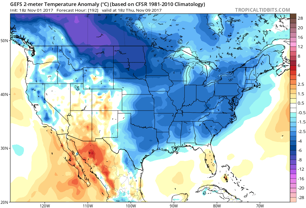
The GEFS ensembles are starting to agree on below normal temperatures around the 9th. This is not technically an extremely cold outbreak, but what’s interesting is all that VERY cold air that will load up in Canada. If any of that tries to spill East, it could be on for some cold shots frequently through Mid-November. This all starts around the 9th. We will have to see if it lasts into mid-month or not before we can say it will be below normal the whole time.
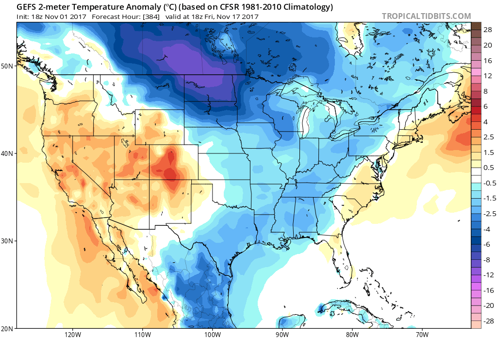
However, once the pattern change comes, it might actually be able to hold for a while. Ensembles are not indicating any kind of pronounced warm-up through mid November, other that the one we are experiencing right now, and was expected. If the cold that comes on the 9th is well below normal, then we could stay that way into mid-November.
GEFS NOV 9TH:
GEFS Nov 17TH:
Make sure to like us on Facebook by clicking here >>> https://www.facebook.com/eastocoastwxauthority
-Mike G.
You must be logged in to post a comment.