
This weekend does not look like a complete washout, although some locations in eastern NC and VA will see rain hang around for a bit on Saturday. As Saturday progresses, we should see much of the rain move away to our east and eventually offshore. This means one thing, and that means we heat up again.
Below is the legend for what you can expect for your area.
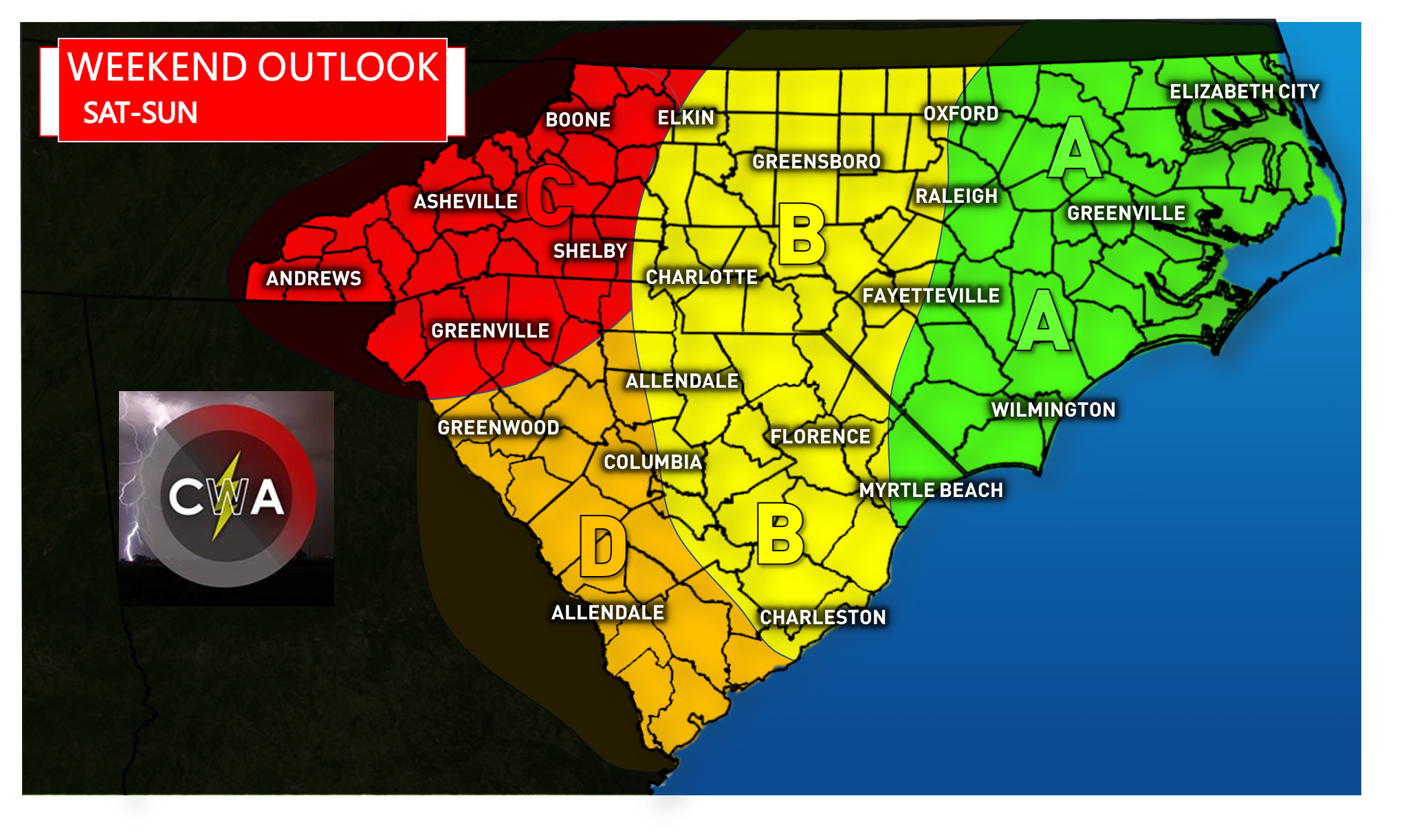
Area A – Rain will still be around early Saturday and through mid-afternoon. Then the rain should move away by Saturday night. Daytime highs will not make it out of the upper 80s. Sunday this area is dry and then we could have highs in the low 90s.
Area B – More clouds than sun to start Saturday, although there could be a few showers left behind before they move away. Highs could reach the low 90s in spots where the sun comes out for a longer period of time. Dry on Sunday, with highs in the low 90s.
Area C – Mainly dry for Saturday but with the risk for thunderstorms, some severe on Sunday. Highs both days in the upper 80s.
Area D – This area will see a mainly dry Saturday but there could be a few remaining clouds. Where the sun breaks through we will see highs in the low 90s Saturday and low 90s on Sunday. Sunday is a completely rain-free day.
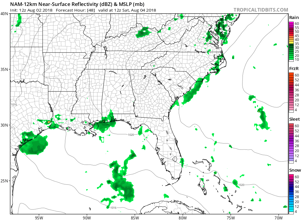
The high-resolution NAM model shows the bulk of the rain breaking up and moving out to sea on early Saturday. This is not a forecast but rather a trend that we used for the above forecast.
We hope you enjoy your weekend in the sun and fun and also stay safe!
If you liked this article please share with your family and friends using the button below! Also check out the rest of our latest news >>> https://carolinawxauthority.com
Carolina Weather Authority
You must be logged in to post a comment.