
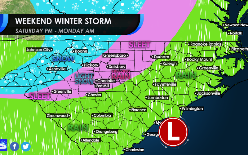
This is our honest-to-goodness update as to what likely scenario will unfold in reality. It’s hard to grasp reality if you’re a winter weather lover. We will see our fair share of sleet for sure in the pink in and around Charlotte. There could be some icing also, causing trees and power lines to fall. So be prepared for power outages in the purple/pink.
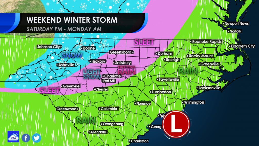
Elsewhere to the south and to the coasts, we can expect mainly rain. Warm ocean air will cause mostly rain since it will be too warm for any frozen precip. This may disappoint snow lovers to the highest degree. Even interior VA may have some more sleet totals than they do snow.
The mountains will receive the biggest thumping of snow. Some locations may get a foot or more in the higher elevation.
For most of us in the Charlotte metro, we can expect an icy mix, so travel late on Saturday and all day Sunday is not recommended. Freezing rain causes roads and sidewalks to become dangerous, and is a possible scenario with this system.
Everything should be over by midday Monday.
You must be logged in to post a comment.