
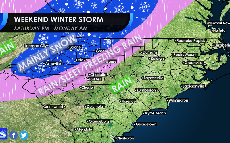
Our winter storm for this weekend is trending, and yes, we realize that we posted a map last night with much more snow coverage than now expected.
Anywhere south and east of I-85 can expect rain from this system (big surprise). It’s the South, and there is always a warm air situation that kills many snow forecasts. However, we may have some kind of frozen precip to deal with along I-85 including Charlotte.
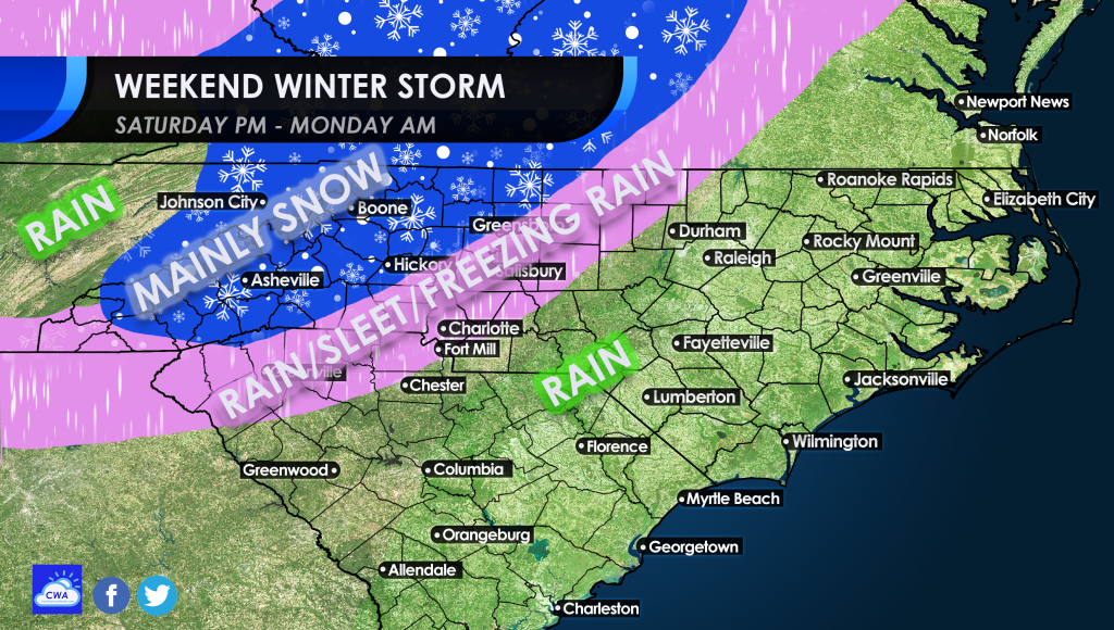
We are shooting for accuracy here, and no hype, and the above forecast is our realistic thoughts as to what will likely happen. Some are saying all out ice storm, but this system will be moving too fast for any serious ice buildup. But there could be some icicles in the trees in the pink. Some flakes could mix in at times in the pink, and the chances of a coating of snow are higher as you go north.
In the mountains and foothills is where we can expect to see the most and consistent snowfall, but it could be mixed with sleet at times.
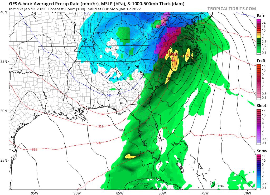
There could be a changeover to some flakes in the pink areas as colder air moves in later during the storm. But along the coast and in eastern SC and NC, all rain can be expected.
If you want to see snow, the mountains are the best bet, and even the foothills.
Please consult your local NWS office before traveling and for all safety information and for official decision making.
You must be logged in to post a comment.