
Yes folks, for those of you that wanted snow in the South, your wish is going to come true this weekend. Again, it’s not wise to flood the stores and clean off the shelves, since snow melts rather quickly in the South and you won’t be stuck at home for days. But it could be for a day or two.
We’re just hoping there’s not a lot of ice, but with this system it looks more like snow and sleet. And amounts are too soon to talk about.
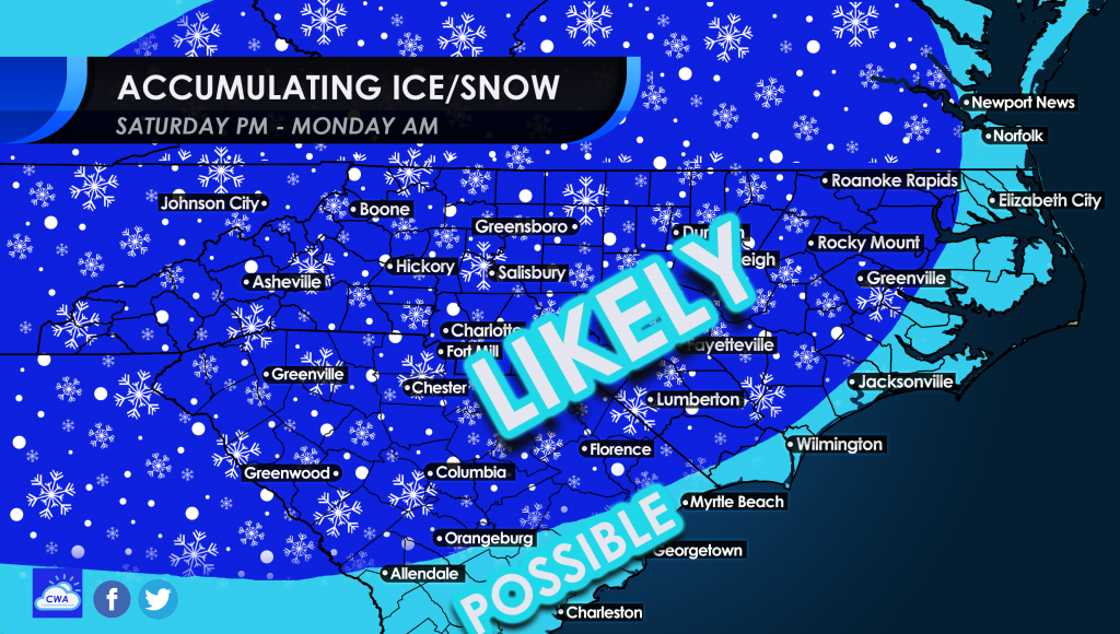
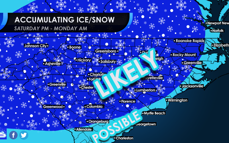
Much of the region will see accumulating snow in some amount. While not very likely, the coasts of SC and NC could see some flakes or even some sleet. Nothing is impossible with this next system, so those along the coast may also want to stay tuned.
The timing of this system looks to be from west to east starting Saturday night, and could last into Monday for parts east, especially parts north and east.
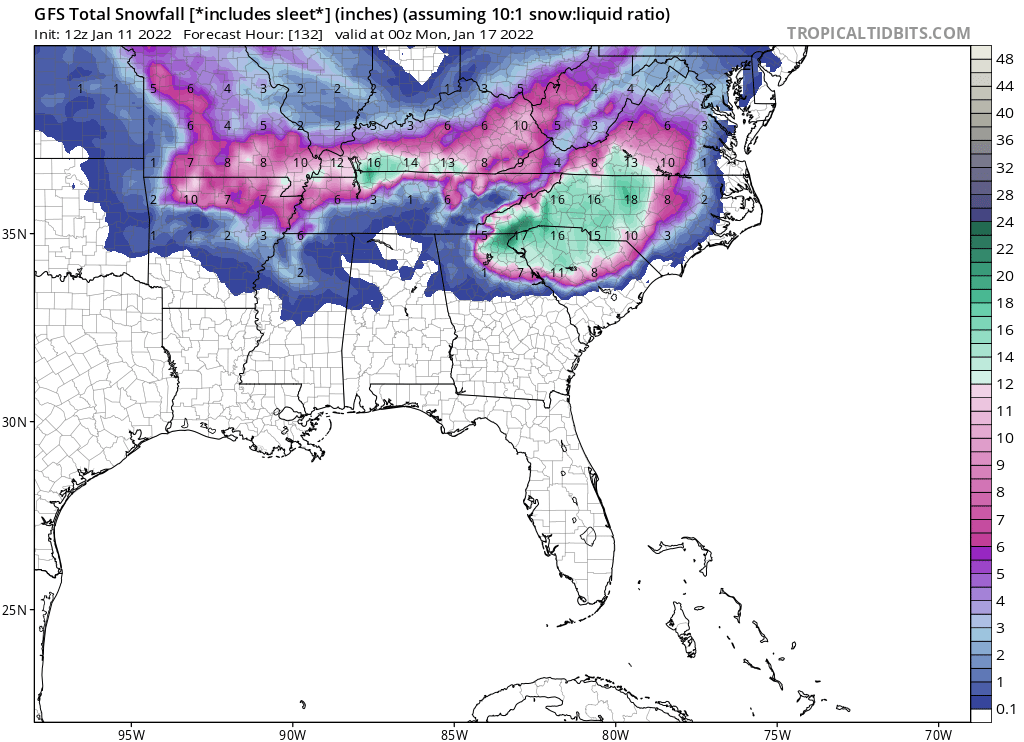
The GFS model below is being thrown around on FB, but keep in mind, these totals include sleet. So the snow totals might have to be cut way down, but not to zero.
This is a pretty rare treat for the South, as it’s been years since a decent snow event that extended into SC. Keep in mind, roads become dangerous in the South with any ice or snow, since local towns are not equipped to deal with such.
Don’t freak out, but rather enjoy, since wintry weather does not “stick” around in the South.
Don’t worry and keep following our page!
You must be logged in to post a comment.