
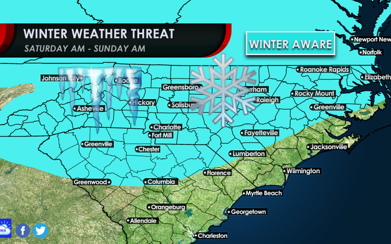
Well snow and cold lovers, your time to shine is coming this weekend. We are not saying everyone in the blue outline is going to get snow, but everyone within the outline should be “winter aware” heading into this weekend.
There are still many factors at play as to who will see how much and when, and where. But we are tracking a consistent system on the models that won’t go away for this weekend.
This looks to be a very hybrid setup as an Alberta clipper nosedives southeastward Saturday into Sunday and forms a stronger low pressure area as it glides along the Southeast under substantial high pressure to the north. Typically, Alberta Clippers don’t make it nearly as far south as this one is projected to by modeling, but strong high pressure to the north will shove it well to the south and may allow it to spread wintry precipitation, perhaps significant to potentially a large portion of the Southeast, including the Carolina’s.
As you might imagine, model divergence is fairly noticeable at this time as we are several days away from the start of the event. Ensemble modeling is certainly the best analysis we can be offered at this early juncture, so let’s take a look at what some of our ensembles are lending:

The European ensemble (EPS) appears to have more of a positive tilt to the system, which would potentially mean a weaker and more progressive system, but still potentially impactful for some areas.

Meanwhile, the GEFS seems to be more amplified as the trough develops more of a negative tilt, which allows for a more amplified area of low pressure to develop, especially near the coast. This would increase moisture and perhaps duration of the storm for some areas, resulting in heavier snowfall for some regions.
Models, including even ensemble modeling will continue to sway from run to run at least somewhat for the next few days. Don’t make any sudden plans at this time, but do be aware that the Carolina’s could be looking at a winter weather system this weekend that could have impacts from Interstate 20 northward. Our zone for potential wintry weather may be adjusted soon, so make sure to check back for details as we track this potential upcoming winter storm.
Will it be cold enough for it to snow? Perhaps. Will there be a sufficient moisture source? Maybe. Are the upper-atmosphere dynamics coming together for a Southeast storm? Check back soon! We need to watch the trends on the models, and they will change potentially quite a bit on this system so stay tuned.
One thing: PLEASE do not clean off the shelves at the markets, as we also want milk, bread, and especially tp, too.
You must be logged in to post a comment.