
This month the battle between winter and spring has been in full swing. Throughout this month below average temperatures and east coast snowstorms have battered the Eastern US. Also, March has been colder then February for many places across the Eastern US. This week we will take a step away from winter, but winter will return with below average temperatures and even another chance at some snow as the pattern will be prime.
Before we begin April, spring will finally show across the Eastern US as we will return to average and slightly above average for many along the East coast.
GFS 2m Temperature for 18z WED March 28th, 2018:
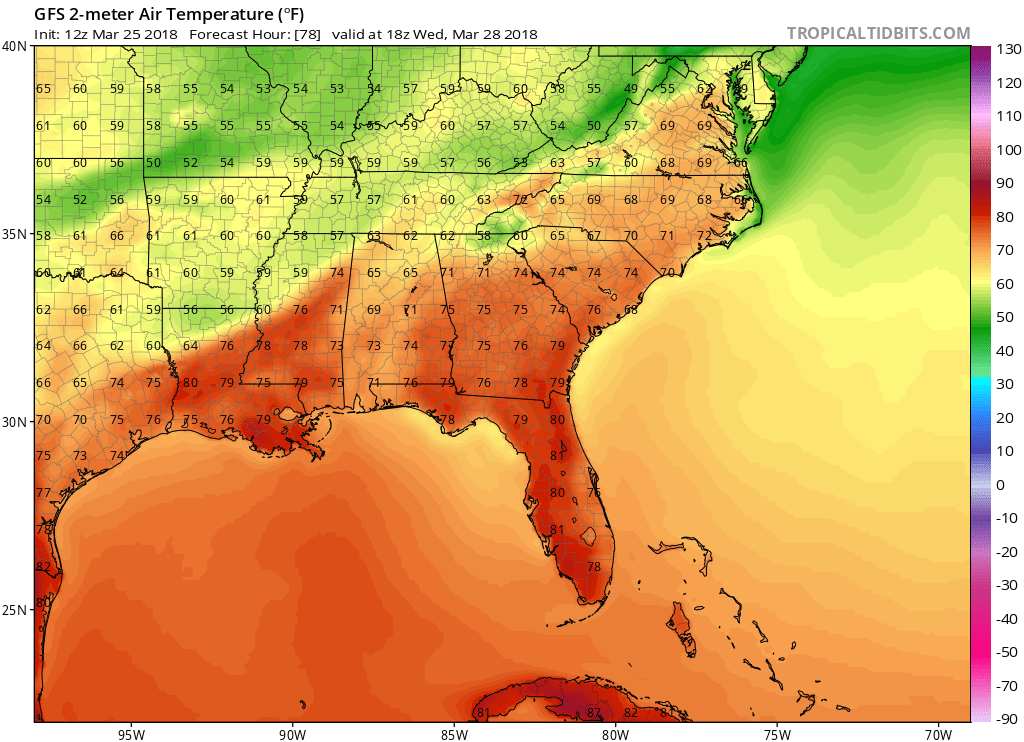
By mid week this week, we will warm up and see upper 60s and 70s for many across the Southeast. Do not let this warmer weather fool you though. By the beginning of April, temperatures will take a tumble back down to below average.
GEFS 5-day 2m Temperature Anomaly for April 1st, 2018 until April 6th, 2018:
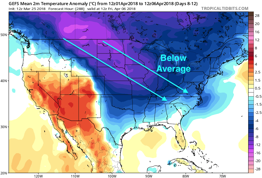
Right now, we have the colder air building back into Canada and the Northern Great Plains. By next week, those below average temperatures will swing southeast into the southeast region as far south as the Gulf of Mexico. With the colder temperatures, the pattern will be prime for yet another chance of seeing winter weather down into the Southeast.
GFS MSLP and P-Type for 12z April 5th, 2018:
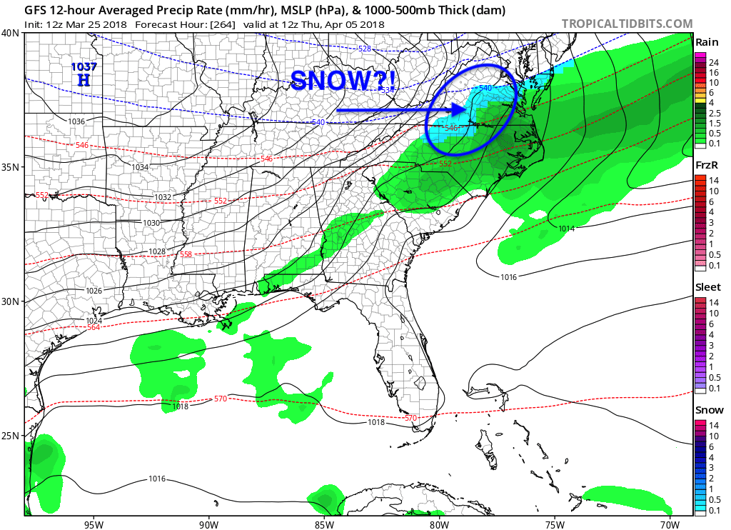
Even though this is over a week away, this is showing forecasters that the pattern has the availability to bring more winter weather into the Southeast. Stay here with us at East Coast Weather Authority as we will keep you up to date on what is to come!
-Alex B
You must be logged in to post a comment.