
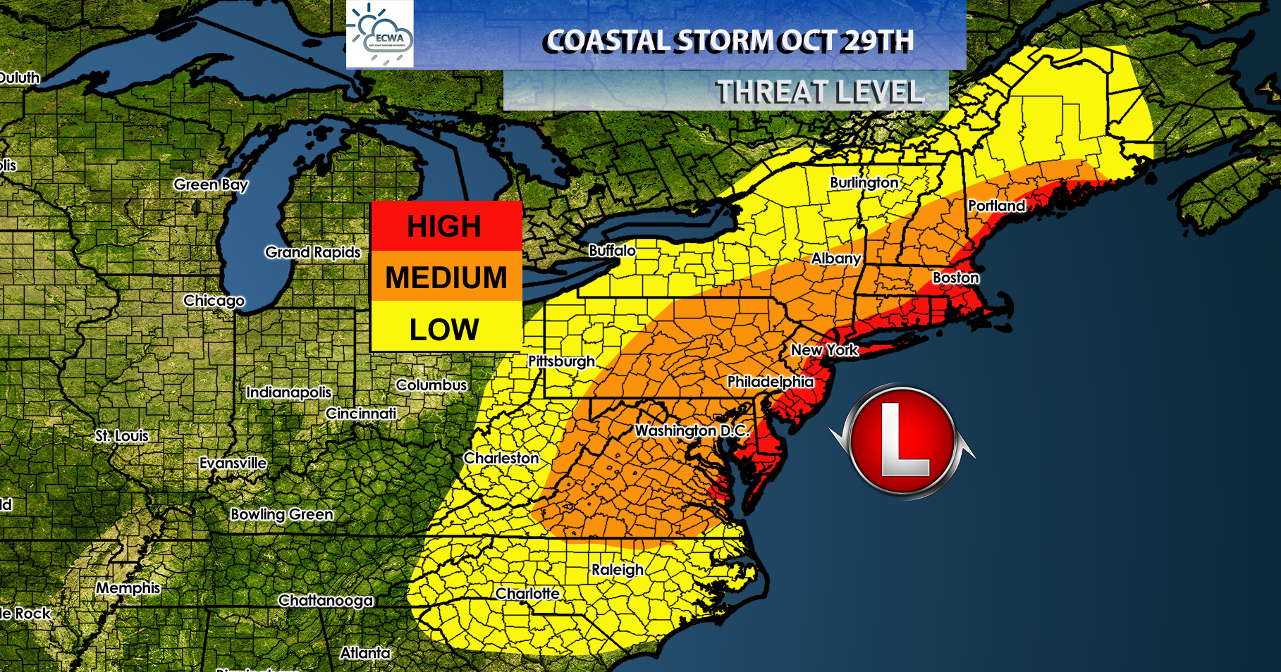
It’s only October, and we are currently talking about a potential nor’easter to strike the Northeast and parts of the Mid-Atlantic this weekend. This weekend, interior portions of the eastern US could see the seasons first significant snowfall.
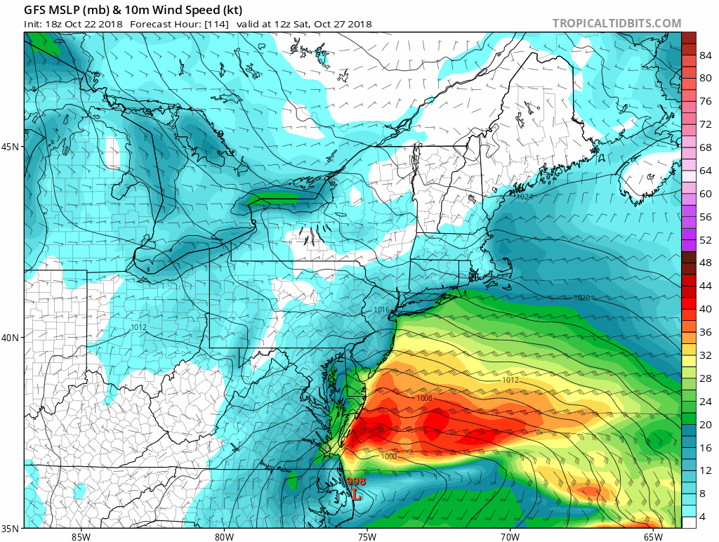
Models continue to go back and forth with precipitation type and the track of the coastal low.
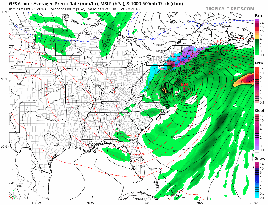
The tracks continue to fluctuate east and west, and will continue to do so until our cold air energy moves onshore in the Pacific Northwest.
We do know this will be a strong wind maker as it moves up the coast from the Carolinas to New England. With the threat of strong winds we could see coastal flooding and beach erosion along the coast.
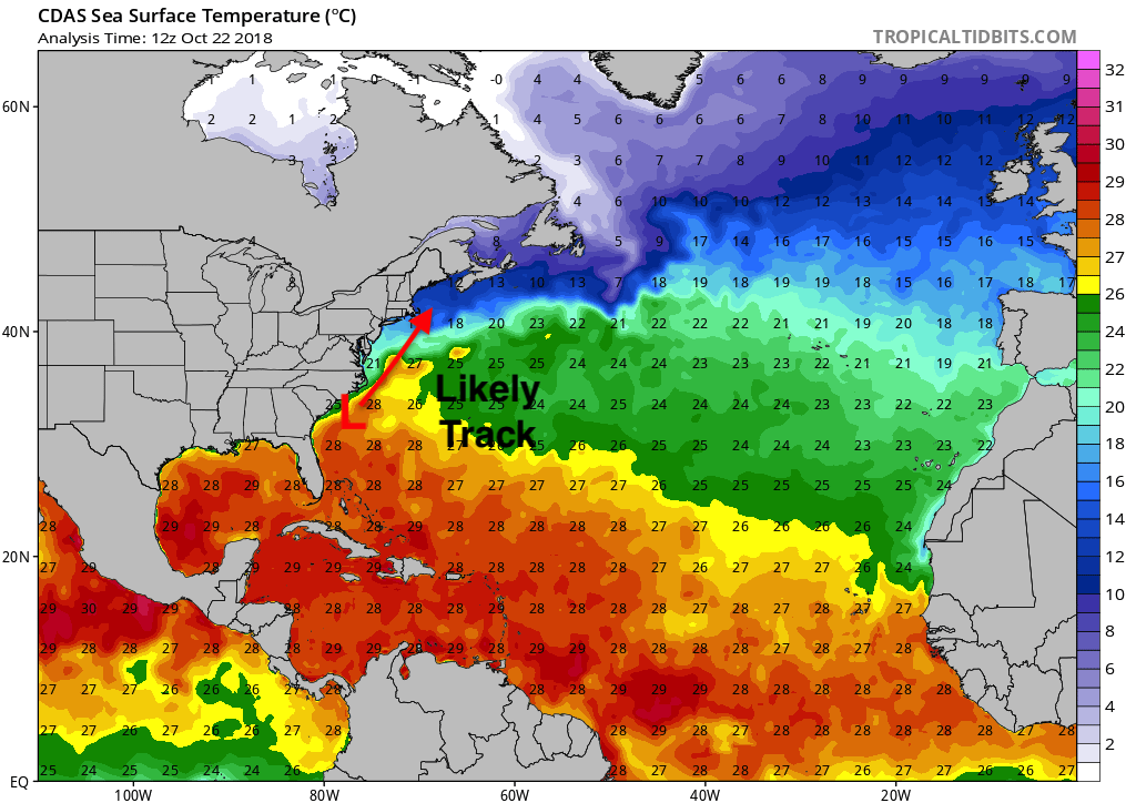
Track is still uncertain, but the general rule of thumb when forecasting nor’easters is to follow the thermal gradient in the sea surface temperatures which will take it close to the 40/70 benchmark and with enough cold air this could bring a significant snowstorm to the interior portions of the Northeast.
A lot of details need to be ironed out, but we will continue to update you as we get more information.
-Alex B.
You must be logged in to post a comment.