
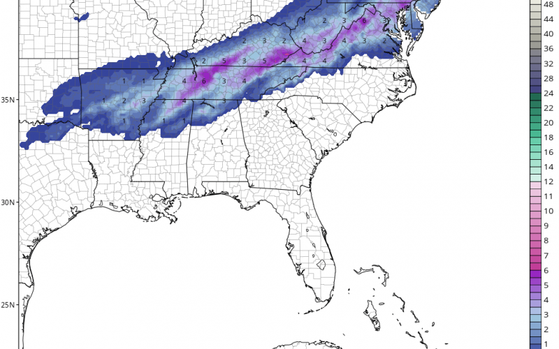
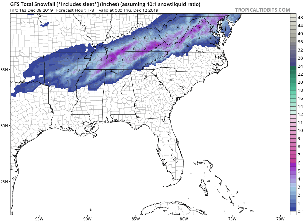
WINTRY MIX FROM DEEP SOUTH TO VA AND PA
A strong cold front will push across the eastern half of the country on Tuesday, and Tuesday into Wednesday a changeover from rain to snow is looking like a strong possibility. Major accumulations are not expected, since there will likely be a lot of sleet before the changeover to all snow.
The areas impacted will be from Arkansas to Virginia and up into Pennsylvania. Remember the below amounts include sleet. It is possible that the Richmond, VA area will receive a dusting, but western VA and up into DC will see better chances for accumulating snow.
Timing: Tuesday into Wednesday. By Wednesday morning, some locations could be a slushy or icy mess. School cancellations are likely, especially in VA and TN and even down into the northern parts of the Gulf Coast states, such as MS and AL.
On the latest NWS forecast map, we can see the snow and ice starting to show up behind the front as colder air moves in on Tuesday and Wednesday. The snow will continue to change over from west to east. Below is their official forecast.
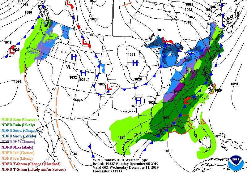
We should not be receiving any wintry precip here in the Carolinas. However, western and northern VA will get ice and snow. Primarily the western and northern parts. For everyone else farther south, expect all rain.
Thanks for reading, and please share!
-CWA
You must be logged in to post a comment.