
02/01/2018
A cold front will sweep across the East coast Thursday into Friday. The main threat from this system across the South will be rain. We are not expecting a big wintry threat from this system for most people. The exception is far northern New England where they could see a brief period of snow.
Below is what we are expecting.
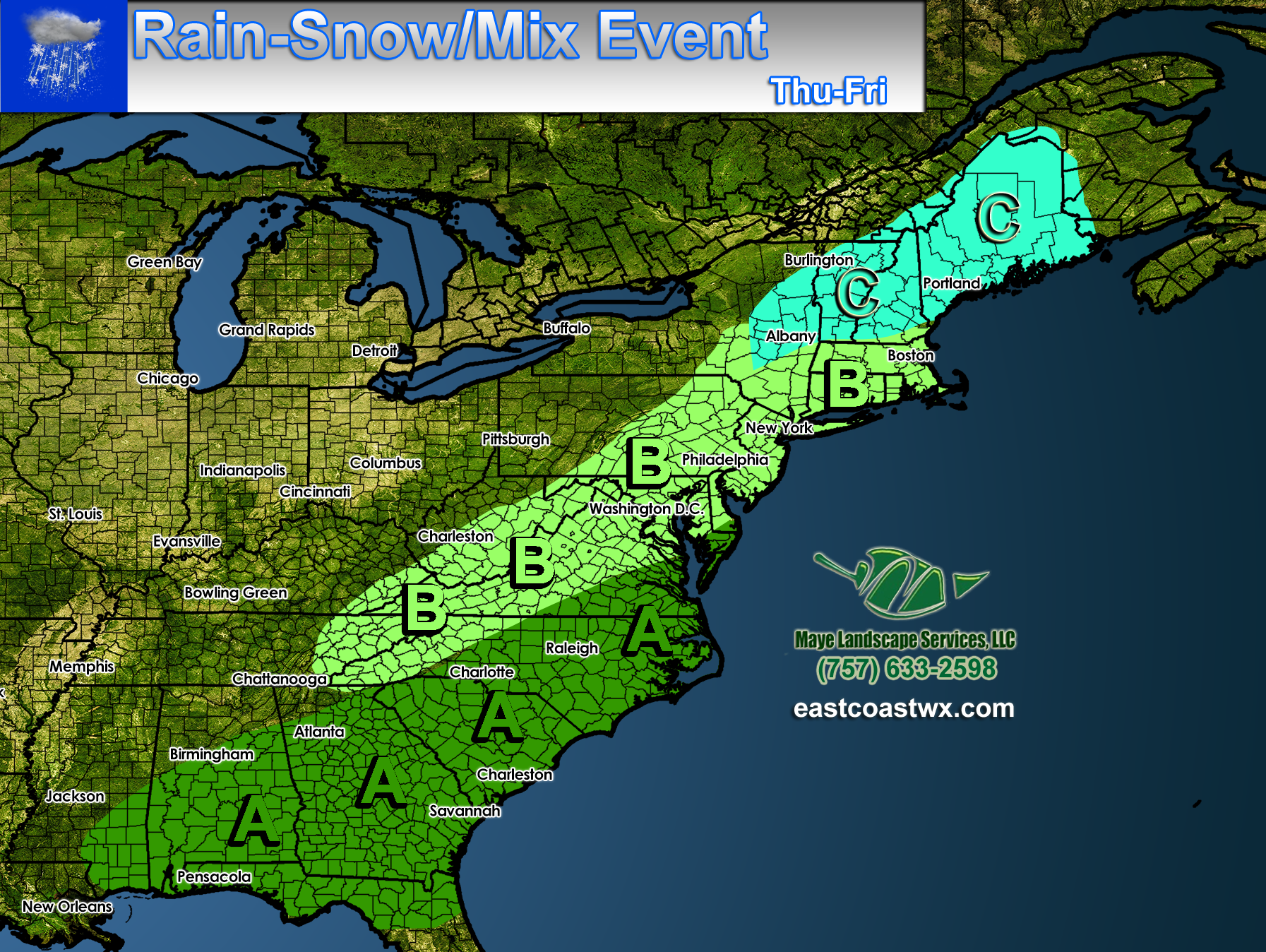
Area A – Mainly rain that will end after the front pushes through. Turning colder but not too terribly cold.
Area B – Rain for the most part, but could change to snow at the end of the event. There is a concern for a flash-freeze as temperatures drop, which could cause patchy black ice on the roads and sidewalks.
Areas C – Light snow, with overall light accumulations expected. The event may start out briefly as rain or sleet.
This is expected to be a minor event and not last too long. The biggest danger is the freeze of any standing water as sub-freezing temperatures move in.
-Mike G.
Meteorologist
Be sure to share this post using the buttons below!
You must be logged in to post a comment.