
ACTIVE IN THE ATLANTIC
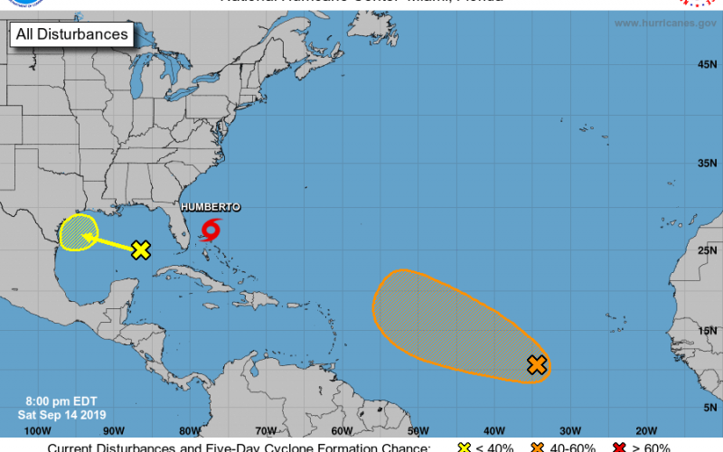
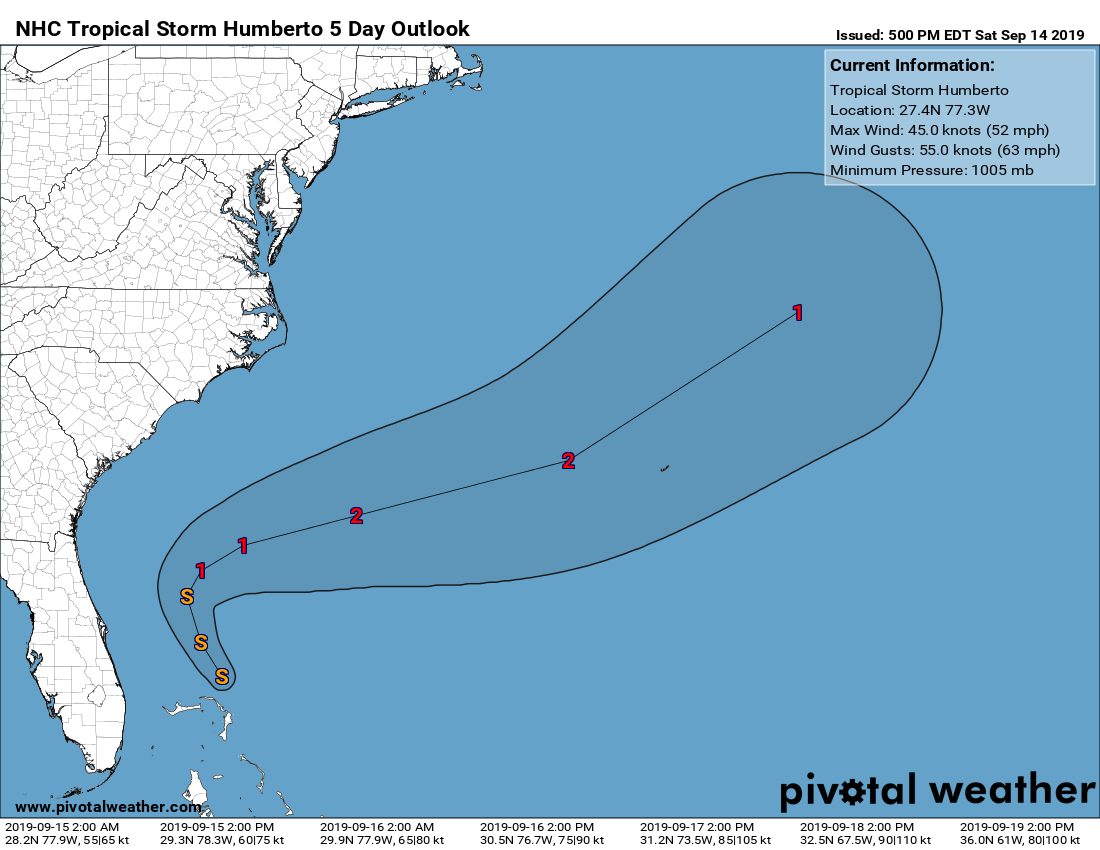
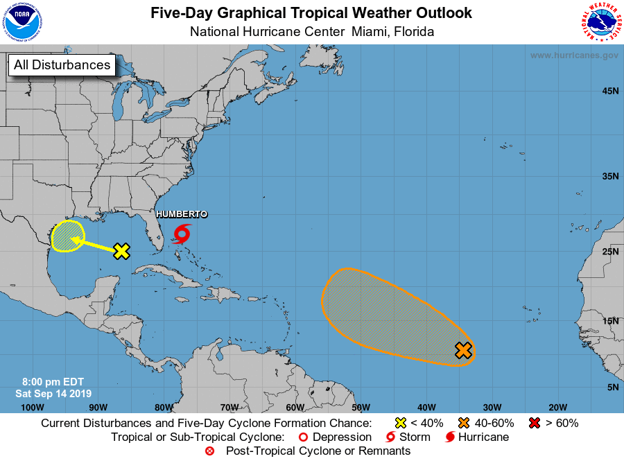
This hurricane season started off slow, but then as NOAA forecasted it become active. This season could be back-loaded with multiple named storms continuing into the late-season. Currently we have Tropical Storm Humberto, however he is not expected to be any threat to land except for maybe Bermuda. He is no threat to the Carolinas. You may hear of him becoming a hurricane next week, however he will continue to move away from the Carolinas and out to sea.
OTHER AREAS TO WATCH
As we are in the peak of hurricane season, we have other areas of potential development to watch. There is a wave of low pressure in the Gulf with a low chance of development, that may impact Texas, right now looking like in the form of heavy rains. Confidence is low for any chance of tropical formation from this system.
An area of greater concern is out in the Atlantic, and currently has a 60% chance of formation. As Humberto moves out to sea, he will creak a weakness where this next tropical wave could follow. If this storm “picks up” on Humberto’s track, it will also make a turn out to sea. However, it is still too early to tell and we should watch this system, and if high pressure tries to build in over the East Coast again, which it very well may. Then, this system would head on a more westward track.
From the NHC regarding this disturbance:
An elongated area of disturbed weather is located over the central tropical Atlantic. This disturbance is currently disorganized and only slow development, if any, is anticipated during the next day or two. Conditions are then forecast to be conducive for gradual development through the middle of next week and a tropical depression could form while the system moves slowly westward or west-northwestward. * Formation chance through 48 hours…low…10 percent. * Formation chance through 5 days…medium…60 percent.
We will continue to bring you coverage of the tropics, Humberto, and this potential new system in the Atlantic, so stay tuned!
Make sure to check out our growing models page! https://carolinawxauthority.com/models
-CWA
You must be logged in to post a comment.