
After some crsip mornings this week, we will return to September next week, or “Octember.” Some pages will show a cold outbreak after the 15th or so, which is possible, but we are not sold on that just yet.
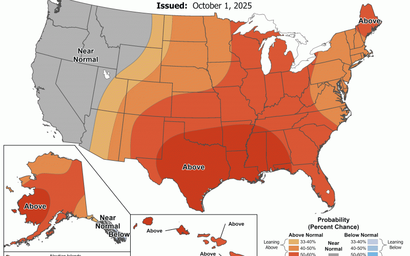
October is usually in the first half and then chilly in the second half for us. But this is normal. Shown below are the Climate Prediction Center’s probabilities of warmer than average temps into the 15th.

There are no signs in the models or ensembles of any cold snap for mid-month. We could have some backdoor cold fronts, but they wont be enough to keep the warmth away as a whole.
Hurricane activity tends to slow down later in October, but still could get a storm or two early this month. It’s amazing and fortunate that we have not had any landfalling Hurricanes on our side of the Lower 48 this season.
Things can change overnight so be sure to keep checking our page for updates. There is a big pool of cold air in Northern Canada. That could spill southward and the models might not be picking that up just yet.
Stay tuned or our site and FB page! Please share if you enjoyed this update!
Mike G
Carolina Weather Authority (Both North and South)