
The southeast experienced heavy thunderstorms and tornadoes less than a week ago that many areas are still recovering from. Unfortunately more severe weather is going to hit the Southeast to start the week due to this relentless pattern. Currently a low pressure system resides just west of Texas and will be swinging along the Gulf of Mexico.
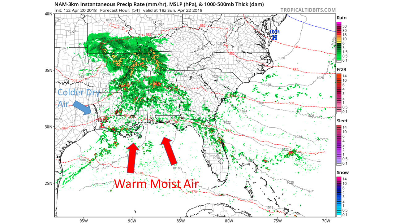
Once the low pressure passes through Texas it is just north of the Gulf of Mexico. This will allow the system to intensify, because the low will draw large amounts of warm moist air from the Gulf of mexico, resulting in a stronger storm with heavier rain. Be aware that as the colder dryer air on the backside of the storm (also known as the dry line) mixes with the warm moist air from the Gulf of Mexico, there will be the greatest chance of severe weather due to increased instability.
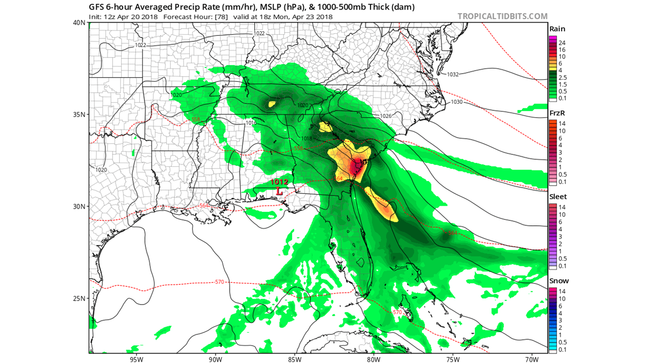
As the low moves further east, by mid day Monday both of the Carolinas and the most of the region will be experiencing very heavy rain and strong gusty winds with a chance of hail. These conditions will persist into Tuesday and will eventually will pass by Tuesday evening, making way for lighter rain and weaker winds.
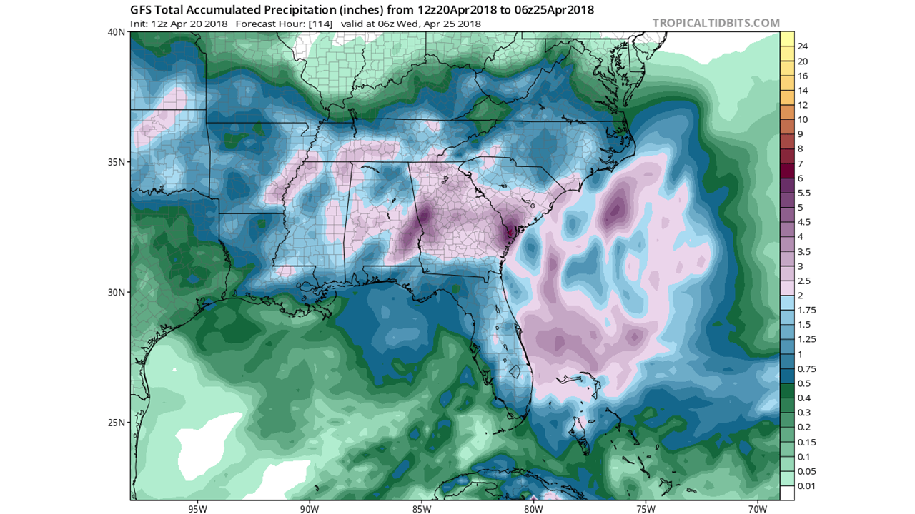
After the rain and severe weather threat is over, the south east could be looking at rain accumulations as high as 1-3 inches and possibly locally higher amounts in the heaviest bands of rain. Flooding and downed trees will be a big risk with this storm due to the very strong winds. So make sure to stay safe, and to check back with us at East Coast Weather Authority to get the latest updates on the weather to come.
-Ben C.
You must be logged in to post a comment.