
The wintry feel a couple of weeks ago was highly unusual for May, and especially when parts of the interior Northeast saw snow. We thought that was a fluke and that the pattern has “normalized” and we will not see any more below normal temperature patterns.
However the latest consensus is leading us into a cooler than average June. The long-range models are not indicating any pronounced ridging or heatwaves for the East Coast into much of June.
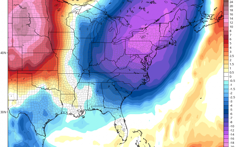
Below is the cold airmass for June 1st at 8am, just in time to kick off the new month.

Temperatures could plunge into the 40s as far south as Virginia, however parts of northern NC could also see lows in the 40s. The farther south you go, the more the temperatures will be close to normal rather than cold. For example, Charlotte will not be as chilly as Richmond and could just be closer to normal.
This is still quite chilly for June, especially in the South. Stay tuned as we will continue to update you on what is looking like a cooler (and wetter) month of June.
-CWA
You must be logged in to post a comment.