
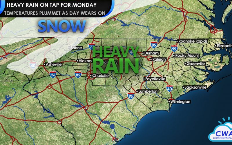
After temperatures climb into the 50s and 60s for the next couple of days, a significant storm will cross the region on Monday, bringing heavy rain, mountain snow, and plummeting temperatures. If you are one of those people who feels aches and pains when strong storms move through, Monday may be a good day to prepare for that.
Low pressure in the Southwest will cross the Deep South this weekend, touching off thunderstorms for the Gulf Coast region. As the storm moves east, it will lose some of its instability, but will continue to carry moisture east into the area. Locations at the coast will likely see lighter amounts of rain, but locally heavy but non-severe thunderstorms will be possible. Areas north of the low pressure track, such as Atlanta, Spartanburg, Charlotte, High Point, and South Hill are poised to get drenched with 12-18 hours of solid rain, as temperatures tumble behind the cold frontal passage during the day Monday.
While some models last week showed a fast changeover to snow affecting more of the area, the general model trend is for rain at lower elevations ending before any change to snow. However, the High Country will likely see light to moderate snowfall during the day Monday. Points further north in the Virginias could have more significant snow totals of 3-6 inches as cold air catches up to the moisture.
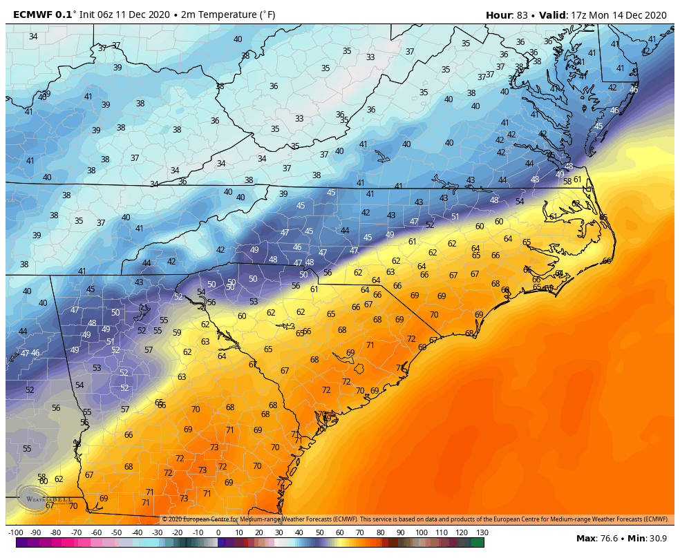
Finally, we’ll see an invasion of much colder air with this storm. While temperatures in many locations will reach the 60s this weekend, the warmth will come to a sudden end on Monday. Models disagree on timing of the front, but most have highs reaching the 60s and 70s east of I-85, but a sharp drop off during the morning in the western Carolinas, lunch time or afternoon in the eastern Carolinas, and by day’s end close to the coast. This will lead to a 24 hour temperature drop of 20-25 degrees or more in some locations. The rest of the week is expected to be on the chilly side with another potentially tricky storm to move in mid-week. We’ll have more on that in coming days.
-CWA
You must be logged in to post a comment.