
The talk of the town is here, and that is a blockbuster winter storm for the Northeast next week. While this storm could mimic “Snowmageddon” from 2009, the details are not clear is this storm will be as impactful. But it could. Models are dumping out hefty snow amounts for DC and the Northeast.
But what about us down here in the Carolinas? The hefty snow will not be here, but western regions could get a few flakes with a glaze of ice. The ice will be the biggest concern as some model trends are showing such.
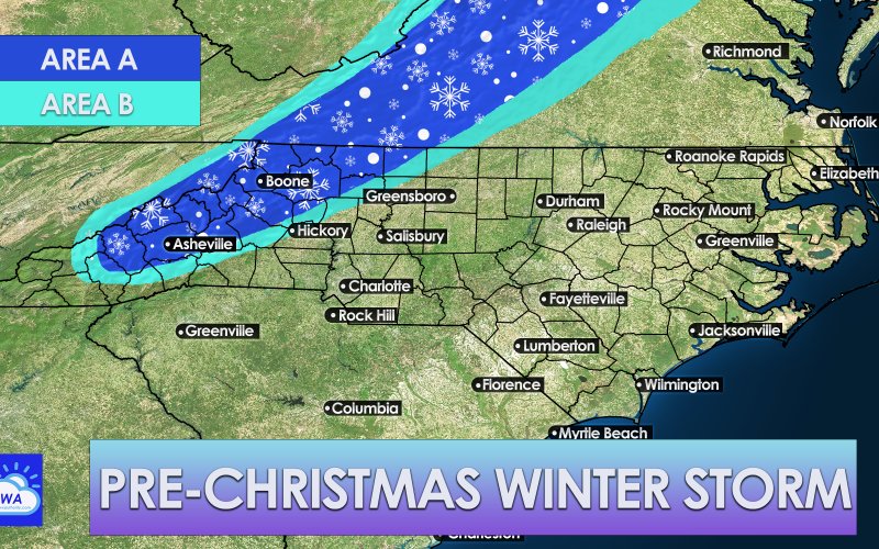
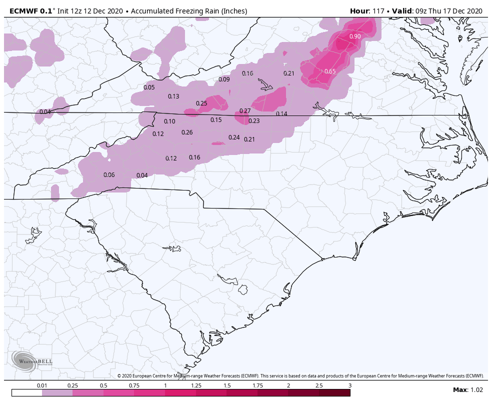
Let’s get right into the specifics of what we are expecting for the Carolinas below. See the legend below the map for what we are currently expecting.
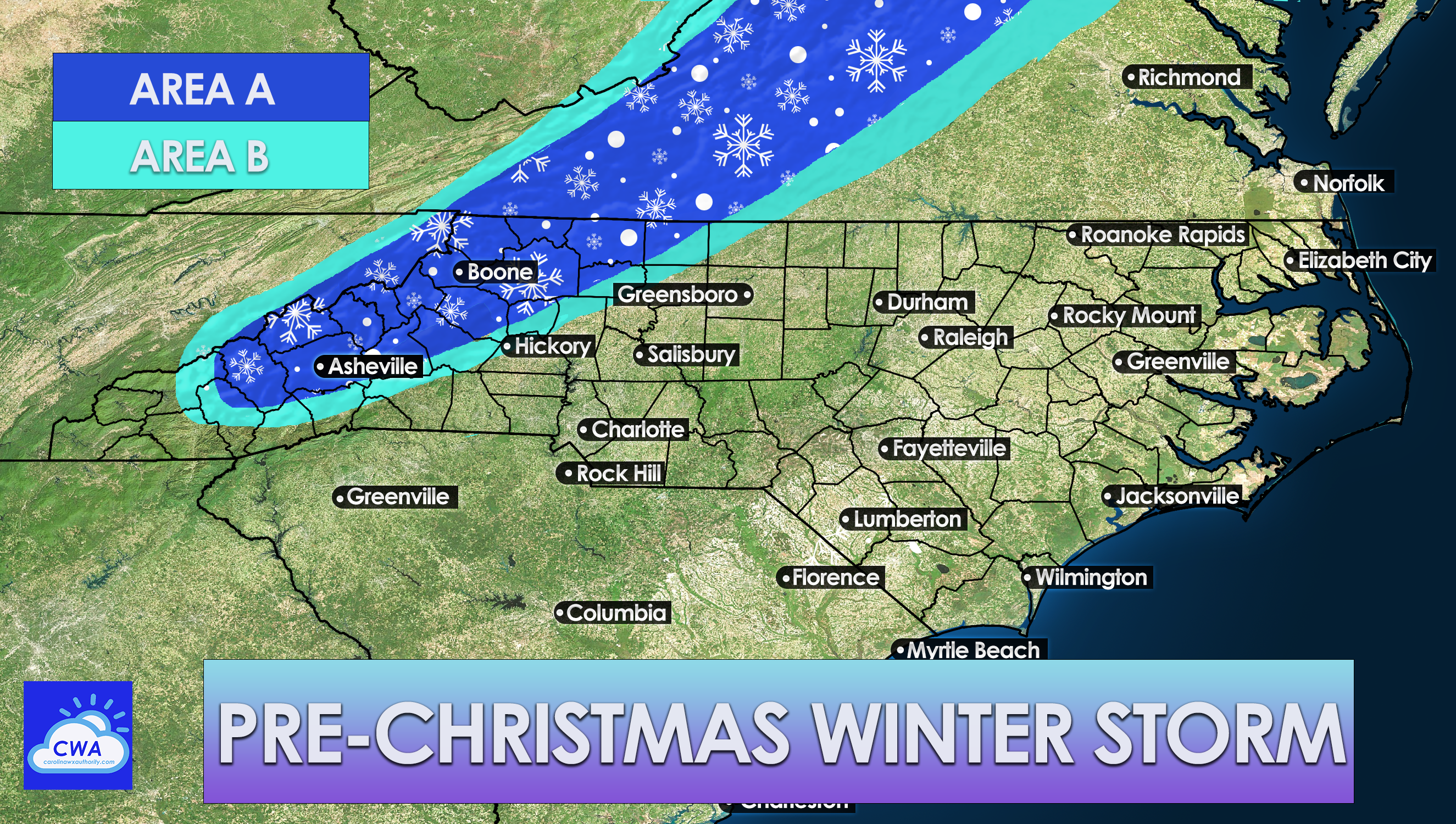
AREA A: This area has the highest chance of seeing flakes, perhaps 1-3″ with higher amounts in the higher mountain elevations. This area could also see a glaze of ice from freezing rain.
AREA B: This area has a chance of seeing flakes, but not guaranteed. Ice is also a possibility in this area as the models are trending towards such. However, some models are trending warmer which would keep the ice threat low for now.
OUTSIDE OF AREA A AND AREA B: All rain.
TIMING:
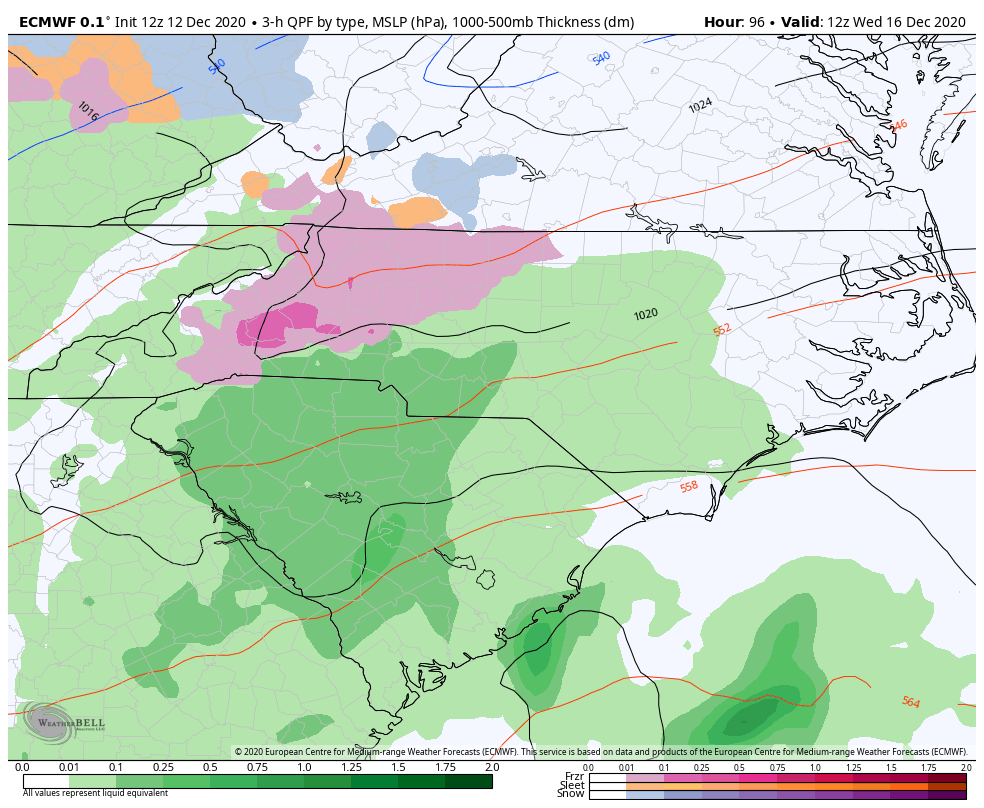
The storm makes its way into our region from the south early on Wednesday morning, before sunrise. Outside of Area A and Area B above, we can expect mainly rain across the Piedmont. however, freezing rain along with some flakes cannot be ruled out across western NC. Below is the timeframe from 4-7 am on Wednesday.
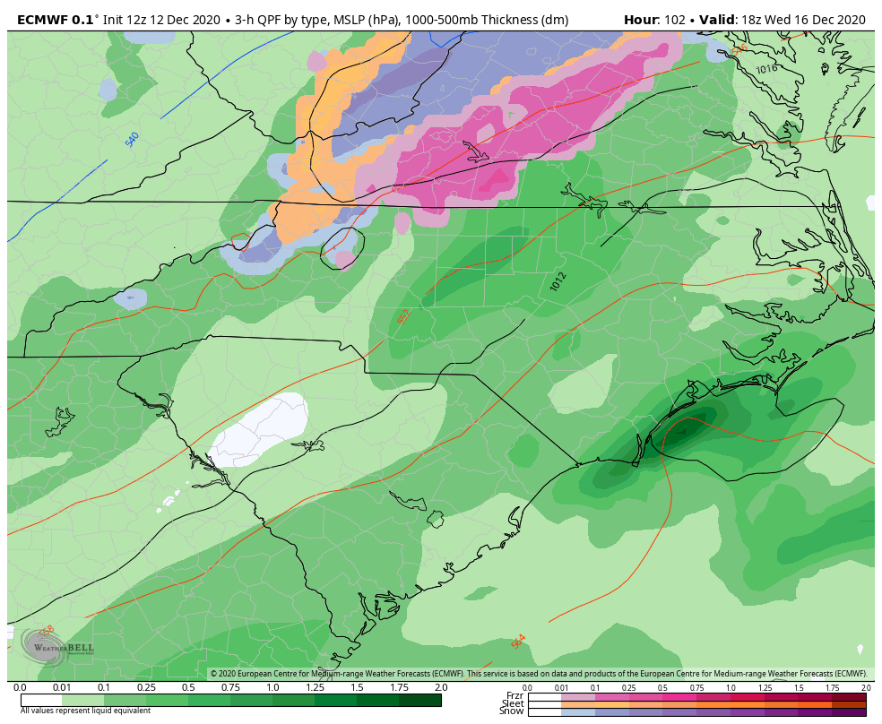
Then by Wednesday afternoon, the frozen precip moves north, and leaves most of us with a cold rain. All of the rainy weather clears out by Wednesday night, and then we turn windy and colder.
The growing concern is the ice potential. While snow is impactful, ice is far more dangerous and this trend should be watched closely.
These models will change, so make sure you follow us for the latest trends! For now, the ice and snow threat looks like it’s limited to western NC and the mountains. Of course the forecast will change a lot since Wednesday is still far away as far as winter forecasting is concerned.
Please share this article on social media!
You must be logged in to post a comment.