
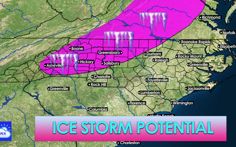
Not the news that many will want to hear, but we are watching the trends of what could be an ice storm on early Wednesday morning. Since the storm will creep in during the early morning hours before the sun is up, it will be cold, and thus anything that falls will freeze on contact. Residents in and around the pink shaded area should prepare for extended power outages, which could mean being without heat for some.
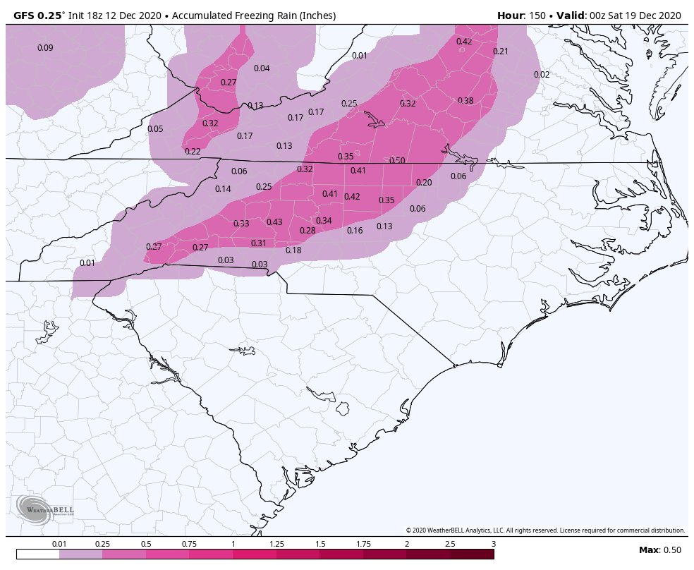
The latest GFS freezing rain amounts for Wednesday are shown below. It’s not looking good for western NC and central VA as it does not take much ice at all to start snapping trees and power lines. We will hope that this will trend warmer, since ice is much more of a concern than snow. A tenth (0.10) of an inch of ice is all it takes to start causing problems!
Our latest ice threat map is below. Again, this is a preliminary estimate since Wednesday is still 4 days away, and predicting ice is even a challenge 24 hours before. All we can say that the signature for cold-air damming that we are seeing is present, and this situation should be monitored in the coming days.
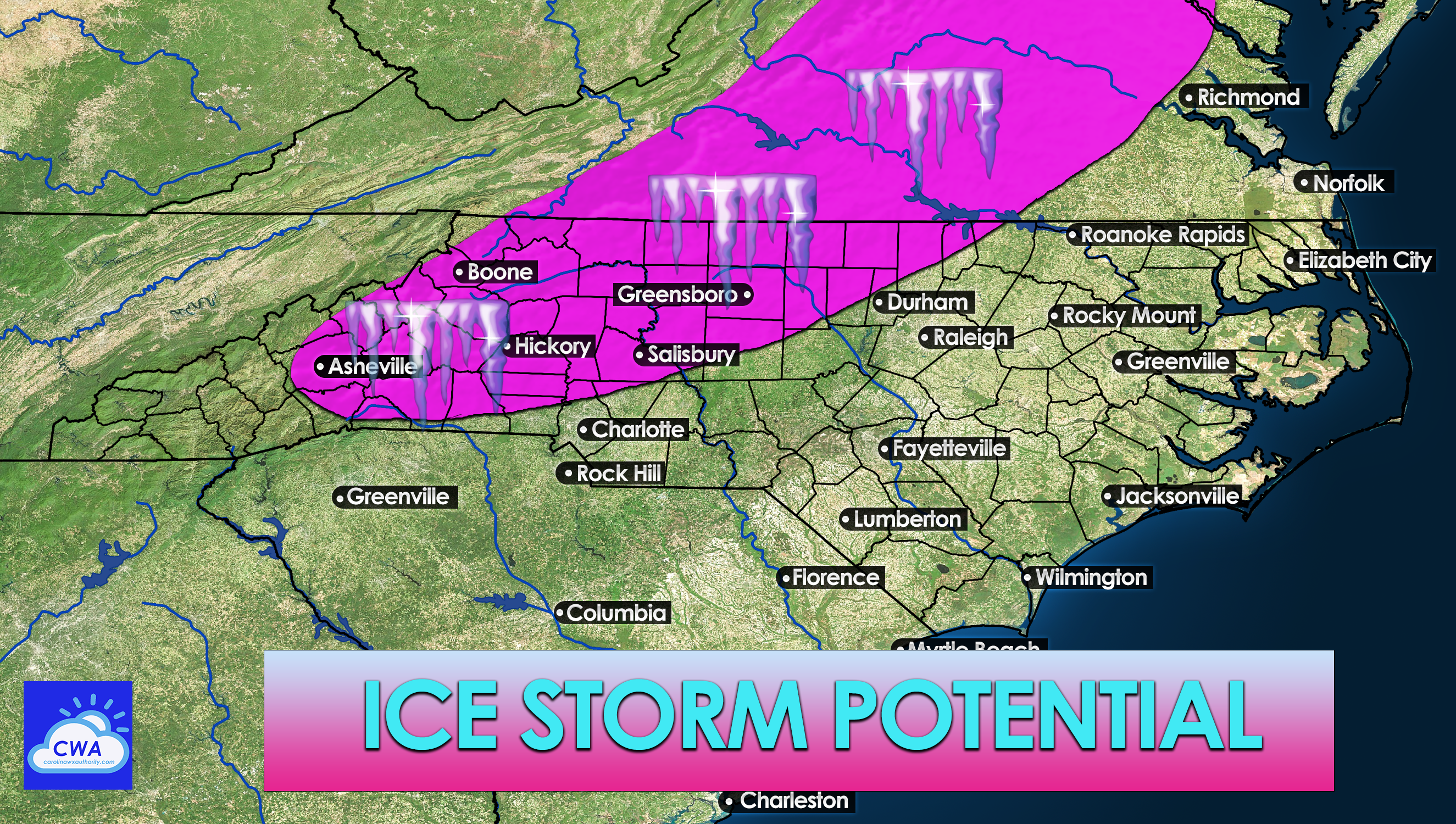
From the mountains to along I-40 and just to the north and west of I-85 and along and west of I-81 into Virginia is the threat zone. The northern Charlotte suburbs and into the Triad are where a lot of folks follow us from, so be on the lookout. The pink shaded area above is the threat zone that needs to be watched.
This is just a preliminary alert and is subject to change, so be sure to follow us. Share this article to alert your friends and family!
You must be logged in to post a comment.