
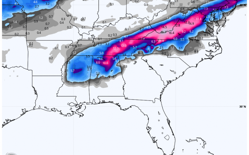
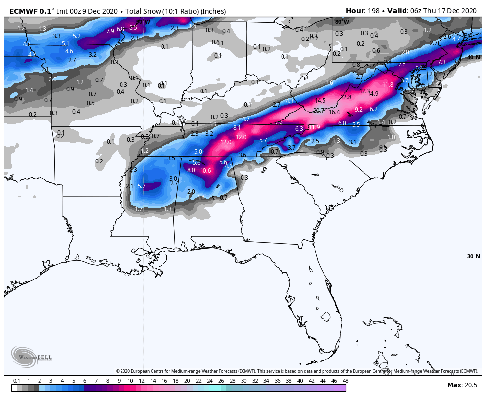
As Monday draws closer, all eyes are on a potential system that will slide across the Southeast on Sunday and Monday. While specifics this far out are still unclear, the Euro has been hinting at frozen precipitation across the Deep South and Carolinas. This is not a lock yet and could change, and the ensembles were only showing mountain snow, so take this with a grain of salt. And thank you for reading this article as many will not and just comment on the FB post.
However, we do have something to watch for Monday morning. And this could be a rather complex system with severe storms, mountain snow, and everything in between.
TIMING:
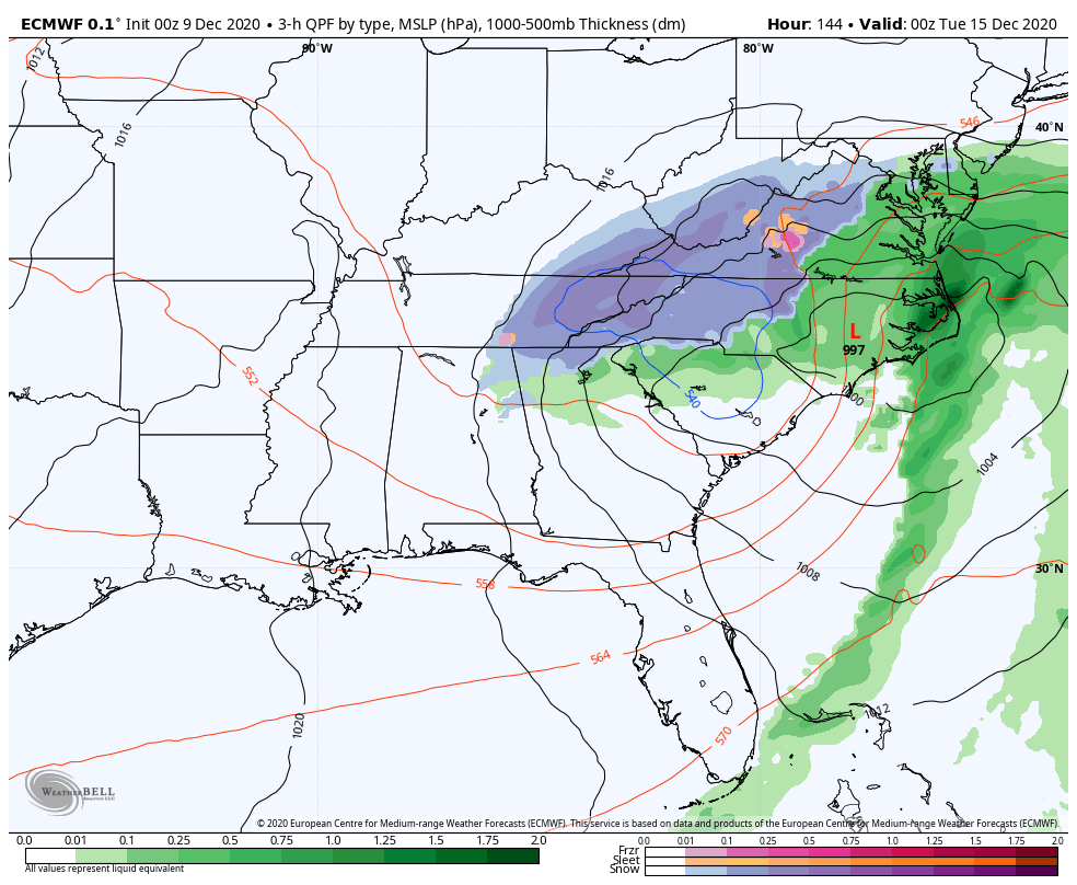
It appears as though the storm gets started on Monday morning, but then as colder air wraps in behind rain changes to snow from west to east by the evening hours. Again, the blue shield which is snow and sleet might be more limited to the mountains, but this is a trend we will certainly watch. So this storm could sit over us and spin its wheels into Monday night, which could mean heaver amounts of overall precip.
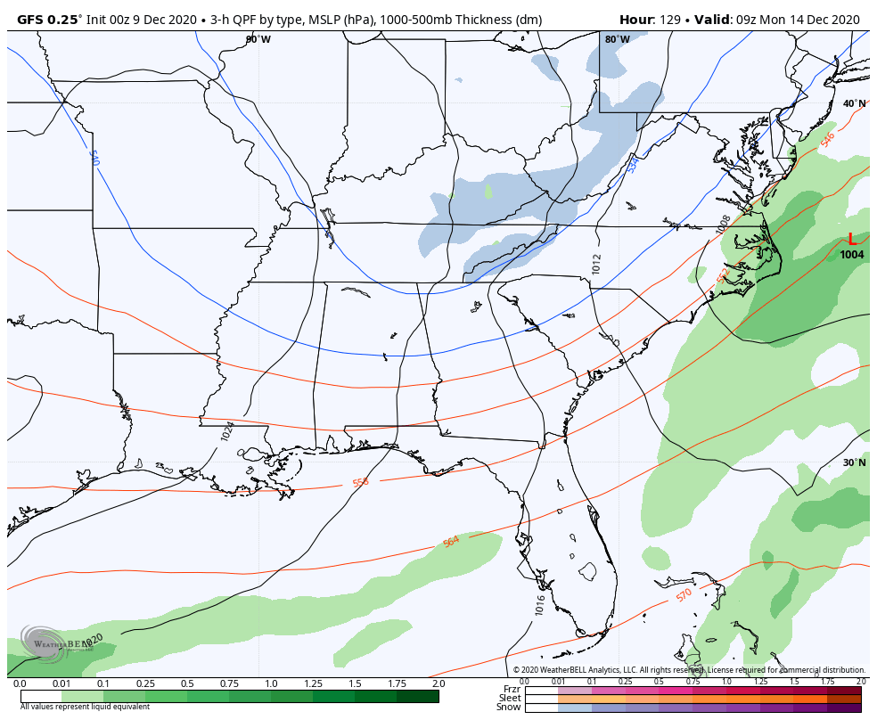
The GFS currently has a nothingburger, with the storm moving out to sea and colder air rushing in behind a strong cold front. This is one reason why this forecast is not a lock yet, as we have to see if the major models come into better agreement.
We will be following this developing potential storm on Monday, so be sure to continue to follow us! Also please have your friends read and share this article also, thank you!
You must be logged in to post a comment.