
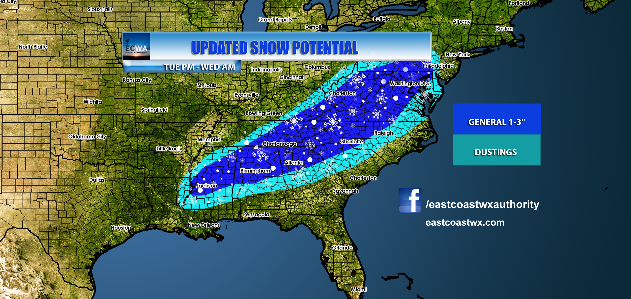
The Euro model is holding steady with snow for the Southeast next week. Timing is looking like Tuesday into Wednesday. A quick burst of snow could leave 1-3″ across Appalachia, and spotty dustings in the lighter blue. However, this will be enough to make roads and interstates icy and dangerous. For this reason, school and work may be cancelled Wednesday morning. From Jackson to Birmingham to Atlanta to Charlotte needs to be aware since it doesn’t take much snow to shut down a city.
The NAM only goes out to 8pm on Tuesday, but is showing the snow getting started across the Deep South in Mississippi and Alabama. This will fill into the Carolinas as we get closer to the event on this model.

Plan for travel delays and work/school issues on Tuesday and Wednesday.
Stay tuned to this site for updates, and feel free to look around! Check out our models page!
-ECWA
You must be logged in to post a comment.