
After consideration of the dynamics of the upcoming Tuesday into Wednesday event, more than likely it will be rain that will change over to snow briefly and then ending. Some locations in Alabama and Mississippi could receive a quick thumping depending on how much moisture there is to work with. Wednesday morning will still likely experience issues with school and work cancellations in the Deep South, and maybe delays in the Carolinas. Do not let your guards down as any snow on southern roads can turn into an icy danger.
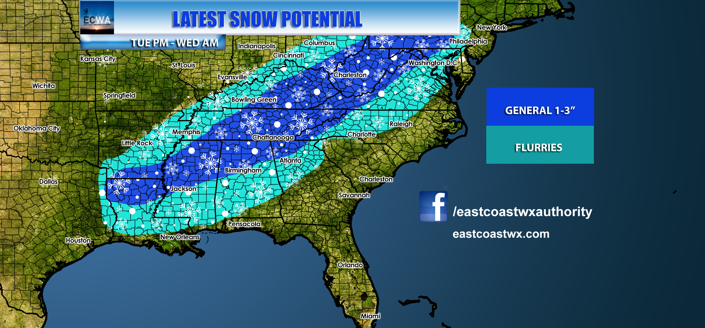
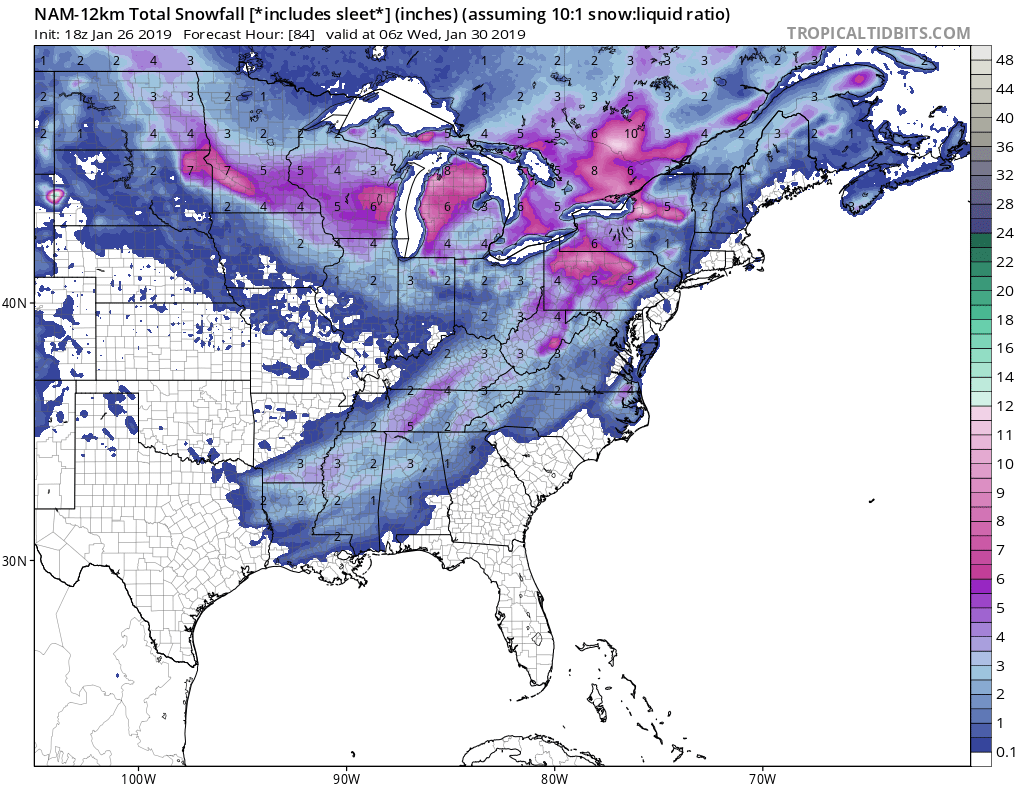
The NAM model paints a pretty picture across the Deep South and up into Pennsylvania Wednesday. Eastern regions of PA could just see some momentary flakes, but they could put down a dusting to an inch. Then extremely cold air moves in behind freezing any standing slush.
Most likely North Carolinas will see momentary flakes, but it will be in the middle of the night when most are asleep. Check conditions before heading on Wednesday!
-ECWA
You must be logged in to post a comment.