
And just like that, a trend is starting to develop with the Euro model which is showing snow in the Deep South next week. With the US government shutdown, model quality has been on auto-pilot according to a NWS source. Therefore, we have to look to our friends across the pond for better quality guidance.
A southern-track winter storm could be on the horizon, and the FV3-GFS is barely picking it up. A strong Arctic cold front will provide the cold air, and a disturbance could develop along the front and intensify, wrapping snow into the Southeast.
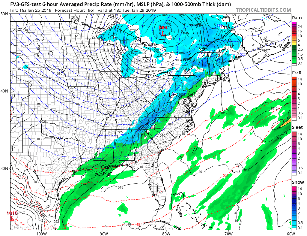
A more accurate picture of what could happen is below, and was taken from the Euro. This is subject to change in the coming days, and this weekend we will have a much better idea of what will happen. Details are still yet to come!

Thanks for reading and please share!
-ECWA
Mike G.
You must be logged in to post a comment.