
As we move into March of 2018, we ask ourselves, what will March be like as far as overall temperature and precipitation? We know that the first week of March will not be anywhere near as warm as the end of February. We expect major changes over the next week.
But what about March as a whole? Well, if we take an analog approach, we find the year 2006 had some stunning similarities when it came to March. Check out the forecast 500mb height pattern for the first week of March or so.
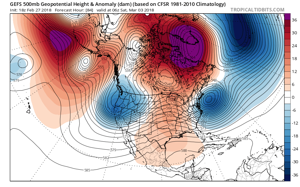
Notice the big blocking pattern over Greenland and northeast Canada, and also the two areas of low pressure off the East Coast and also the West Coast. Now, check out the pattern from March 1-7 or 2006.
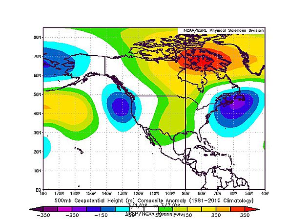
Almost looks like an identical pattern. So what are we trying to say here? When March started out like this before, the temperature trends were near normal for the entire month. Below were temperatures departures from normal for March of 2006. We can suggested that if it happened before, it can happen again. These are called analogs. March 2006 was overall normal as far as temperatures, or neither above or below normal.
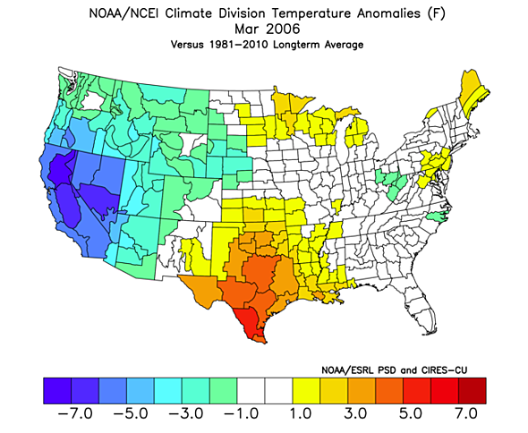
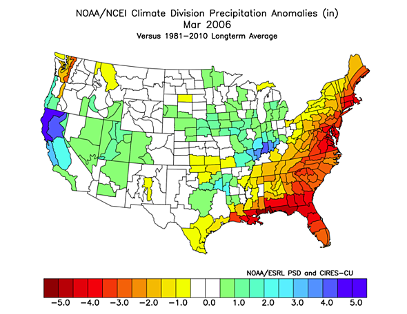
The West Coast was well below normal cold, while Texas was above normal. This can suggest that the biggest anomalies will not take place along the East Coast. What about precipitation? March of 2006 was VERY dry in the East, so we may expect drought conditions to begin to form this year.
We are hesitant to say that March will be a cold month in the East. While it may start out below normal with the cold, we could see things start to warm up. After all, we will be approaching spring. Near normal temperatures but DRY are the conditions we can expect.
-Mike G.
You must be logged in to post a comment.