
Before I write about our upcoming east coast storm that will effect the Northeast and parts of the Mid-Atlantic at the end of the week, let’s take a look what will hold after. A reason to why I am not writing about our upcoming storm for the end of the week right now is because there is still much uncertainty which should be more ironed out by tomorrow. One thing is for sure though is the pattern after our east coast storm moves on by.
To start, I will show you what the height anomalies will look like as our storm will be churning up in the Atlantic.
GEFS 500mb Height Anomaly for 18z March 2nd, 2018:
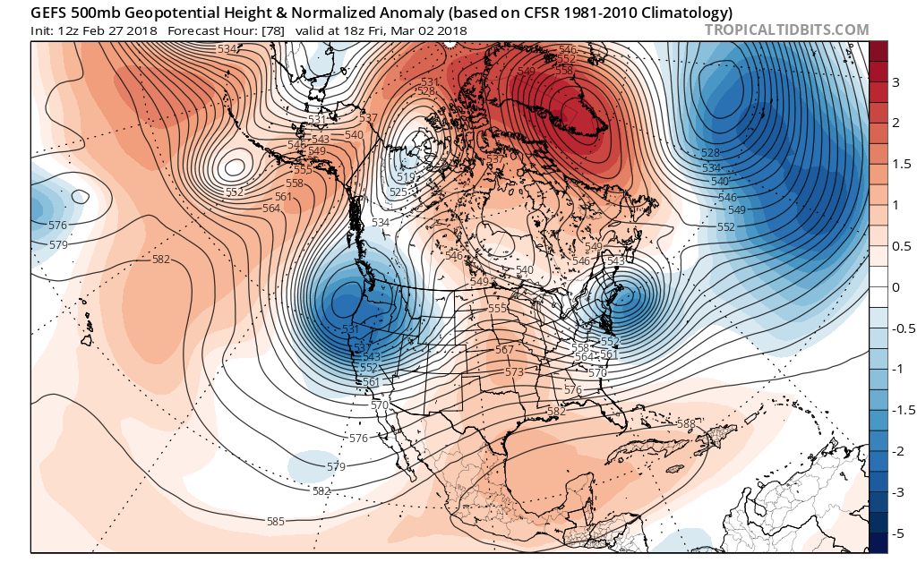
Many things are to be taken in by this model image, so let’s get to them. First, notice the strong blocking high over Greenland, that blocking high will help keep our system along the coast longer then a typical east coast storm, but more on that tomorrow! Secondly, notice the trough/ridge pattern on the continent of North America. After our strong system moves on by we will experience above average temperatures through mid-week next week, but that ridge will not last forever and begin to weaken. As that ridge begins to weaken the trough on the west coast will begin to take over.
GEFS 500mb Height Anomaly for 18z March 6th, 2018:
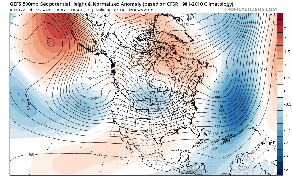
This is the height anomaly towards the middle of the week next week and notice how the ridge that was in the Central US has progressed eastward as well as decayed. That ridge will be responsible for bringing above average temperatures from this weekend through mid-week next week across the east, but the trough behind our mini ridge will be on its heels and by the end of the week next week average to below average temperatures are on the way.
GEFS 500mb Height Anomaly for 18z March 8th, 2018:
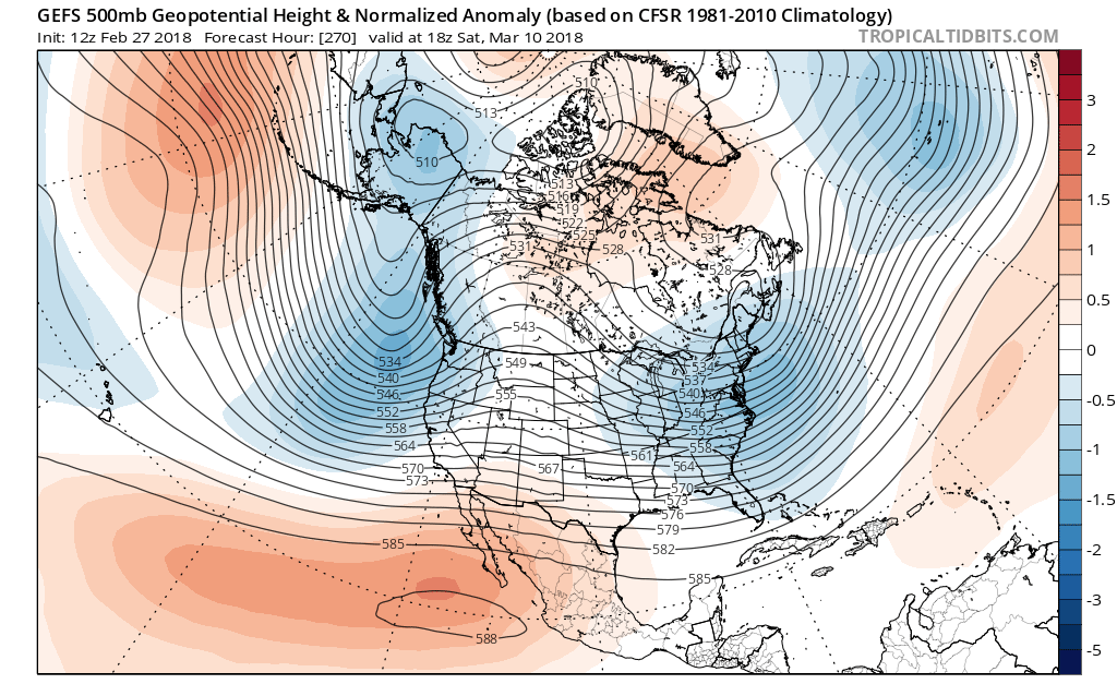
By the weekend next week the trough and below average temperatures will be over the region as our blocking high over Greenland will be persistent over this time. The blocking high will then help maintain below average temperatures over our region.
Colder temperatures are on the way after a brief warmup this weekend into mid-week next week, so stay with us here at East Coast Weather Authority as we get you prepared on what to expect, and more on our upcoming coastal storm tomorrow!
-Alex B
You must be logged in to post a comment.