
Again this week we are expecting a slight chance of severe weather for the Gulf sates up into the Tennessee Valley. The upcoming chance for severe weather is due to our potential east coast storm, and as it begins to move from the Rockies and into the Ohio River Valley it will bring the chance of severe weather along the Gulf states and into the Tennessee Valley. Many different parameters go into forecasting severe weather so let me begin to tell you our upcoming scenario and why there is a chance of severe weather.
First off, there is a parameter in forecasting severe weather and that is called CAPE or convective available potential energy, and CAPE is the amount of energy that is available for convection. The higher the CAPE values the taller a thunderstorm can grow. Now we will not be seeing CAPE values like we will see in the upcoming months, but there will be enough energy to spark some scattered severe storms.
CAPE/CIN for 21z WED Feb 28th, 2018:
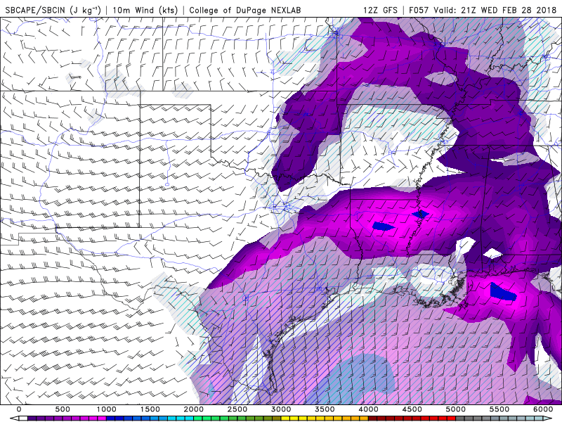
What this is showing us is that there is energy available for thunderstorms to grow in places like Louisiana, Texas, Mississippi, and up into the Tennessee Valley. Also, a key to severe weather is that we need a trigger, like a front, to help lift the air and allow it to cool and condense into clouds. Our lifting mechanism for Wednesday will be a warm front originating out of the Gulf of Mexico and working its way into the Gulf States that could flare up some severe storms.
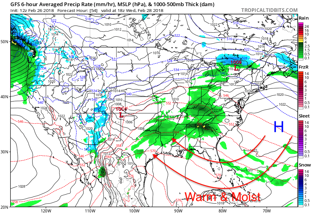
Remember our dear old friend the Bermuda High that helped bring record temperatures to portions of the Northeast, well it is still out there and like before with the clockwise wind flow of a high pressure warm and moist Gulf of Mexico air which will be pumped into the states at risk for severe weather on Wednesday.
Another parameter that brings the risk for severe weather is wind shear, and wind shear is a big contributor for severe storms because it winds at different height levels to clash with each other and create rotation which helps strengthen updrafts which allow tall cumulonimbus clouds form.
GFS 500mb Winds for 21z WED Feb 28th, 2018
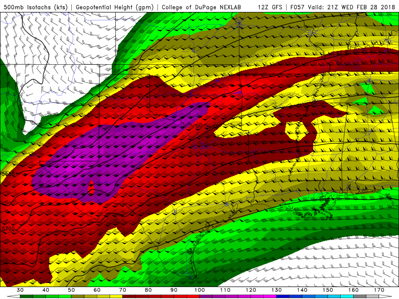
Notice the strong winds at the 500mb level, these strong winds will help enhance lift and form a deep-layer of vertical wind shear that will help enhance the idea of damaging winds and small hail which are the main concerns, BUT we can never rule out a possible tornado.
Finally, our last significant ingredient for severe weather is instability, and for convective instability we need dry upper levels to ride over warm and moist lower levels, so let’s see if we have that.
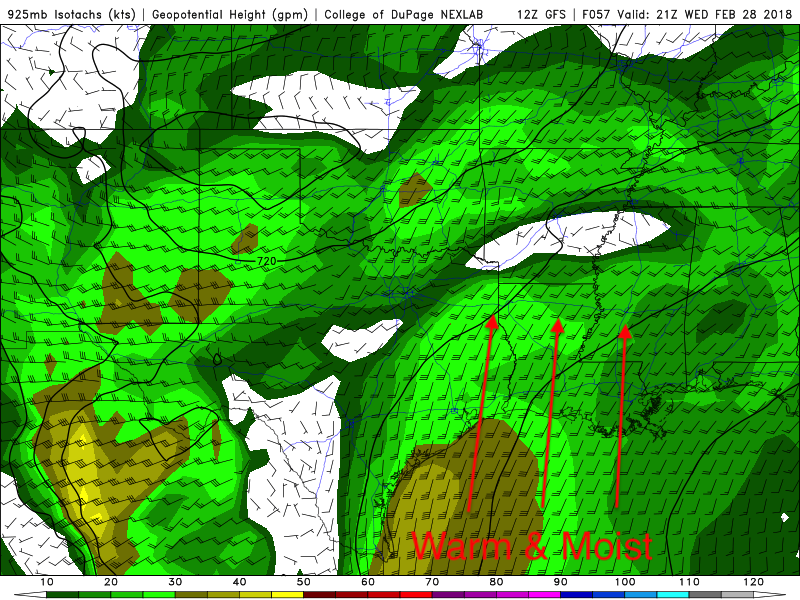
925mb Winds at 21z WED Feb 28th, 2018:
500mb Winds at 21z WED Feb 28th, 2018:
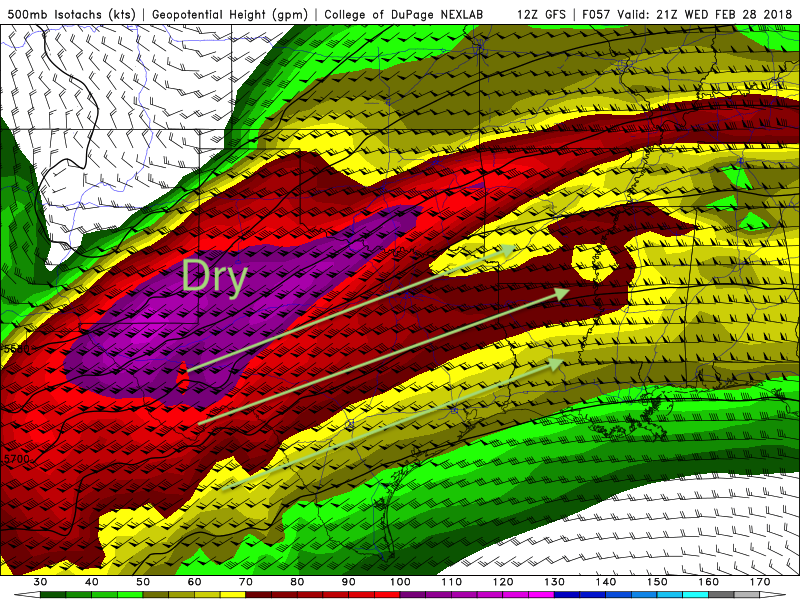
So, as you can see from the above images we do have convective instability. We have that warm and moist Gulf of Mexico air underneath the dry desert Southwest air that really sets the stage for some severe weather to take place.
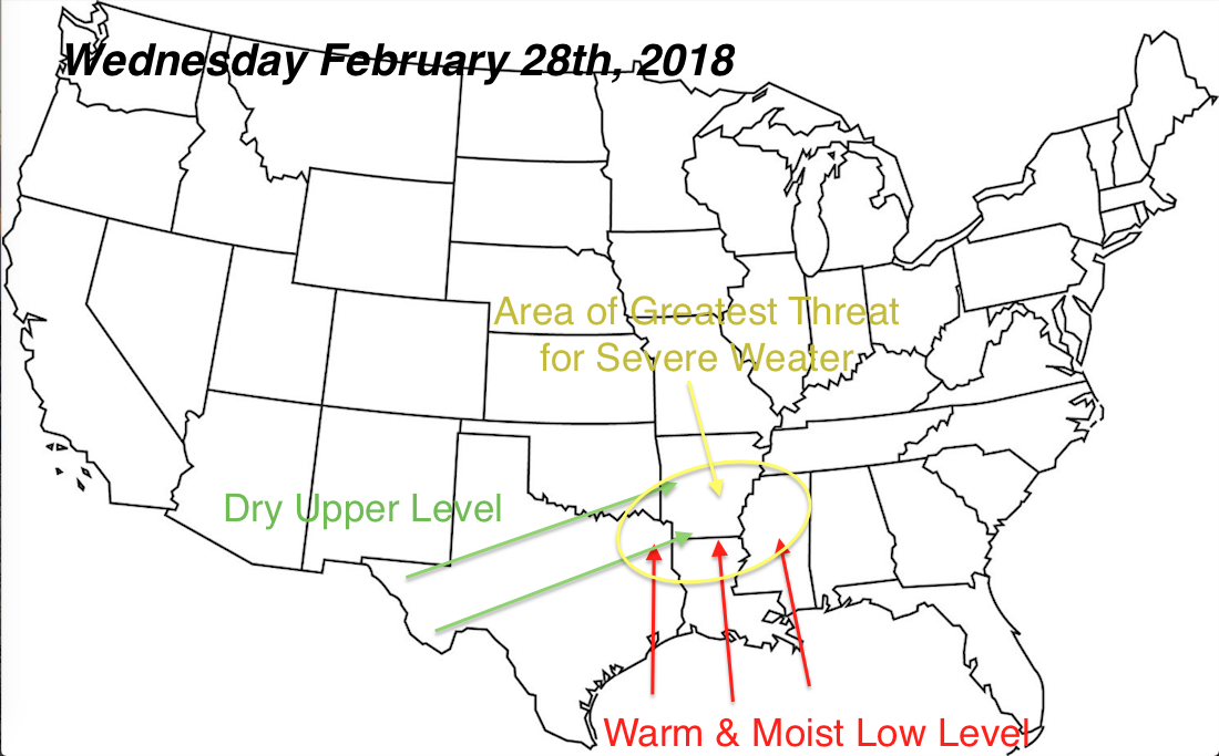
In conclusion we do have our three parameters that will help contribute to severe weather on Wednesday. We have our CAPE, wind shear, lifting mechanism, and our convectively unstable air. Below is my forecast on where I expect to see the greatest threat for severe weather, stay safe and continue to monitor the weather along with us!
-Alex B
You must be logged in to post a comment.