
Skip to content
Latest
  • Latest 2026-27 Winter Outlook for the Carolinas
  • Winter 2026-27 May Not Be What We Expect in the Carolinas
  • A Drop Down to Normal Just In Time for Fall?
  • Hot September Incoming
  • Single Digits Likely Tonight in the Carolinas
Carolina Weather Authority

Carolina Weather Authority

  • Home
  • Map Wall
  • Home
  • Michael Griffith
  • Page 143

Author: Michael Griffith

I have had a passion for the weather since a very young age and am a degreed meteorologist. I have a Bachelor of Science from Penn State University and a Master's from Plymouth State University. If you ever see me out and about in the Charlotte, NC or Fort Mill, SC area, be sure to say hi!

Fair Across the Northeast, Stormy in the Southeast

July 15, 2017 By Michael Griffith

The Northeast will once again see temperatures that won’t hit 90, and will be mostly in the low 80s across the region for Sunday. We’reRead More

Share to inform your family and friends!

  • Tweet
  • Email a link to a friend (Opens in new window) Email

Like this:

Like Loading…

STRONG TO SEVERE STORMS TODAY FOR THE CAROLINAS, ATLANTA

July 15, 2017 By Michael Griffith

Marginally strong to severe storms possible across NC/SC today including the beaches. Altanta is on on the storms today as well. Be ready to seekRead More

Share to inform your family and friends!

  • Tweet
  • Email a link to a friend (Opens in new window) Email

Like this:

Like Loading…

Rounds of Relief from the Heat are in Store

July 14, 2017 By Michael Griffith

Tired of the heat? It has been brutal, especially across Virginia, PA, and portions of the South. The good news is that the Mid-Atlantic, andRead More

Share to inform your family and friends!

  • Tweet
  • Email a link to a friend (Opens in new window) Email

Like this:

Like Loading…

Rounds of Storms to Rumble Through Southeast PA, Philadelphia

July 13, 2017 By Michael Griffith

There is currently a Severe Thunderstorm Warning out for Southeast PA including Philadelphia and other nearby locations until 9pm Thursday. Some of the storms mayRead More
Share to inform your family and friends!

  • Tweet
  • Email a link to a friend (Opens in new window) Email

Like this:

Like Loading…

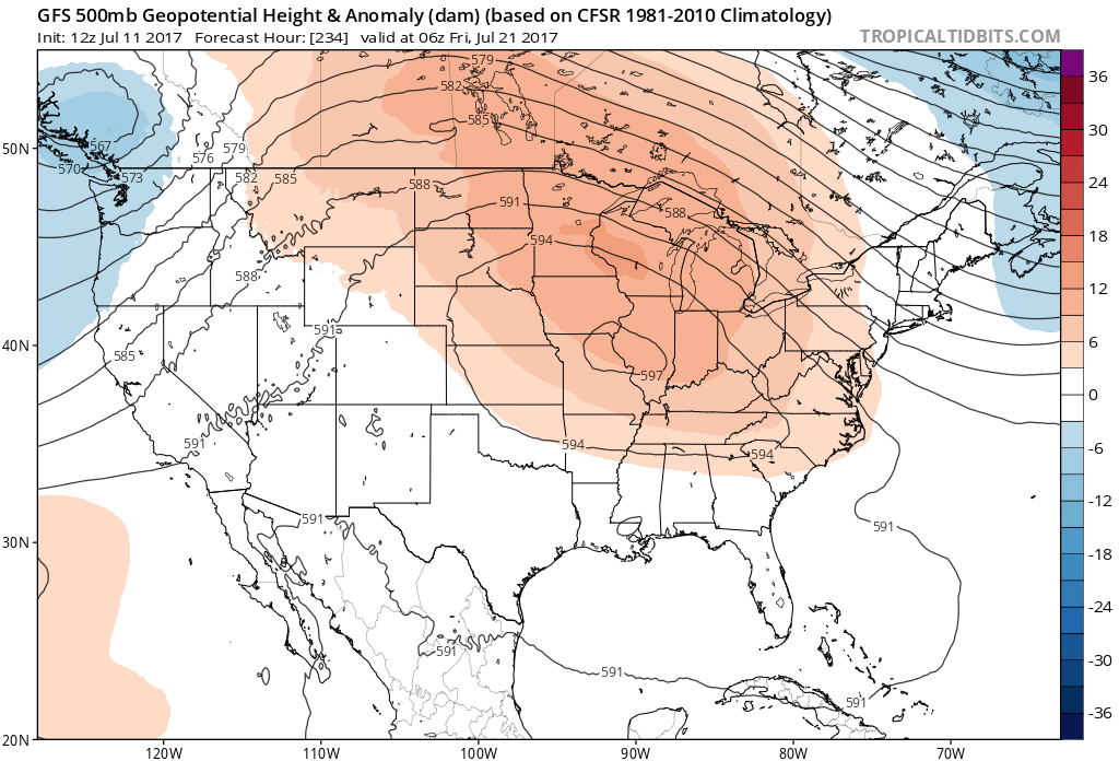
Hot and Sticky for the Rest of July, But Not Too Hot

July 11, 2017 By Michael Griffith

It is July, so we can expect July-like temperatures for many locations. There has been a series of cool shots, not cold, but cool thatRead More

Share to inform your family and friends!

  • Tweet
  • Email a link to a friend (Opens in new window) Email

Like this:

Like Loading…

Weak El Niño Rest of Summer

July 6, 2017 By Michael Griffith

El Niño easing in the Pacific Could Mean Stormy We’re in July now, and there has not been much of a change in overall seaRead More

Share to inform your family and friends!

  • Tweet
  • Email a link to a friend (Opens in new window) Email

Like this:

Like Loading…

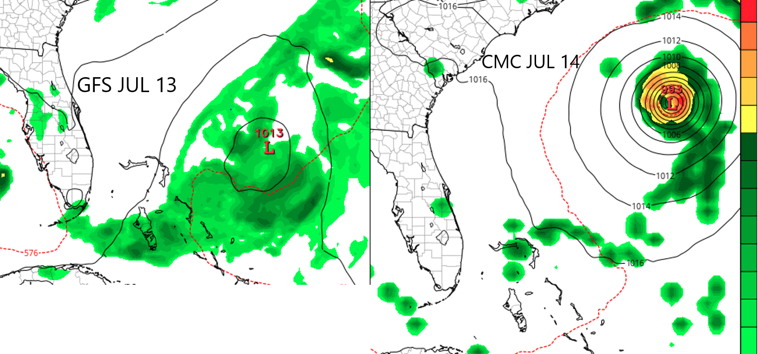
Long Range Outlook for July 2017

July 5, 2017 By Michael Griffith

Looking into the long-range, we’re not seeing a lot of heat here in the East. It will mainly be focused in the West, at leastRead More
Share to inform your family and friends!

  • Tweet
  • Email a link to a friend (Opens in new window) Email

Like this:

Like Loading…

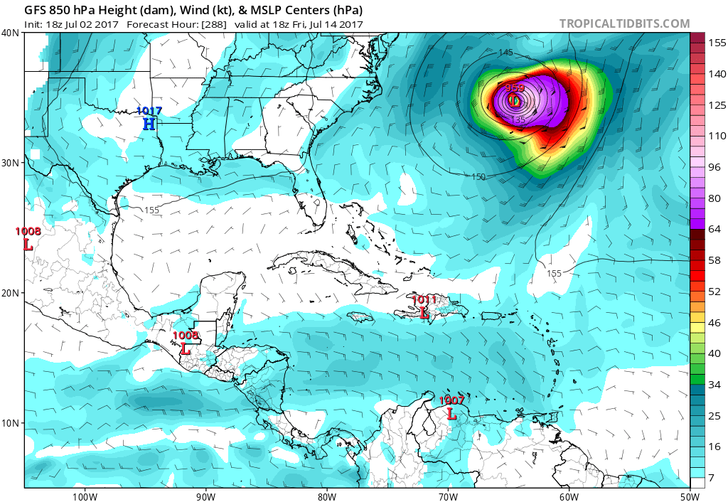
0Z Models and Analysis Shows Invest 94L May Weaken and Head out to Sea

July 5, 2017 By Michael Griffith

Looking at the latest 0Z models early Wednesday morning, Invest 94L may not have a direct impact on the US, and may fall apart andRead More
Share to inform your family and friends!

  • Tweet
  • Email a link to a friend (Opens in new window) Email

Like this:

Like Loading…

Invest 94L is Born

July 2, 2017 By Michael Griffith

We now have Invest 94L in the Atlantic. Chances of development are 60% over the next 5 days by the NHC. Fortunately, models are takingRead More

Share to inform your family and friends!

  • Tweet
  • Email a link to a friend (Opens in new window) Email

Like this:

Like Loading…

NHC and Models Continue to Indicate Tropical Trouble

July 2, 2017 By Michael Griffith

The NHC has now increased their probability to 50% of formation with the tropical wave currently in the Atlantic. This wave is forecast to continueRead More

Share to inform your family and friends!

  • Tweet
  • Email a link to a friend (Opens in new window) Email

Like this:

Like Loading…

Posts navigation

Older posts
Newer posts

Like us on Facebook!

Like us on Facebook!

Active Alerts

Current NWS Watches, Warnings, and Advisories

7-Day Tropical Outlook

Today’s Severe Threat

Follow Us

  • Facebook
  • X
  • Instagram
  • YouTube
© 2019 Best blog in 21st Century
Powered by WordPress - Lekh by ThemeCentury
Carolina Weather Authority
Loading Comments...

You must be logged in to post a comment.

%d