
A break in our summer-like pattern will arrive mid to late week as Hurricane Humberto jogs northeast and drags a trough in behind it just off the East Coast, supplying the Carolinas with cooler, early autumn-like weather.
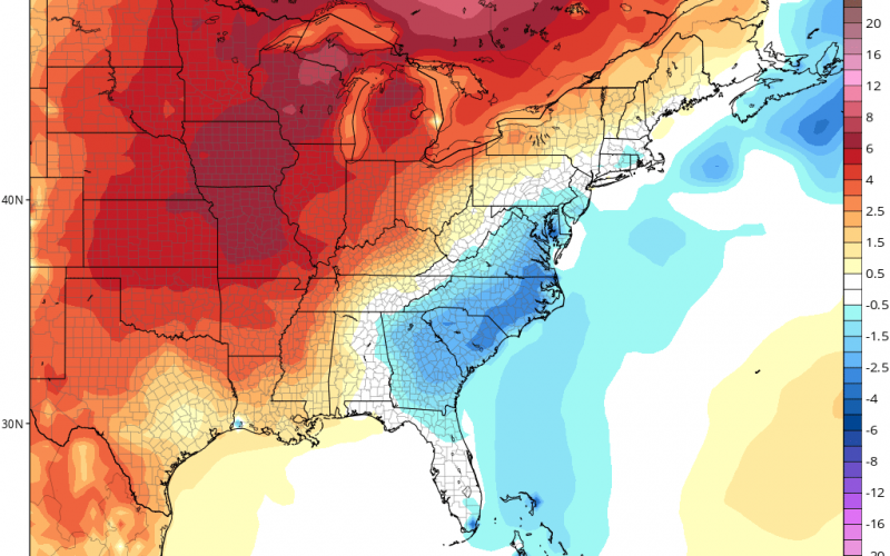
High temperatures Wednesday through Friday will be in the 70’s for most areas with maybe just a few 80’s further south and east closer to the coast and only 60’s for many mountain locations! Lows will drop into the 50s for much of the Carolinas and low 60s closer to the coast with some of our higher elevations dropping into the 40’s! The coolest morning will be on Friday. Check out the latest run of the GFS for Friday morning:

Humidity will also be considerably lower. A stray shower is possible Wednesday and again Friday in southern areas, but generally conditions will stay pretty dry, with no real beneficial rainfall .
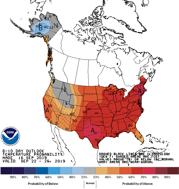
We return closer to seasonably warm conditions this weekend into next week with temperatures well into the 80’s and eventually 90’s again in spots as the ridge returns. The Climate Prediction Center keeps the Carolinas at a higher probability of seeing above normal temperatures over the next 1-2 weeks in general.
No real sustained autumn-like pattern seems to be in the cards just yet, so enjoy the brief taste coming up for later this week. As always, make sure to stay tuned to Carolina Weather Authority for the latest significant weather information on Facebook and Twitter and here on the site.
-Jesse
Carolina Weather Authority
You must be logged in to post a comment.