
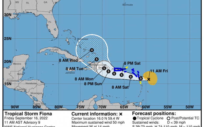
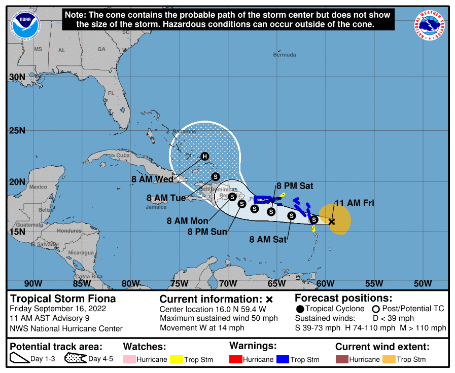
Tropical Storm Fiona is expected to affect Puerto Rico and the Dominican Republic by Monday morning, and then the Bahamas early next week. While she is expected to remain at tropical storm strength, she will intensify into a hurricane by early Wednesday.
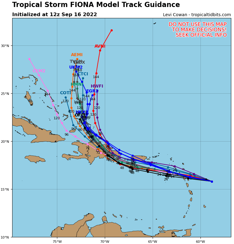
Current spaghetti plots do indicate a turn out to sea, but if this system remains weak it will still continue on a westward trend. But a good cluster of tracks below indicate that eventual north turn.
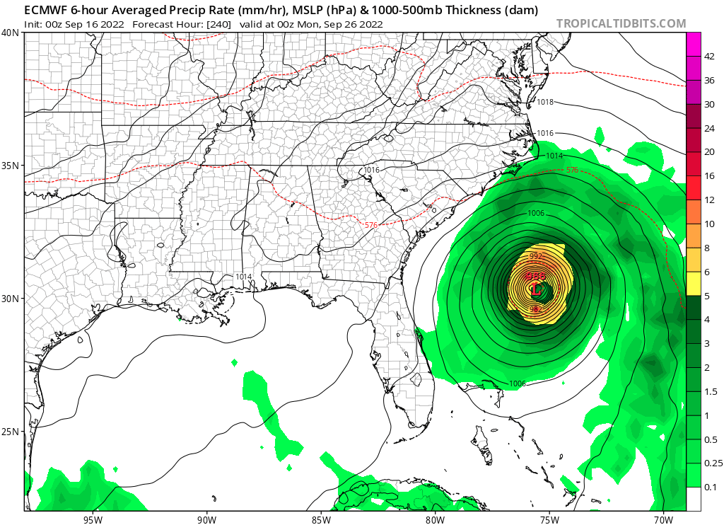
The Euro operational now available on www.tropicaltidbits.com shows a more concerning look off the coast around the 26th or in 10 days. This does not look like a monster hurricane however as far as strength. But the Carolina coasts should continue to monitor this storm as it evolves.
This is just an estimation, and for all safety and financial decisions, please consult the NHC or your local NWS for all decision making.
Keep at here at Carolina Weather Authority with Mike and Jesse StormTrackerSacher!
You must be logged in to post a comment.