
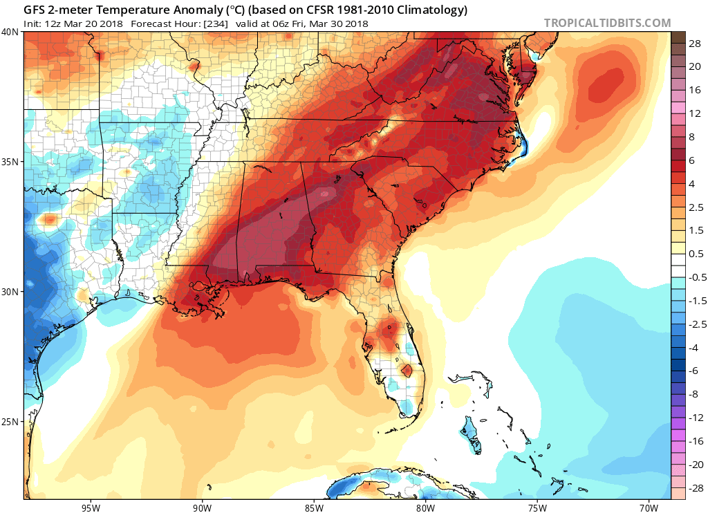
Currently across the Mid-Atlantic and Northeast we are preparing ourselves for the fourth nor’easter in as many weeks. The question still lingers, when will spring arrive? Right now we have the fourth nor’easter dragging down cold Canadian air and bringing heavy wet snow to portions of the Mid-Atlantic. Some relief is in sight from winter though, after our storm moves on by a brief warmup period to end March will move into the East.
Directly after our storm moves on by the cold air will remain in place until mid-week next week when a ridge will move into the region bringing temperatures back to near or above average. Also, there is great agreement among the two major global models for this brief warmup period at the end of the month.
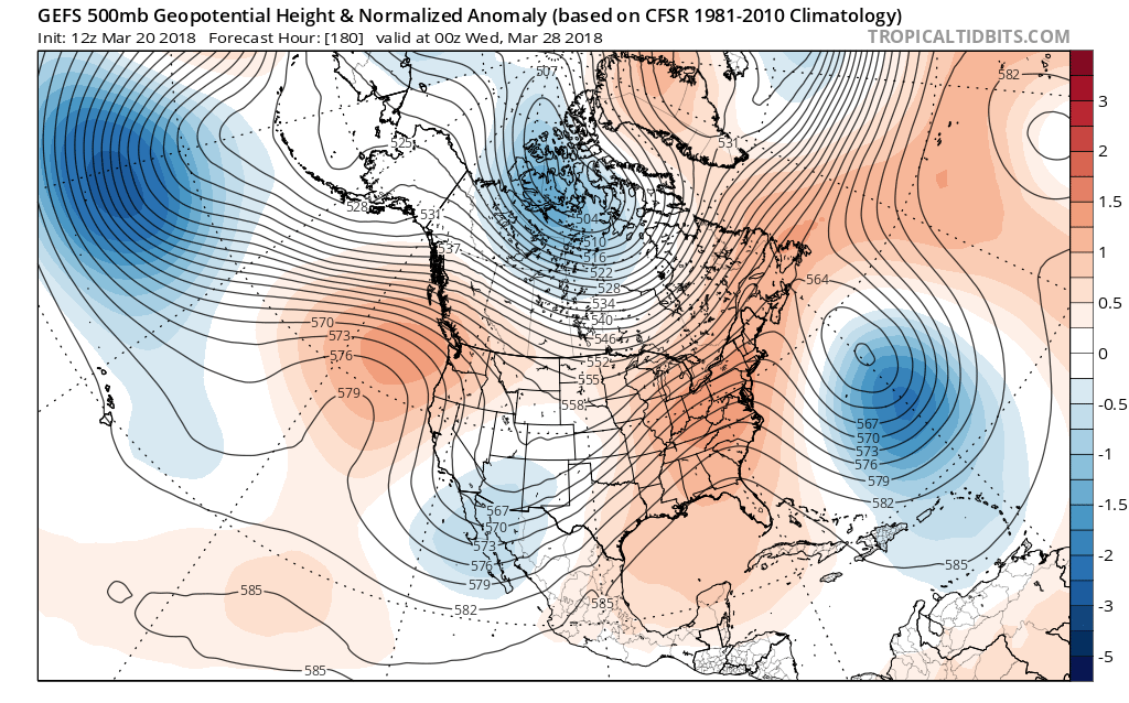
GEFS 500mb Height Anomaly for 00z WED March 28th, 2018:
EPS 500mb Height Anomaly for 00z WED March 28th, 2018:
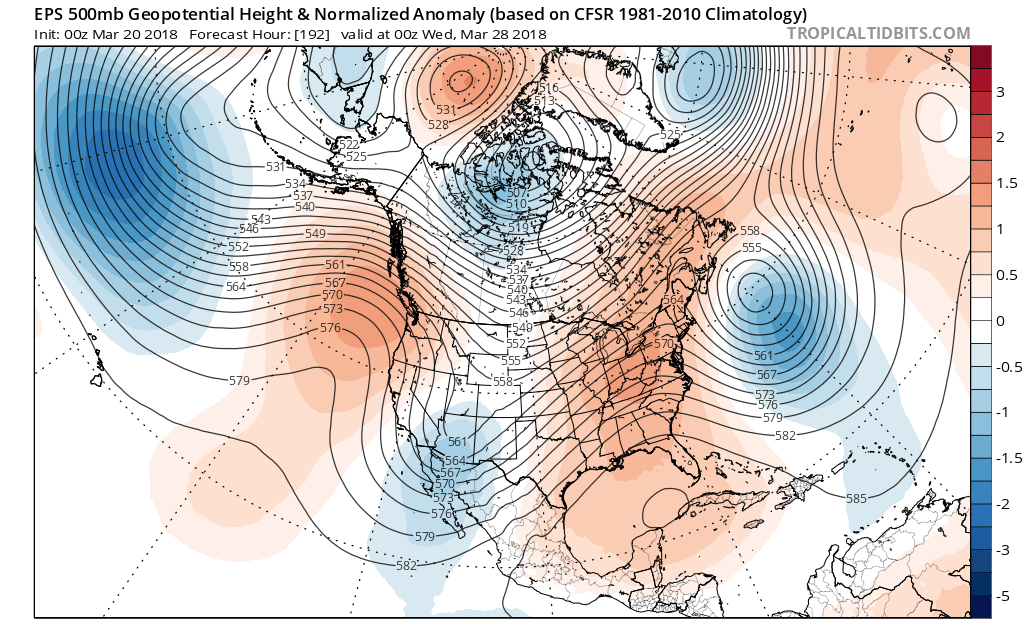
As we can see, there is very good agreement for a ridge that will build in the Eastern half of the US by the end of March. This warmup is likely brief though, as we begin April returning to below average temperatures and the threat for winter weather returns.
GEPS 500mb Height Anomaly for 18z April 2nd, 2018:
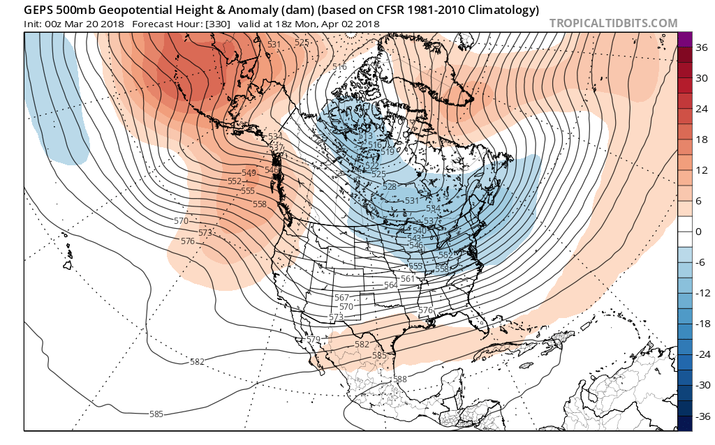
Looking at the beginning of April, we can see below average heights return to the east coast. That means that we could yet again see more wintry weather for the east coast as we begin the month of April. Still a very long ways away, but hints of winter sticking around are all around. Continue following along with us here at East Coast Weather Authority as we keep everyone updated on what is to come!
-Alex B
You must be logged in to post a comment.