
Widespread snow is to overtake the Mid-Atlantic region later tonight and into the day tomorrow. Heavy wet snow and gusty winds bring the threat for widespread power outages to places like Washington D.C and Philadelphia.
Our system really gets going later tonight as the initial energy moves into the Ohio River Valley and then transfers its energy to the coast. A new low will develop and strengthen into the fourth nor’easter in as many weeks. Before we get to the forecasted snowfall let me just show you the steps our storm is to take in order to bring heavy wet snow to many locations.
GOES 16 Visible Imagery:
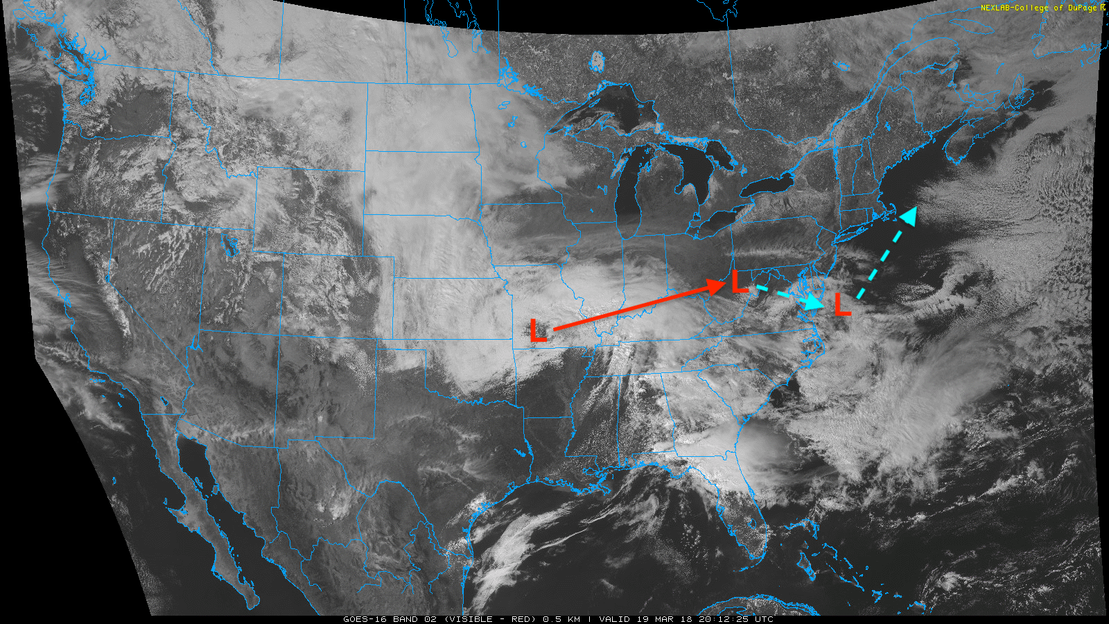
Right now our system is centered in southwest Missouri and will move northeast into the Ohio River Valley as mentioned before. Then, the system will transfer its energy south of the Delmarva and then continue to move northeast and dump heavy wet snow along the coast and to places like Washington D.C and Philadelphia.
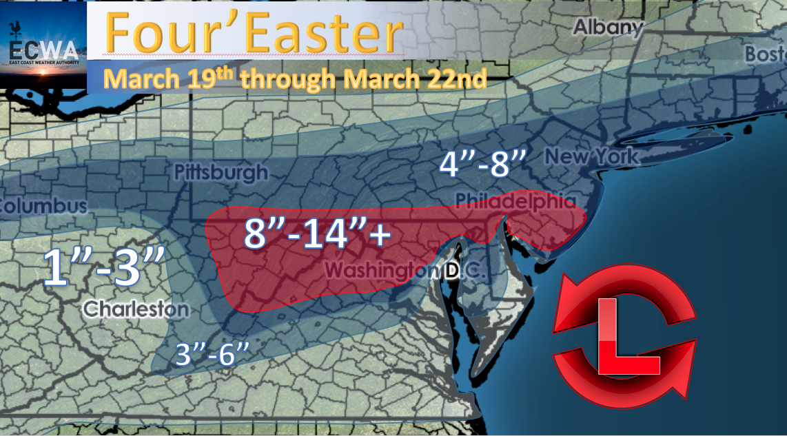
For our forecast, we have 8′-14″+ for the D.C and Philadelphia area. There is a lot of agreement among the major models that this region will see the heaviest snow. Initially D.C will start out as a mix, but when the second system along the coast takes over cold air will be dragged down from Canada quickly changing the mix to all snow which will be heavy at times.
Stay here with us at East Coast Weather Authority as we keep you updated with any changes to the forecast!
-Alex B
You must be logged in to post a comment.