
A dangerous coastal storm is underway for portions of the Mid-Atlantic tonight and into Sunday for eastern VA, the Outer Banks of NC, the Delmarva Peninsula, as well as NJ, PA and parts of Long Island. This storm is projected to move into upstate PA into Sunday, but not before causing power outages, extremely heavy rainfall, and high winds.
Travel into this evening is not advised across the Mid-Atlantic.
Impacts that will be felt are power outages, flash flooding, and downed trees and power lines due to strong winds.
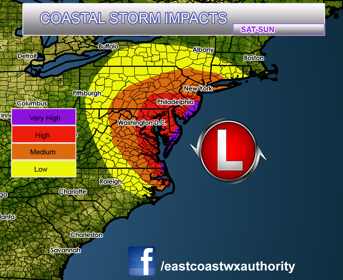
Washington, DC and Philadelphia and their suburbs are in the crosshairs for some high impacts tonight. Power outages are likely in those areas. Along the coast, impacts are the greatest due to beach erosion, power outages, coastal flooding and wind damage.
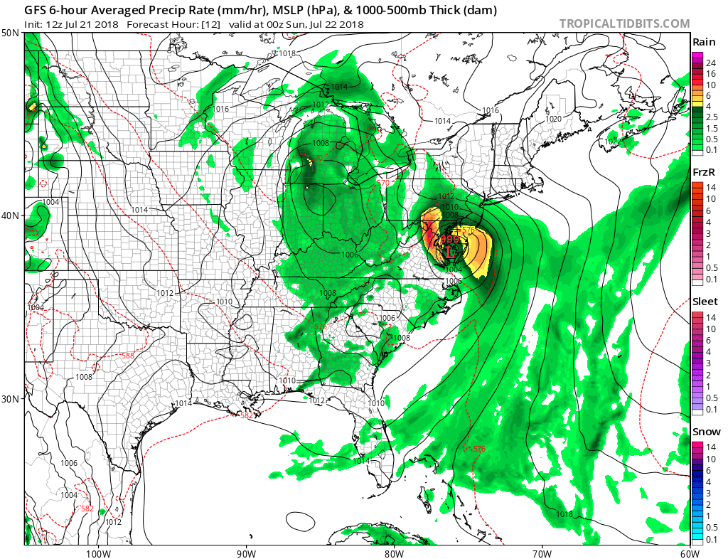
This storm may rapidly intensity as it moves up the Chesapeake Bay. Shown is the GFS for 8pm this evening.
Keep alert for statements from your local NWS and news stations. Avoid travel if possible and have a safe place to shelter.
East Coast Weather Authority
You must be logged in to post a comment.