
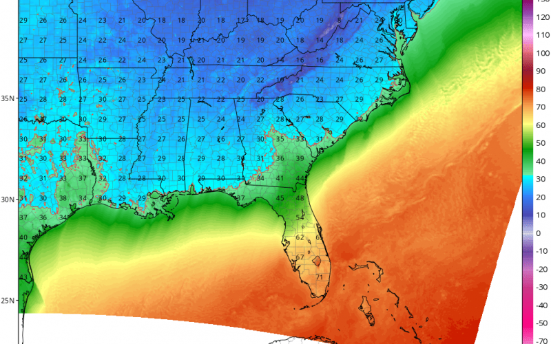
After a cold end to the week and a cold wake-up Weekend, we will start to slowly warm up a bit on Monday and for part of the day on Tuesday. But then at some point on Tuesday a powerful cold front sweeps across our region and brings crashing temperatures into the night. By Wednesday morning wake-up, many of us will be looking at lows in the 20s! Shown below are forecast low temperatures for early Wednesday morning:
Charlotte will be in the low 20s and the mountains will be in the teens! Eastern TN and the NC mountains could see flakes, especially as colder air blows in. Below on the Euro places such as Knoxville, Johnson City, and Asheville, Boone, and Banner Elk could pick up some light accumulations. At the minimum, flurries, at the most a coating to 2 inches. Below is the Euro valid at 7 am Monday:

The flakes will most likely be limited to the mountains. The rest of NC, SC, and VA will NOT see snow, although MOMENTARY flurries can’t be ruled out
This will be a very strong cold front, and pets, pipes, and people should be protected since lows will dip a good deal below freezing by Wednesday morning. The cold will also carry over into Thursday morning, then temperatures start to moderate. We are keeping an eye on something for next weekend as well, although it’s a long time away, so stay with us!
-CWA
You must be logged in to post a comment.