
When looking at hurricanes in the medium-to-long range, we must see if there are any similarities between the models, as in agreement. If there is agreement, then we can say with some confidence that a situation could likely play out. Lots of times, pages will post a single model a week away and it will be a scary looking image. We are not trying to be like that.
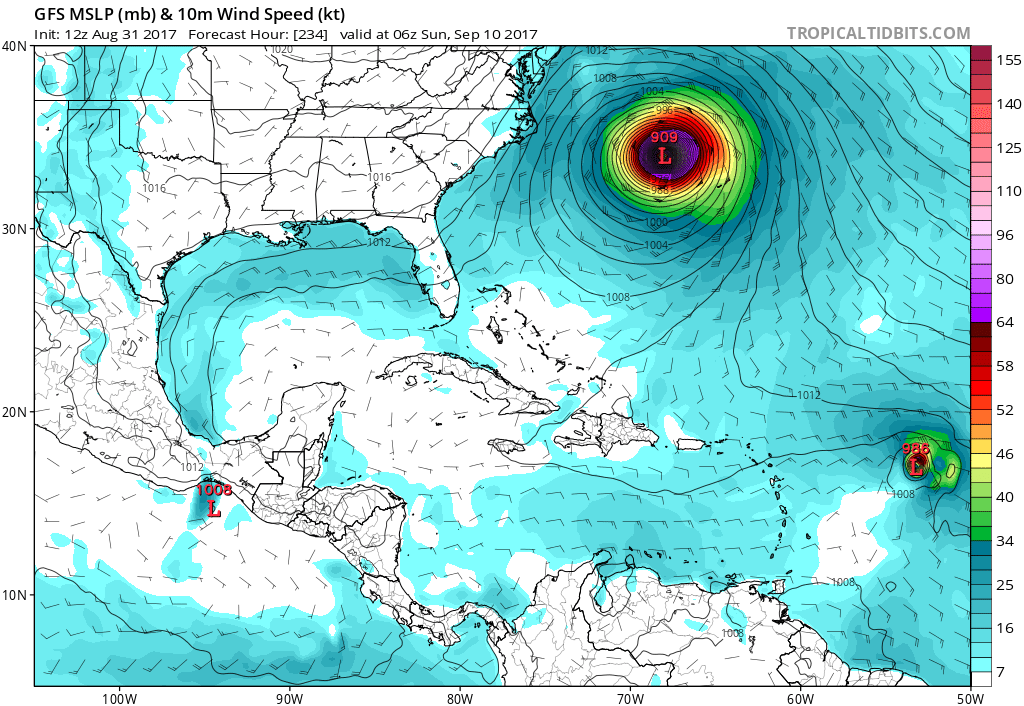
The first image shown is the GFS, around September 10th. It puts Irma on a track that heads out to sea, which is fortunate.
Now let’s take a look at the Canadian model. This model has it track a bit slower than the GFS, and a bit more west. However, there are indications that the storm would take more of a northward turn at the end of the model run. This would also be out to sea if, and only if, this model was correct.

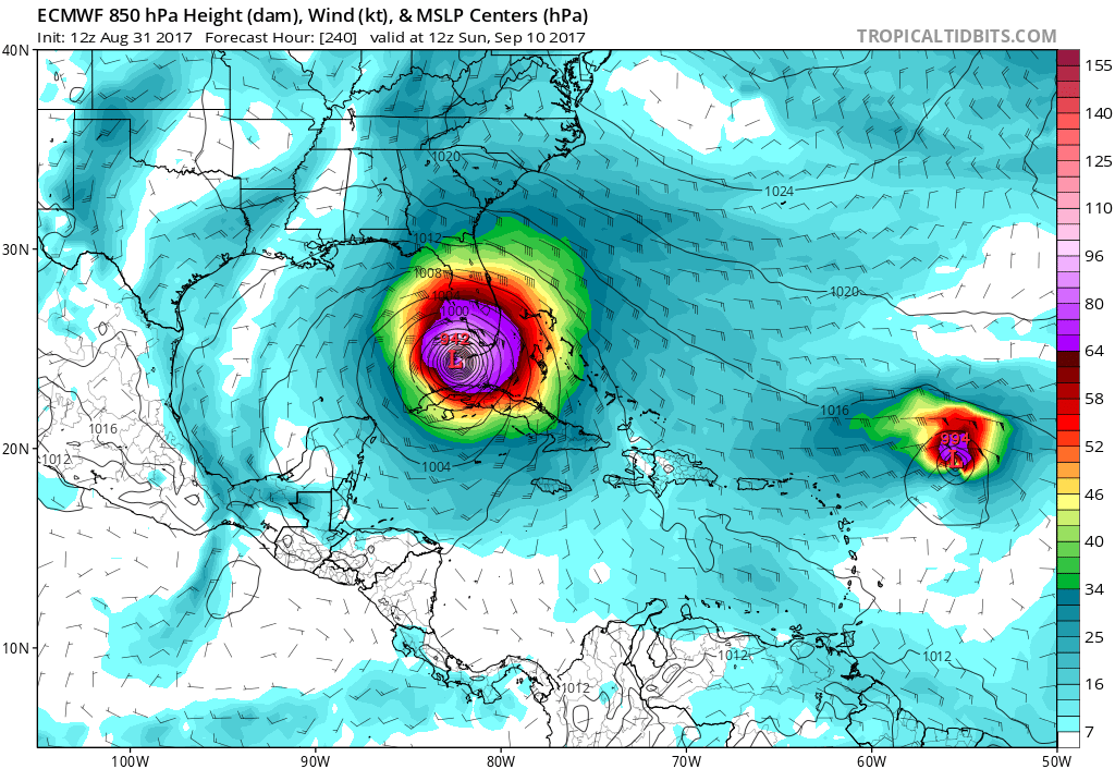
How about the “king” Euro? It is not so forgiving. It keeps Irma on a westward path, which is NOT GOOD at all. This would be right past the southern tip of Florida! Also, note another storm on her heels. The GFS also has this storm that follows. Puerto Rico, the Bahamas, Cuba, and Florida all seem to be threatened by the Euro model. Also, if this plays out, the Gulf Coast is not safe from this monster!
Euro:
Sept 10
This is a potentially VERY dangerous situation, and everyone from the Carolinas, to Florida, to the Gulf Coast needs to pay close attention to this hurricane. Check back on this blog for updates!
You must be logged in to post a comment.