
Father’s Day weekend will be a hot one, especially across Virginia, but then temperatures will likely go back to near normal for this time of year. The heatwave will begin on Sunday and will last until about the 20th when a backdoor cold front pushes through. We could see some temporary relief from the heat then, otherwise we will be back to near normal temperatures. The 21st through the 25th looks like near normal temperatures but models are indicating we could be slightly above normal. Temperatures could range from 5-10 degrees above normal.
But then we start to see a cool shots of air invade the nation’s midsection. This shot of cool air I’m thinking will try to push east over our region. Below is the GFS for the 25th:
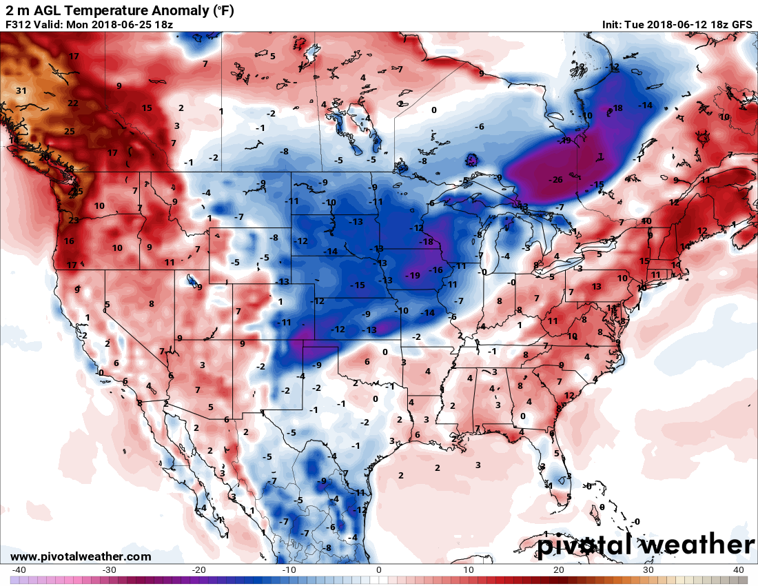
There is evidence of the cooler air trying to make its way east on the GFS. The 26th shows the cooler air over the Midwest and Ohio Valley. While models are not quite picking up on this yet, my suspicion is that the next stop for the cooler air would be the East Coast. If it does make it here, it could feel like late spring.

The catch with this invasion of cooler air would be severe weather with an associated cold front. The Southeast would be included in this potential severe threat IF the cold air situation were to unfold. As of now, this is just a possible scenario that I’m looking at for a pattern shift later this month.

You must be logged in to post a comment.