
According to the GEFS ensembles, there is another pattern flip coming later this month. After a ridge of high pressure this week, with warm temperatures in the upper 80s to low 90s, a big change comes. Unfortunately, we will have to deal with another severe outbreak depending on how fast and strong the cold front will be that brings the changes. Around the 20th, we expect the change to take place. But around the 17-19th is when we can expect possible damaging thunderstorms. The GEFS model showing 500mb height anomalies, which are pressure patterns in the upper atmosphere that correlates with storminess:
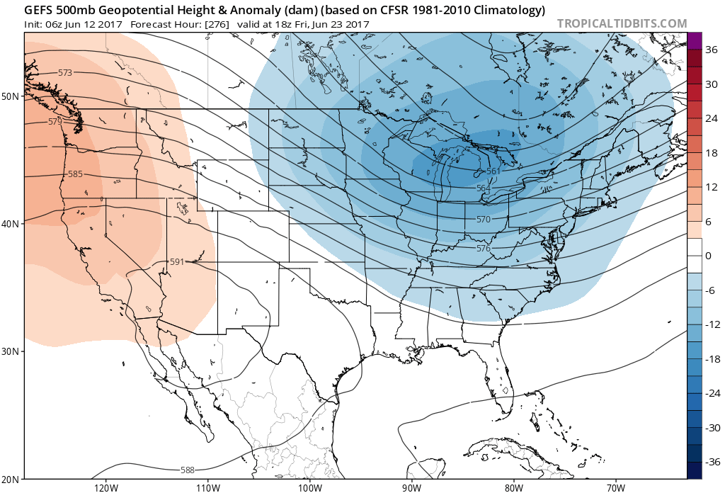
This pattern will continue at least through the 26th or 27th.
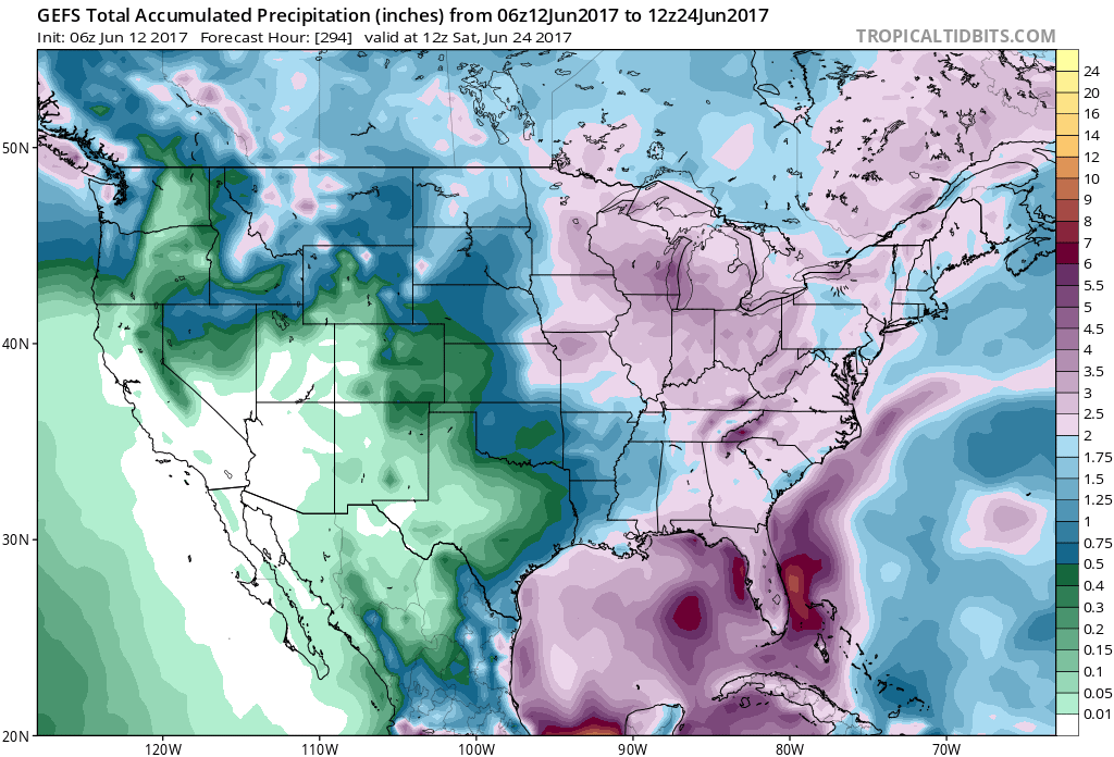
Total accumulated precipitation amounts from the GEFS ensembles is showing wetter than average in the East. Florida once again will be the concentrated area for flooding rains. GEFS accumulated precipitation through June 24:
Here is the regular GFS showing an example of one particular cold front moving across the Northeast and Mid-Atlantic that could bring damaging thunderstorms along with cooler weather:
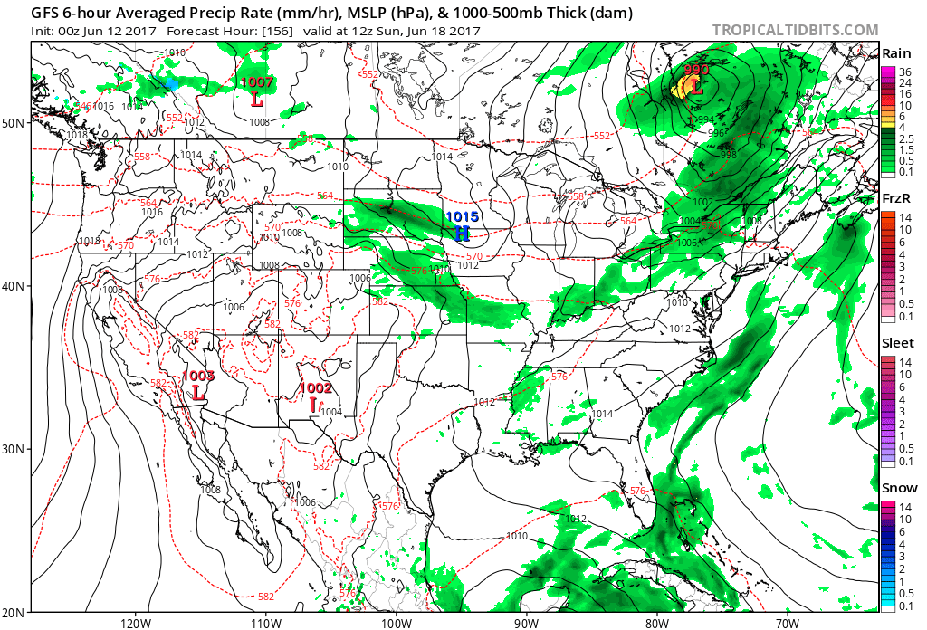
However there will be more than one cold front in the coming days that could touch off severe weather. Be on the lookout for severe weather forecasts, and watches and warnings!
Mike G.
You must be logged in to post a comment.