
Do not put that winter coat away just yet! It is April 18th, and we are still talking about colder temperatures coming our way. Today we will have highs get up into the 70s and 80s, but knocking on our door are cooler temperatures and another step back from spring.
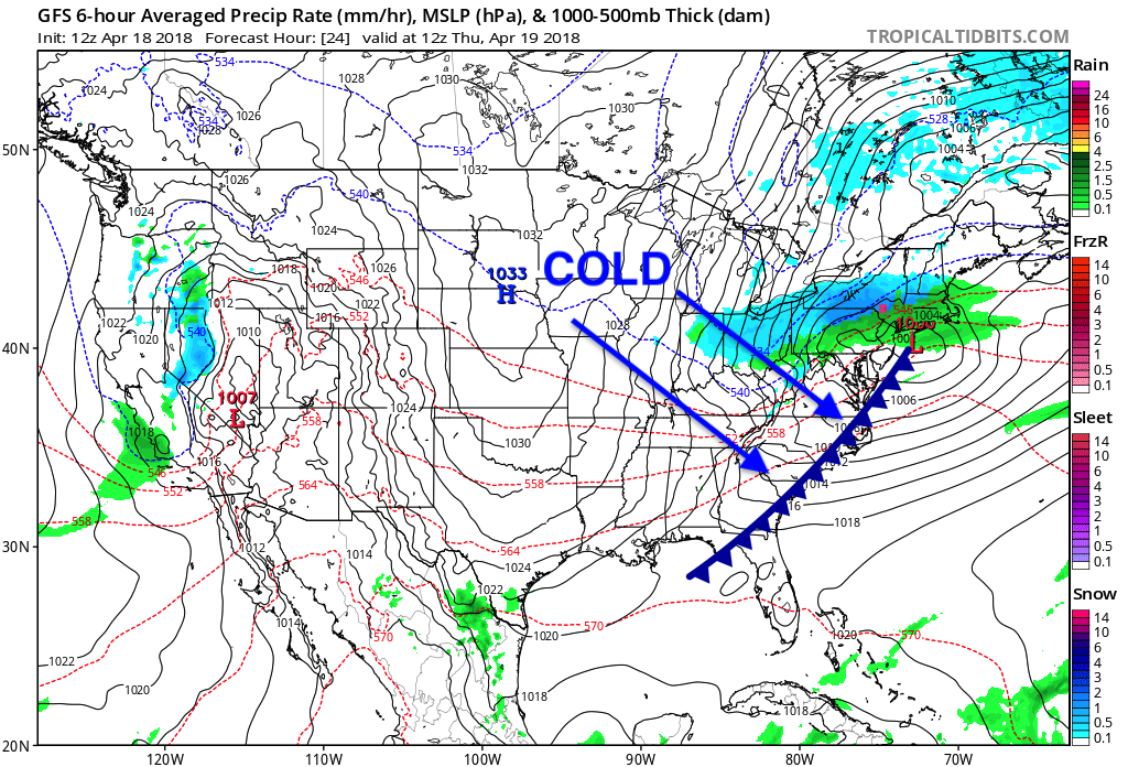
A cold front is to swing on by early tomorrow morning, and on the backside are yet again below average temperatures that are going to hinder spring fever once again.
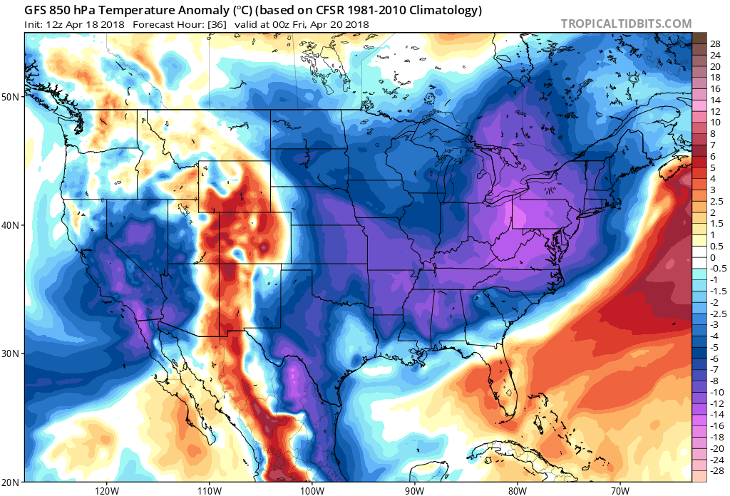
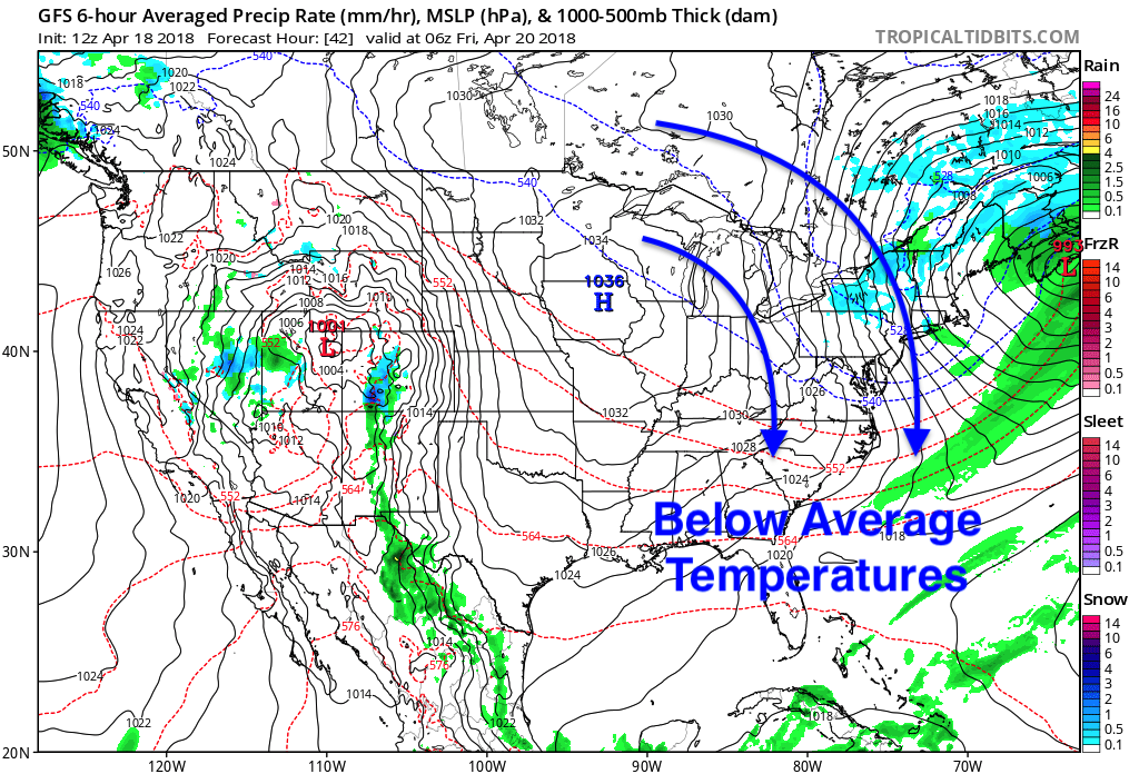
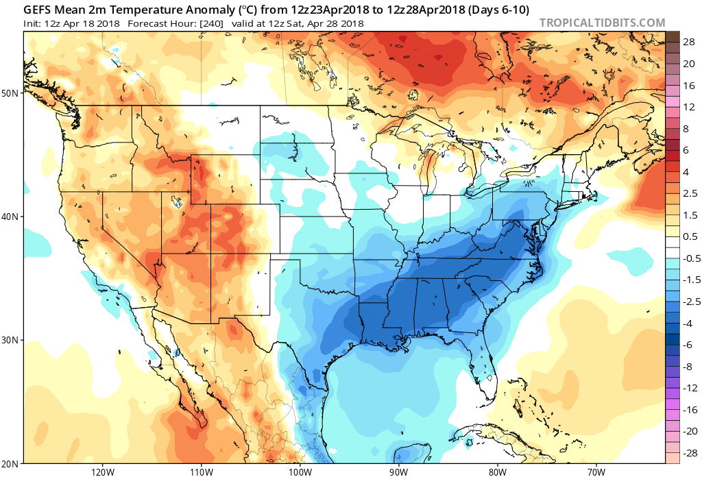
This cold front pushing through will pave the way for a high pressure to form in the central plains. With the clockwise flow of a high pressure, cooler Canadian air will be flushed into the Southeast and keep us below average.
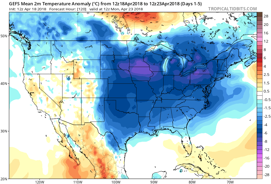
Below is the GEFS anomaly for temperatures and we are to be below average through the next 10 days across the entire Southeast region as high pressure in the Central Plains helps feed cooler air into the region
Cooler air is on the way back and looks to stay for the next week. Make sure you stay here with us at East Coast Weather Authority as we get you prepared for what mother nature brings next.
-Alex B.
You must be logged in to post a comment.