
Updated 06/19/2020 02:10am – Added River Forecast image and statement.
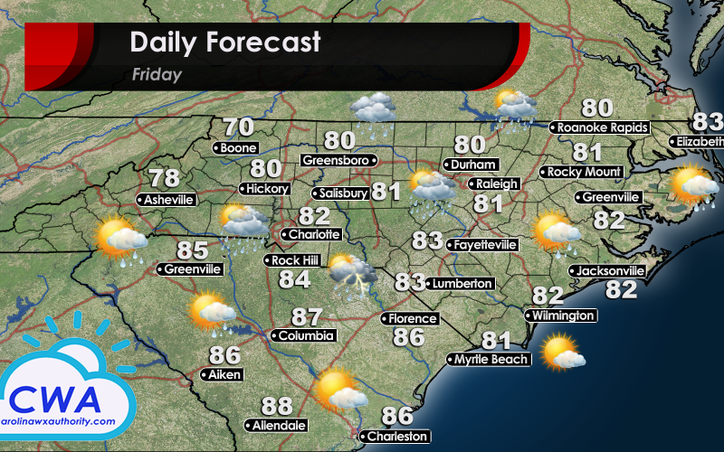
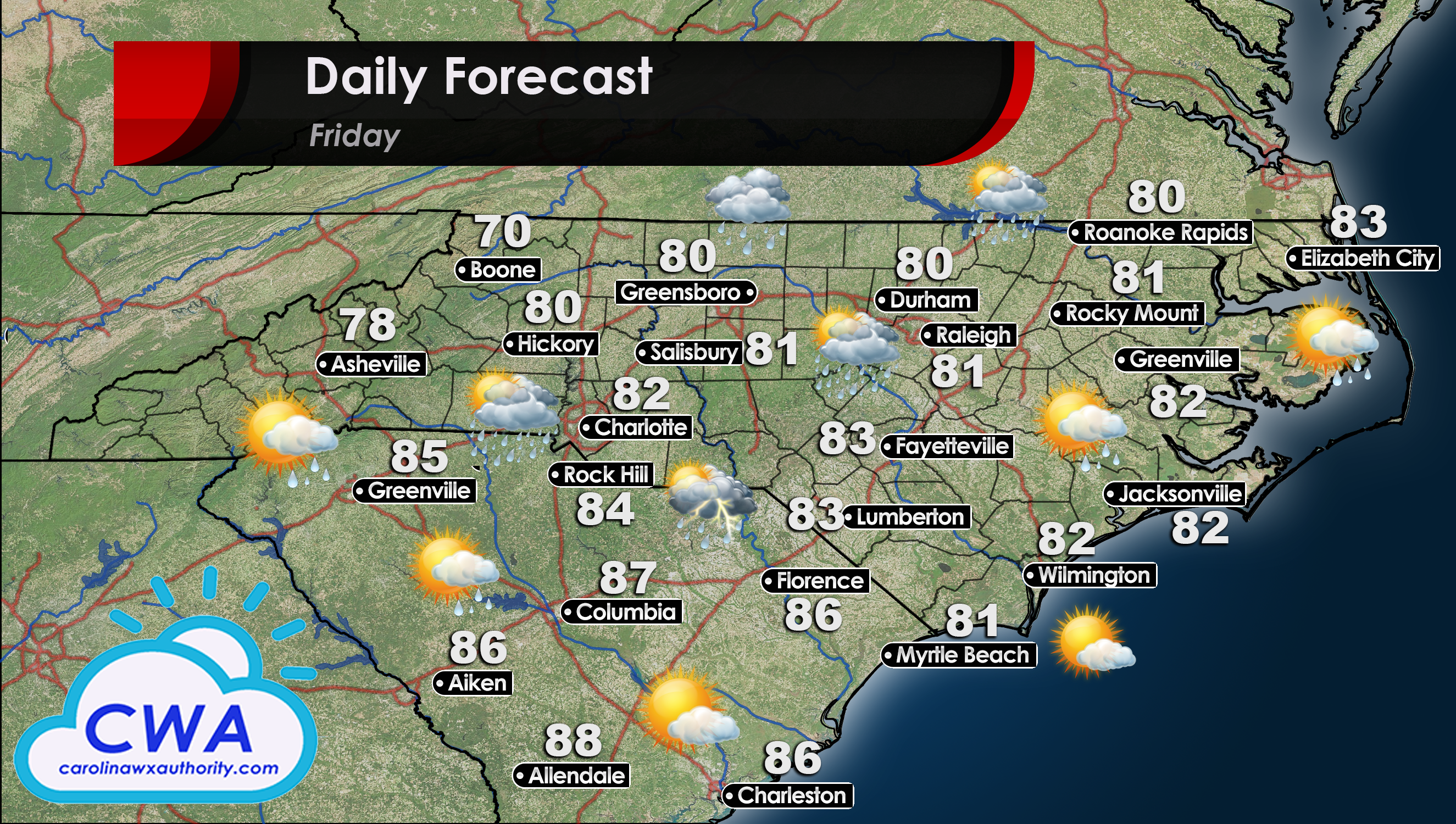
Chance of Rain still Possible Across Central North and South Carolina
As the heat continues to slowly build across North and South Carolina, we can expect storm chances to increase with the heating of the day. That is, for areas that are free from cloud cover. That pesky upper level low is still not done with North Carolina, and will continue to send waves of energy towards Northern and Central North Carolina. Fortunately, while most of the ingredients needed for storm formation are in place, there is going to be insufficient lift to generate widespread rain/storms.
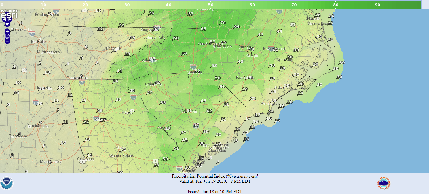
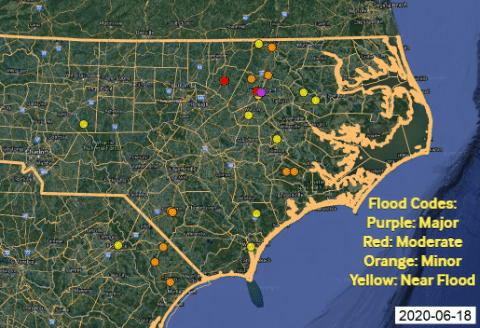
We are still tracking some potential flooding along the Tar River and Stoney Creek in North Carolina. We will be watching the river levels closely over the next week and a half, as it can take quite some time for water to make its way across the state. Below you can see the official river stage forecast for NC/SC. Only river gauges which are forecast to be “Near Flood Stage”, or greater, are shown. Thankfully, the highest water levels look to be Friday, and only in very isolated locations.
Temperatures are Rising, but Still Below Average
Temps will still be enjoyable for North and South Carolina. The beaches are looking particularly beautiful for the weekend. While the temps continue to rise each day, we are still about 5° below normal. Unfortunately, dew points are creeping up as more moisture builds into the region thanks to a generally south-southeasterly flow at the surface. As such, humidity will be in the 70% to 80% range for both states.
Still, it will be beautiful, so enjoy this nice weather before the summer comes back with a roar!
Finally, for a more in-depth look at the rest of the weekend, check out Meteorologist Joshua Nagelberg’s latest YouTube video, or watch it below!
You must be logged in to post a comment.