
In a year where we don’t want any more bad news, we have to at least get through the next chapter of 2020 which is hurricane season. And this year is expected to be quite active. Ocean water temperatures leading up to the Caribbean are anomalously warm, as is the Gulf.
What this warm water serves as is fuel for developing and intensifying hurricanes. Especially as they approach the Gulf and East Coast.
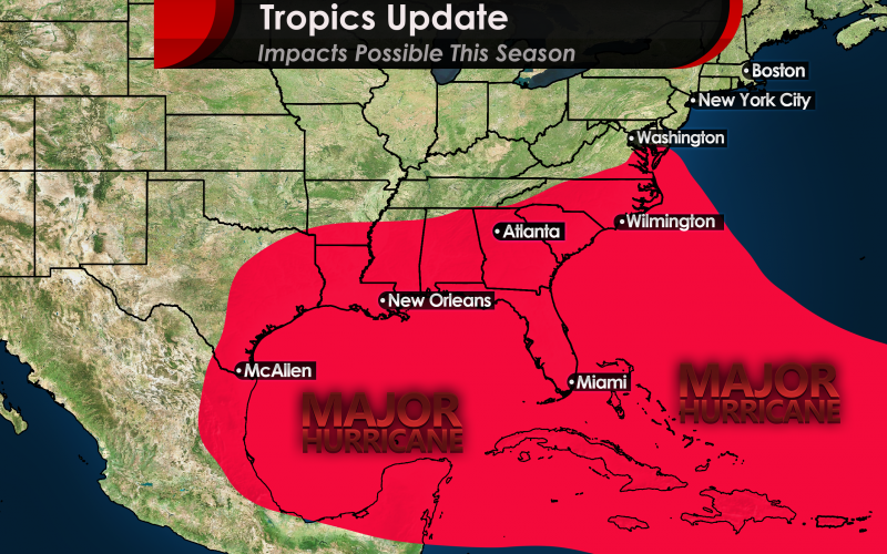
Therefore, a major hurricane (Category 3 or higher) is expected to make landfall somewhere along the East Coast or Gulf Coast this season. We are expecting at a bare minimum a Cat 3, but there could be a 3, 4, or even 5 striking land somewhere.
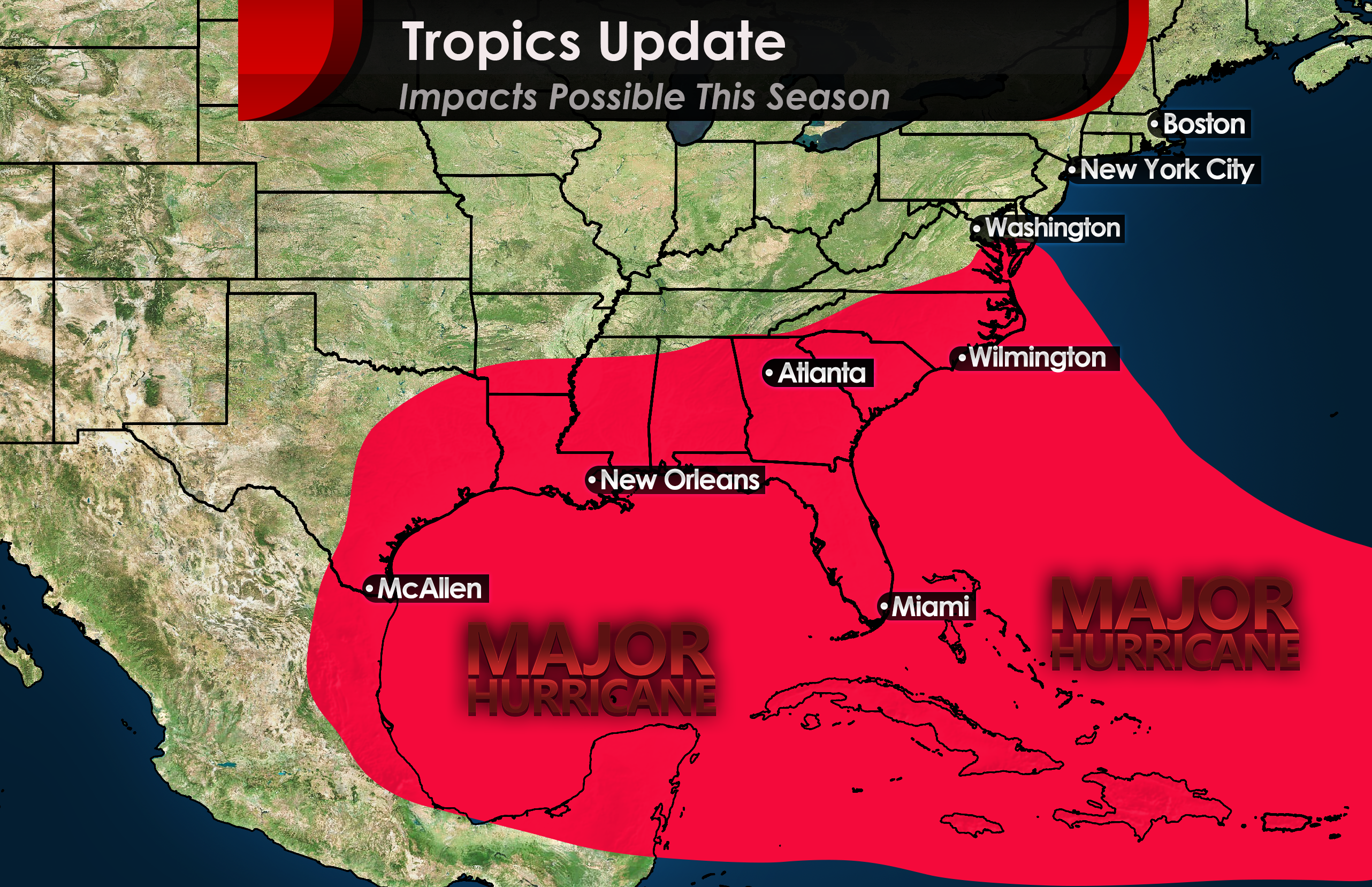
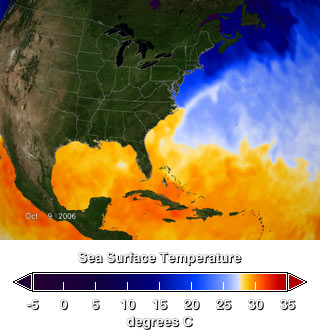
The image below taken by NASA shows very warm ocean water temperatures already and it’s not even July. Anywhere in the orange will serve as a zone for hurricanes to rapidly strengthen. This is actually warmer than this time of year back in 2005 when there was a hyper-active hurricane season, where we at least made it to a “W” storm.
See our other article discussing more detail here: Hurricane Season 2020 Could Spell Trouble for Carolina Coasts
We will continue to monitor the tropics closely this season. For now, the tropics are sleeping and now and there is no imminent threat. Once the second half of July comes around, or even mid-July, things could pick up again.
Stay with us right here at Carolina Weather Authority, and please be sure to share!
You must be logged in to post a comment.