
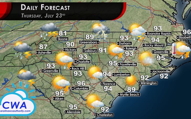
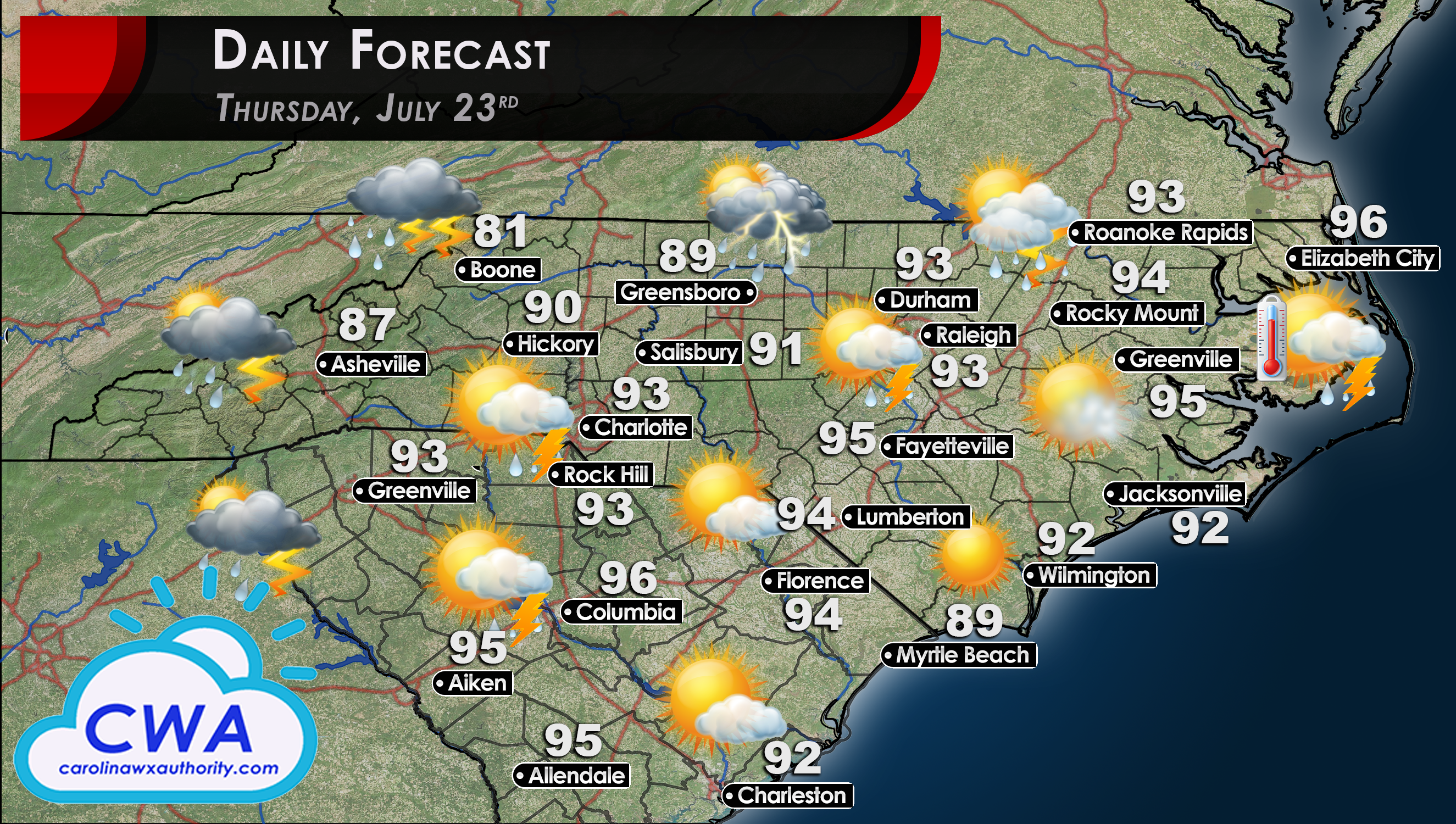
Daily Forecast for Thursday: Slight Cooldown Begins Today
Well, you might call me a liar by mid-day, but I promise the Daily Forecast for Thursday includes temps that are technically lower than they were on Wednesday. The real cooldown begins on Friday and will extend into Saturday as a weak cold front moves through the area. This will bring even better chances for storm development, as well as cooler temps (upper 80s).
As for storm chances, there is a slightly better chance for storm development across western and central North and South Carolina. We will go with ‘widely scattered thunderstorms’.
If you haven’t yet, check out Meteorologist Joshua Nagelberg’s article about the sudden burst of activity in the tropics. It is still too soon to tell if Tropical Storm Gonzalo will impact the Carolinas, or even the US. Tropical Depression Eight, on the other hand, will definitely impact Texas and Louisiana. Get all the deets on Josh’s article, and as always heed any warnings and advice from your local weather office and the NHC.
Until tomorrow, enjoy your Thursday!
You must be logged in to post a comment.