
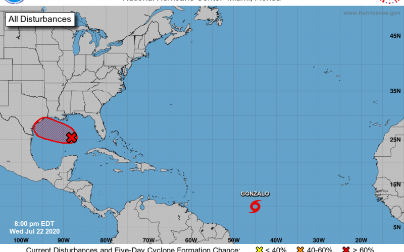
The 2020 Atlantic hurricane season is showing big signs of life, after a quiet start to the week. The first tropical storm originating from the Cape Verde Islands off of Africa formed earlier today – Tropical Storm Gonzalo is small and compact, but steadily strengthening towards hurricane status in the next 24-48 hours east of the Lesser Antilles.
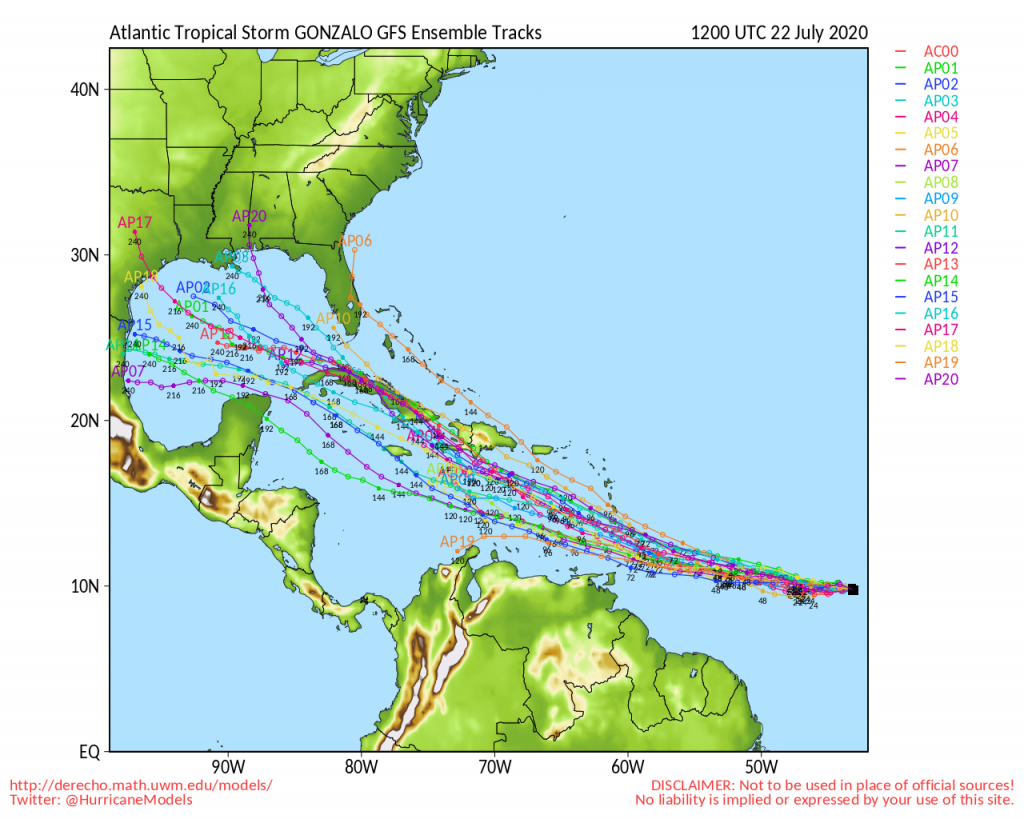
The future track and intensity of Gonzalo are both uncertain as conditions favor strengthening up until the Windward Islands, then stronger wind shear could considerably weaken the storm over the Caribbean. There’s a lot of warm water over the northwestern Caribbean and southern Gulf, so a resurgence is certainly possible several days down the road. It doesn’t look like Gonzalo will be a threat to the Carolinas.
Another system developing over the central and eastern Gulf has a good chance at becoming our next tropical storm (Hanna) by Friday as it nears the Texas coast. A lot of rain will track into central Texas by the weekend. With not a lot of time to develop, it’s unlikely this system would become a hurricane.
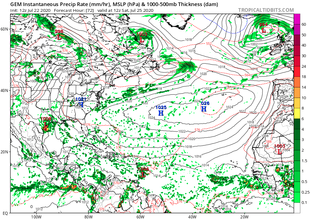
Another large wave coming off of Africa in the next day could develop down the road, and European model tracks last night showed a long track storm, likely a hurricane, could form at some point next week between the Caribbean and the central Atlantic. It’s a long way’s off, but a record ninth named storm (Isaias) looks possible, and that will be something to watch in the Carolinas for potential impact in early August. Don’t cancel any plans yet, but be mindful of what looks to be a burst of storms including major hurricanes which will catch our eye. Below is the Canadian for late next week for reference (forecast subject to change).
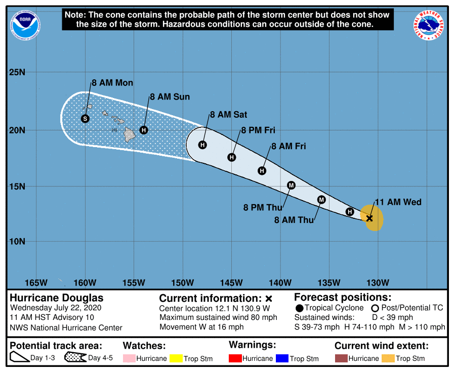
And finally, the first hurricane of the East Pacific season, Douglas, looks to continue to intensify and could be a major hurricane in 1-2 days. Models are in strong agreement that Hawaii will be threatened later this weekend as Douglas weakens slowly over cooler water. Still, it’s possible that Texas, Hawaii, and Barbados all have a landfalling storm Friday night into the weekend – a sure sign of things to come!
You must be logged in to post a comment.