
We are in the middle of a dangerous heatwave, and it will continue across the Carolinas at least through Friday. On Thursday, we could be looking at some of the hottest temperatures of the heatwave. Heat indices will continue to be in the 110-115 degrees F range across inland location.
The below map outlines the areas where we are expecting different ranges of high temperatures. See the legend below for expected high temperatures.
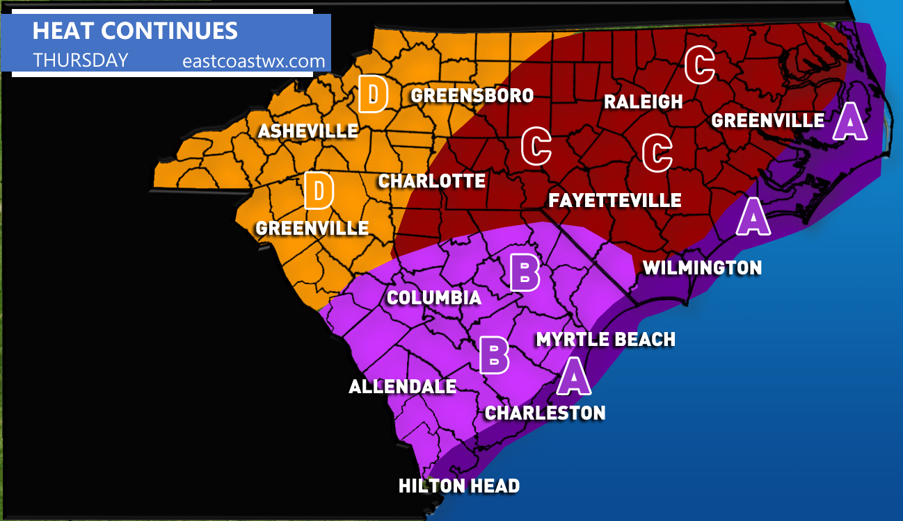
AREA A – Highs will range from 88 – 91 F on Thursday. The exception is Charleston could hit 97 F at the airport. Otherwise the beaches will be cooler than locations inland due to the sea breeze.
AREA B– These locations will experience very hot temperatures and humidity. Highs will range from 95 – 99 F.
AREA C – It will be hot but not quite as hot as it has been. Expect daytime highs ranging from 90 – 95 F.
AREA D – Expect daytime highs in the low 80s. Some areas could see a high more than 85 F.
The NAM model is indicating very hot temperatures for the Carolinas on Thursday, with highs in the mid to upper 90s inland. The only locations that may get a break from the heat will be at the beaches if a sea breeze develops during the day.

Try to stay in the air conditioning Thursday. Take frequent water breaks and try not to work outside during the hottest part of the day. It’s generally a good idea to have outdoor activities completed in the morning or late evening. Remember to check on pets and the elderly.
East Coast Weather Authority
If you liked this article, use the share button below to inform your family and friends!
You must be logged in to post a comment.