
What can we expect after our temporary cooldown later this week and weekend? A warmup, But then, the question is what will be the pattern as we head more into December? At first glance, it looks like more cool outbreaks, but nothing Arctic or severe is still on the horizon.
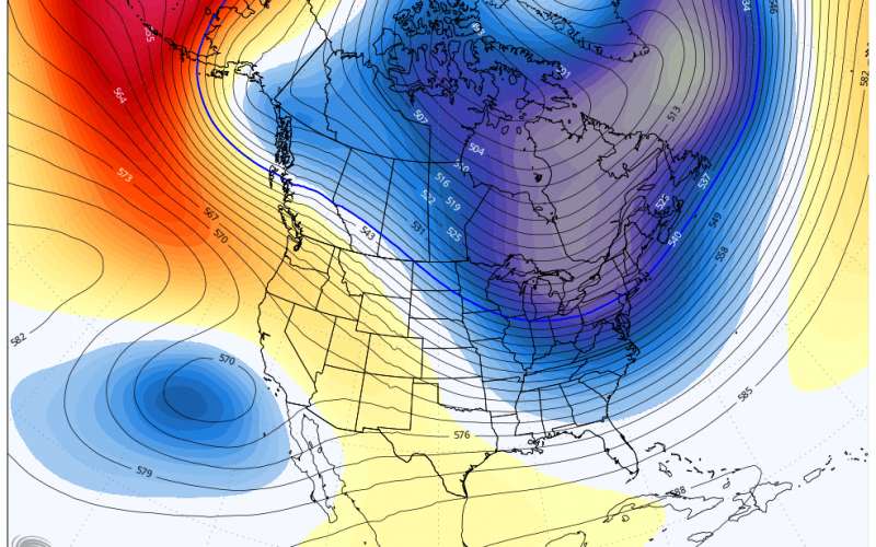
There will be some transient cool shots such as the upper air pattern showed in the model image below around 12/6. However, this is not a very deep trough, in fact, it may not even be as deep as the one later this week.
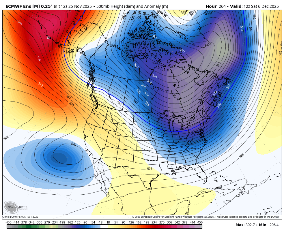
The overall pattern, ufortunately for winter lovers, looks to be warm overall. If there are any cool shots, they will quickly be replaced by warm-ups. The pattern at the end of the first week of December looks more like a ridge of high pressure across much of the southern tier or the country.

What does this mean? Exactly the title of this article, “Ups and Downs.” However we think ups will be more dominant, at least into the first 10 days of December.
The start of Meteorological Winter is in less than a week, on December 1st. The start of Astronomical Winter is on December 21st. Still a ways to go until then.
Mike G.
Carolina Weather Authority
We will be working on our Ads experience! We realize they are a lot and might need some better positioning! We will let you know when our website experience changes for the better.
You must be logged in to post a comment.