
December is certainly starting off warmer than average, and dashed many’s hopes of having a deep digging storm system right above now was supposed to deliver cold and snow for some. We are glad we did not take the bait.
For the next 10 days or so, we can expect well above average temperatures here in the Carolinas. There are a couple of not few chances for rain on the horizon, which would be welcomed here in Charlotte as we are in a severe drought.
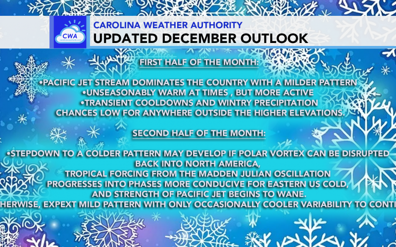
The graphic below depicts, in short, what we can expect for the rest of December:
Nonetheless, a “blowtorch” will plague us over the next 7 days or so, however clouds and even occasional rain may keep the torch from becoming too extreme. But days where the sun is out, it will feel more like early or mid fall.
Below is the Euro valid on December 15th:
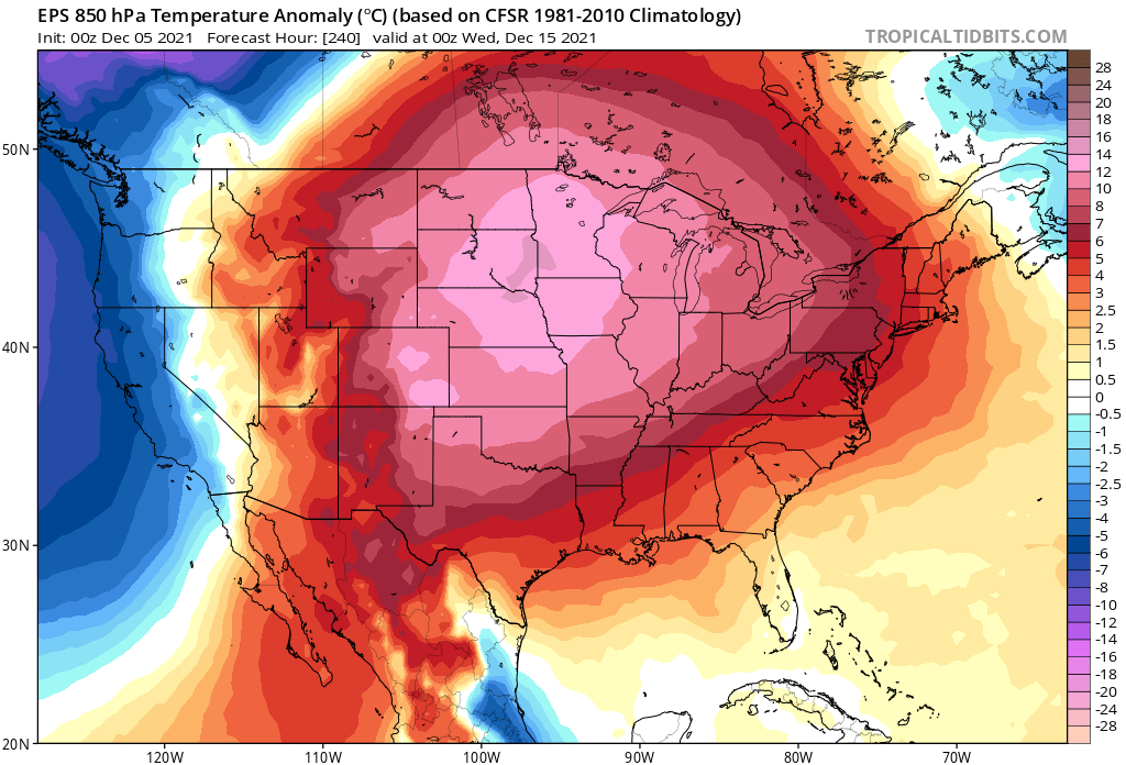
This is not exactly a favorable pattern for cold and snow in the Southeast. But the warm may be transient, meaning it doesn’t last long with cold air following behind.
After the 15th it’s pretty much anyone’s game. If we can get the Polar Vortex to weaken, it may drop a lobe down into North America. But this is a long shot.
There are multiple factors needed for a cool-down, and other than the abovementioned, the Pacific Jet stream needs to relax, and we will need a favorable MJO pattern.
All is not lost, we have not even officially begun winter just yet.
You must be logged in to post a comment.