
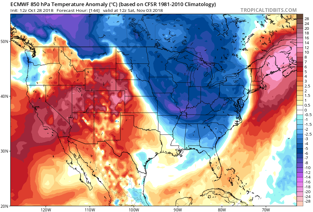
After a warm Halloween this week, we will experience yet another temporary change in the pattern. A powerful cold front will push east from the Plains later this week, bringing the threat for severe thunderstorms and possibly tornadoes. The threat could arrive along the East Coast as early as Thursday afternoon. Severe weather could extend from Alabama into the western side of the mountains. Behind the cold front the chill will be reinforced here in the East.
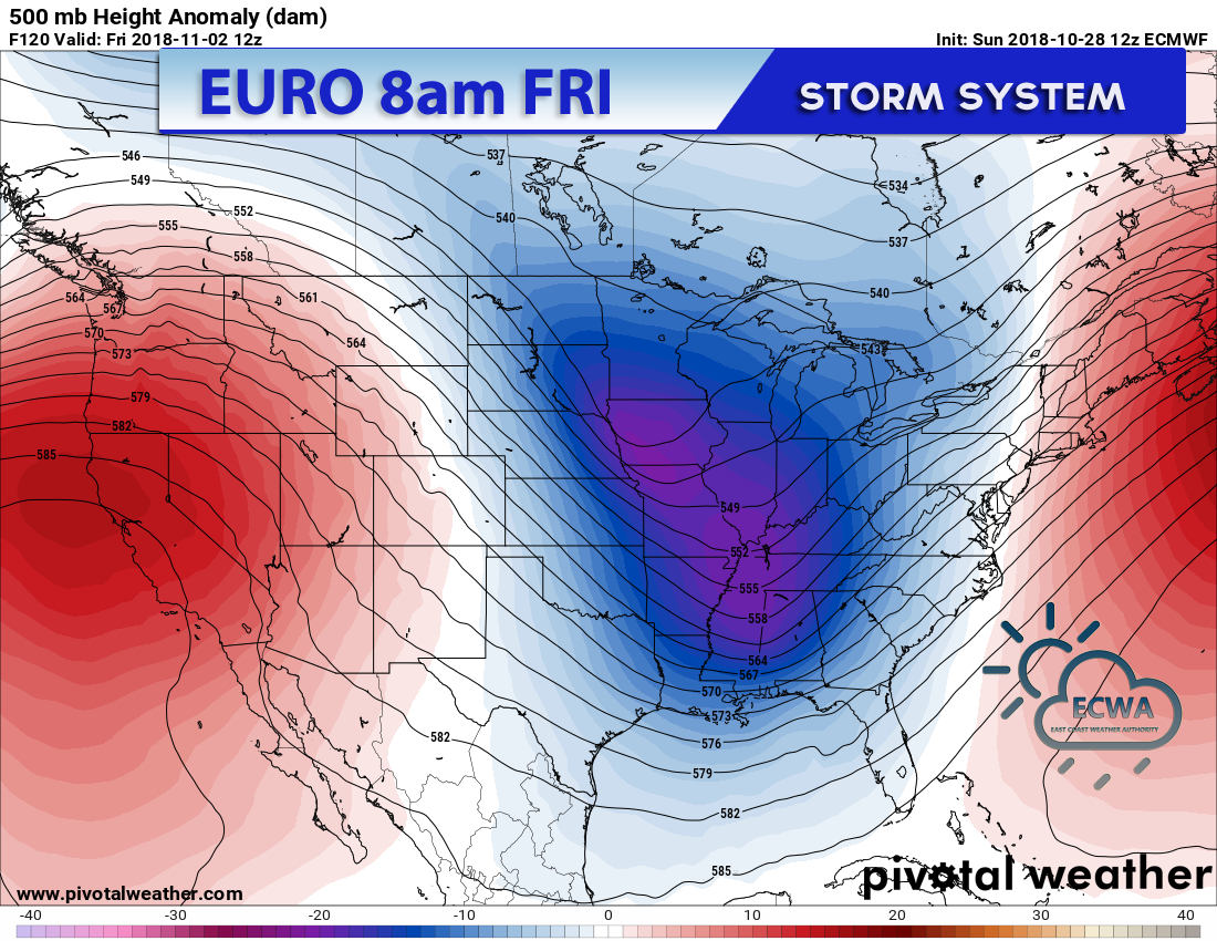
Next Wednesday could have some cold wake-up temperatures. Next Saturday on the Euro looks quite chilly, and it could be much cooler next weekend. While there could be flurries or snow showers in the mountains, it will be too warm for snow here in the Southeast.
Want more details? Sign up for our paid services today and get access to our premium blog and DAILY emails by following the link below!
You must be logged in to post a comment.