
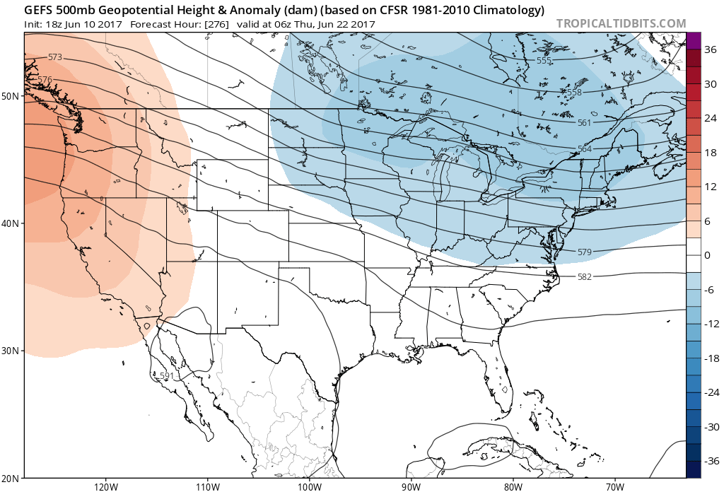
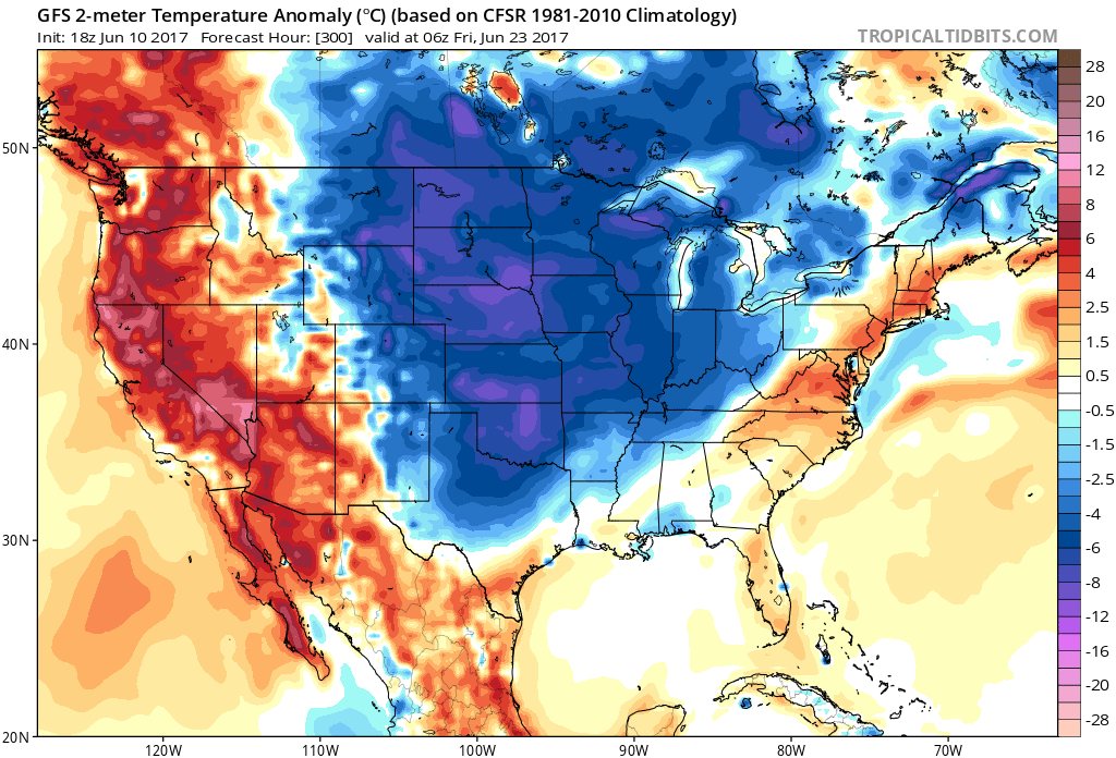
This week’s heatwave will make things uncomfortable, especially for those who work outside. The good news is that it will not last, and there will be an end in sight. While temperatures this week will be in the 90s, a powerful cold front will move through, possibly touching off severe weather later next week (Friday the 16th) or around this time. Behind the front things will cool off once again. I’m thinking that showers and thunderstorms will return along with the rain. Therefore, the rain activity will keep temperatures down to start off the official summer. First image is the 500 millibar height pattern anomaly, which shows a trough in the East, and hence cooler weather. Second image is the projected temperature departures from average. First image is the GEFS ensembles, second is the GFS. If the ensembles are showing a deep trough, you can bet it’s coming. Hang in there if you don’t like the heat and humidity.
Click here to like East Coast Weather Association on Facebook
Click here to like Carolina Weather Pro on Facebook
You must be logged in to post a comment.