
Summer is coming in full force across much of the Southeast and Mid-Atlantic with the Carolinas right in the heart of an early-season heatwave for the remainder of the month more typical of the middle of summer.
Expect temperatures reaching well into the 80s and even 90s in many areas for daytime highs in the Carolinas going into next week and likely Memorial Day weekend as well. In fact, many areas will be susceptible to maxing out near 100 degrees or higher as we near the holiday weekend with heat indices likely surpassing the 100 degree mark in many areas.
Also, keep in mind we will likely skew drier than normal in terms of how much precipitation we see over the course of this period coming up with any rainfall being associated with occasional scattered showers and thunderstorms that develop; mainly in the afternoon and evening hours. A weak cold front may spark some convection on Monday. Even with the occasional chance of convection, we don’t anticipate any prolonged rainfall events for awhile. We will certainly let you know of any changes in the days ahead as we are still a week out from the holiday weekend and models differ on solutions nearing Memorial Day itself. Make sure to check back as we get closer to that time frame.
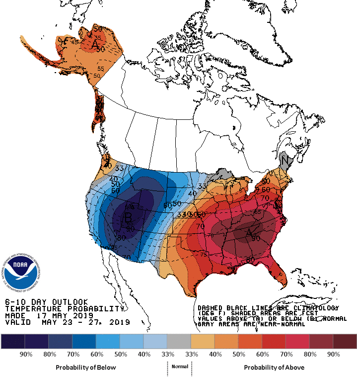
Shown is the latest 6-10 day outlook from the Climate Prediction Center highlighting a high likelihood for hotter than normal temperatures in the Southeast. This early season heatwave is more typical of something we would see in July and August versus late May so take all necessary precautions, especially if you have any outdoor activities.
-Jesse
East Coast Weather Authority
You must be logged in to post a comment.