
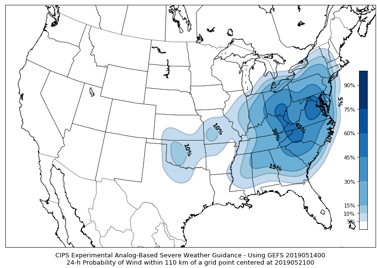
An experimental model based on past events, which is what we call “analogs” has been released by Saint Louis University. The parameters included are the probability of high winds, hail, and tornadoes. While this is a week away, we can use it as general guidance as to when the next severe event may unfold here in the Carolinas and Virginia. As of now, there is a 45% chance of the event happening and event higher perhaps in certain locations within the dark orange outline.

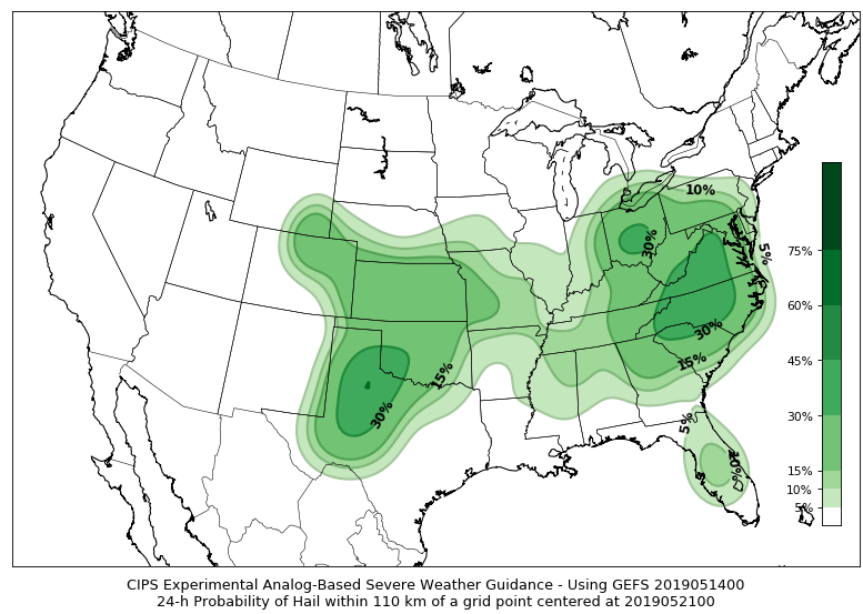
The biggest threats for this potential event are wind and hail, and not so much tornadoes. However, keep in mind no two events are similar, and this model is based upon past events.
Wind threat:
Hail threat:
This new experimental outlook can be found at Saint Louis University’s website : http://www.eas.slu.edu/CIPS/SVRprob/SVRprob.php?rundt=2019051400&fhr=F168&type=ALL&map=fill
The model is indicating there could be some kind of a threat later this week into this weekend for the East Coast, so stay tuned!
-ECWA
You must be logged in to post a comment.