
Intense Rain in the West May Lead to Downstream East Coast Flooding
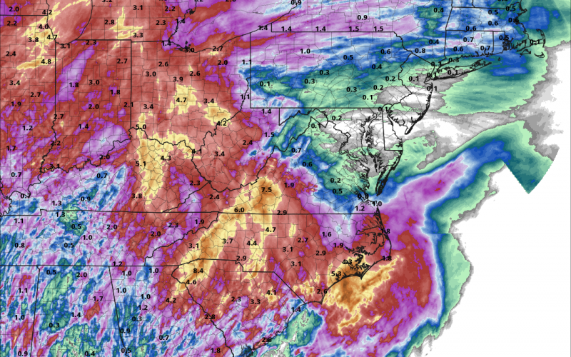
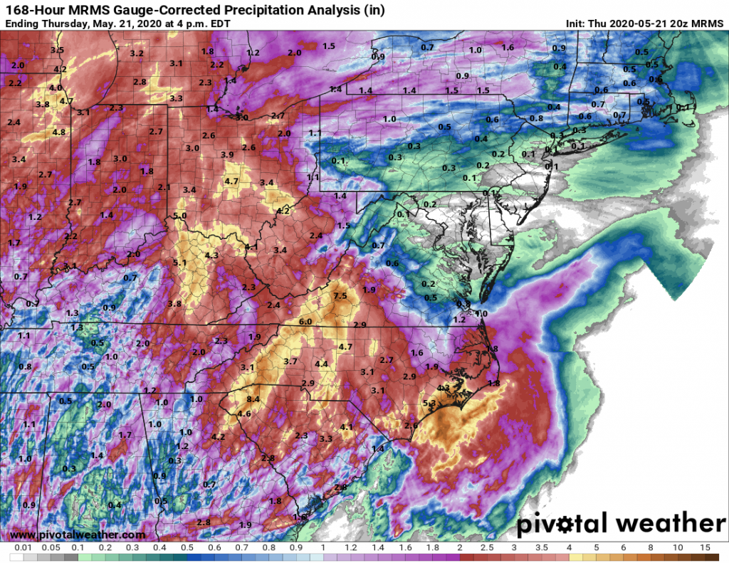
It has been a very wet week for North and South Carolina. The National Weather Service issued Flash flood advisories late in the day on Thursday for western North Carolina. As rain piles up in the west, the risk of potential east coast flooding increases. For evidence of the risk, we only need to look at the river and stream flow rates across the region. North and South Carolina have received a massive amount of rain, and it is not done yet.
In the map below, each circle represents a USGS river gauge. Current water level readings are represented by each shaded point. Darker colors represent higher percentiles as compared to the 30 year average. As you can see, many of these tributaries, streams, and rivers are well above their averages. As you can see, the highest values exist in the western portions of the states. Here, the Appalachian Mountains forced moist air higher into the atmosphere, enhancing rainfall totals. At the time of posting, 6 western rivers in North Carolina are already at flood stage. East coast flooding can occur days after a large event as the water works its way east via streams and rivers. You can view the most recent levels for North Carolina rivers using the USGS website.
Slowly Draining Rivers
As these waters flow downhill towards the coast, it is likely that locally flood-prone areas will experience minor to moderate flooding. If you live in an area near a stream or tributary, especially if it often the first to flood, you should make plans now to ensure the safety of yourself as well as your property. If you are still concerned about the potential for east coast flooding, you can check out the latest watches and warnings for North Carolina and South Carolina right here at Carolina Weather Authority.
Relief in Sight
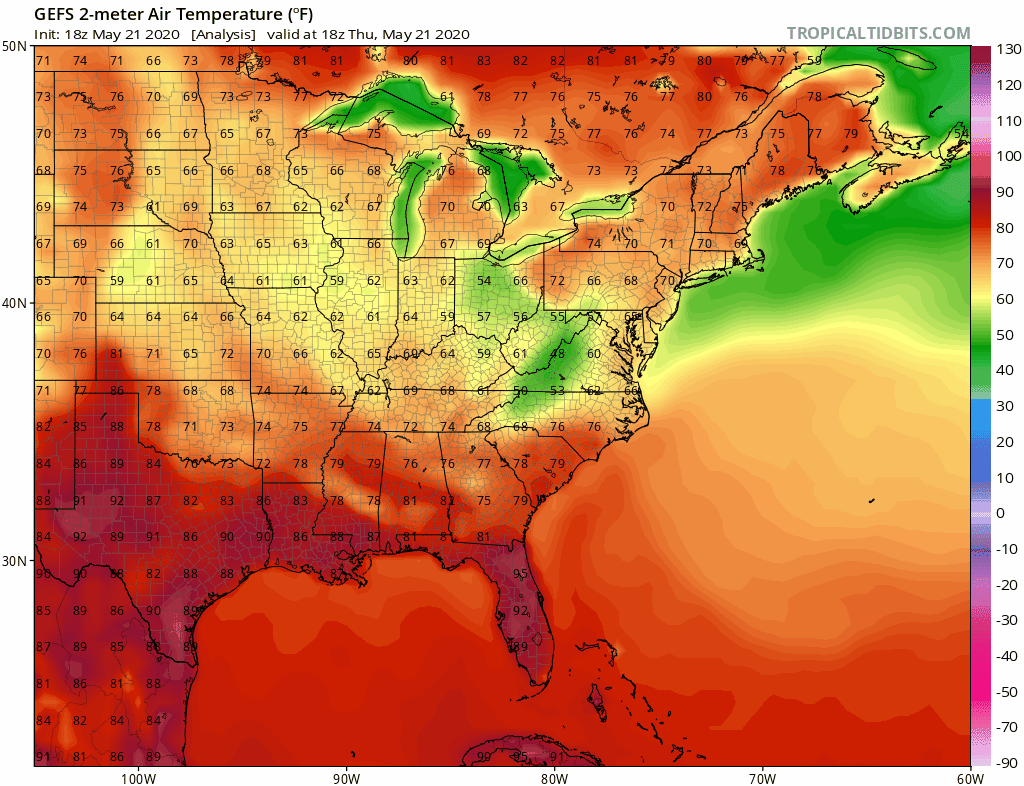
Thankfully, the upper level low which dominated the area’s weather for the last week is finally starting to lose some energy. Models agree that the cut-off low will be exiting our region by Sunday evening. The sun will return gradually with clouds clearing from west to east. Looking ahead, cool air will make for a pleasant Monday, but there will be consistent warming during the work week. Daytime highs will be in the low to mid 80s. Below you can check out the 7-day GFS surface temperature model. Each frame shows the 2:00pm temperature projection.
Until then, stay dry and stay safe!
You must be logged in to post a comment.