
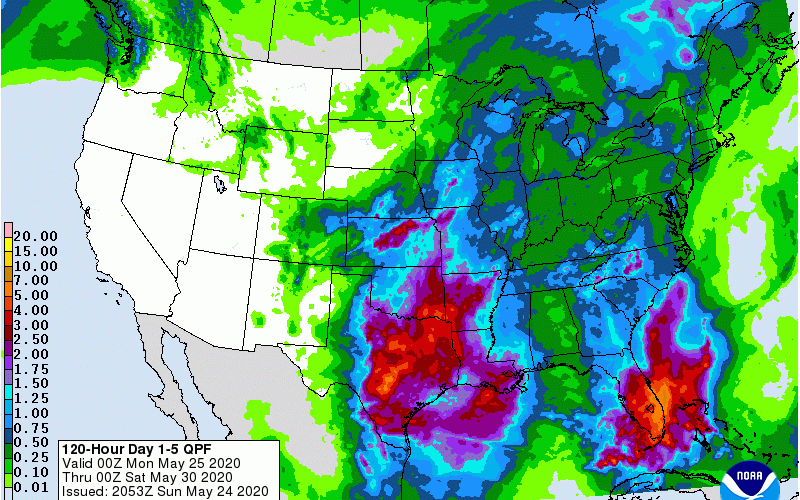
We are currently stuck in a wet pattern, and that pattern does not looks to break anytime soon. There will be some more warm days this week as we could touch or break 90 degrees again, but afternoon and evening storms will persist.
These storms will be the type that will not move much once they form, thus causing streams and rivers/lakes to flood. Ponding on the roads will also be an issue. The already saturated grounds will cause little tolerance for any additional heavy rains.
Rain totals will be on the soaking side along the I-85 corridor from Charlotte to Greensboro and to the west of Raleigh. Much of SC and NC will also remain wet, with little drying.
What this means is that the daytime, evenings and mornings will be on the humid side. where it will be easier to sweat when we are outside. When the sun is out, or if it’s not raining at night, it’s like being in a steam-bath.
At least this puts a dent into any kind of drought issue.
As a reminder, DO NOT drive into flooded roads, as the water may be deeper than you think. You don’t want to lose your car or truck and have to be rescued.
-CWA
You must be logged in to post a comment.