
Here we go, the unusually cold air is there, and it is already making headlines with snow pictures from the NC mountains to New England. It was certainly cold across the Southeast this morning, but we have not had our coldest night yet. When the wind calms down later tonight and things become still, conditions will become favorable for frost across much of NC and the Upstate of SC.
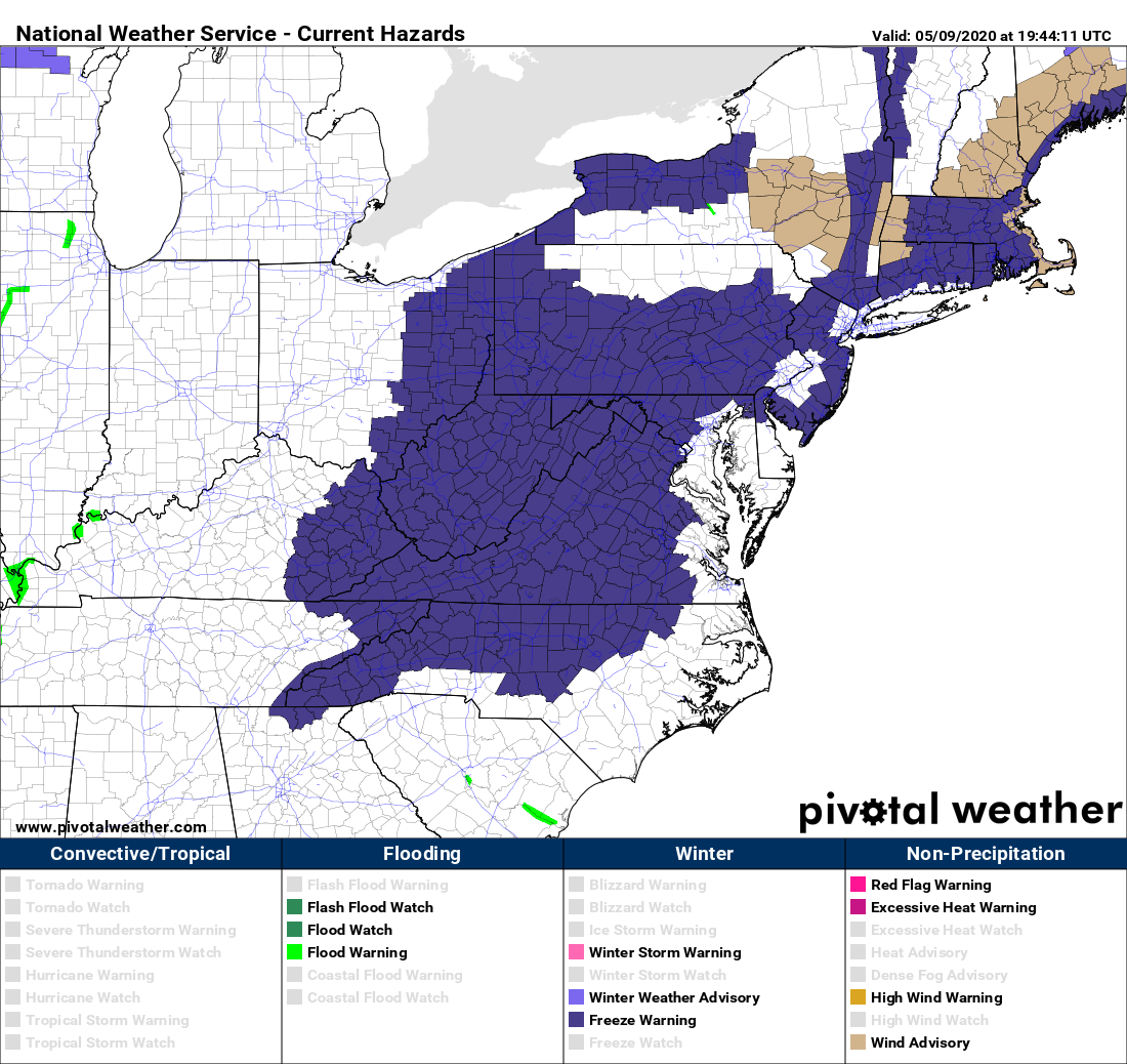
Currently, there are widespread Freeze Warnings in effect through Sunday morning:
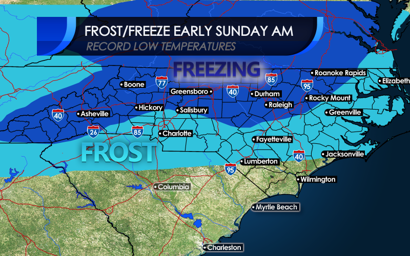
However, this does not include the frost advisories that expand outward from the Freeze Warnings. We have included this area in our graphic below:
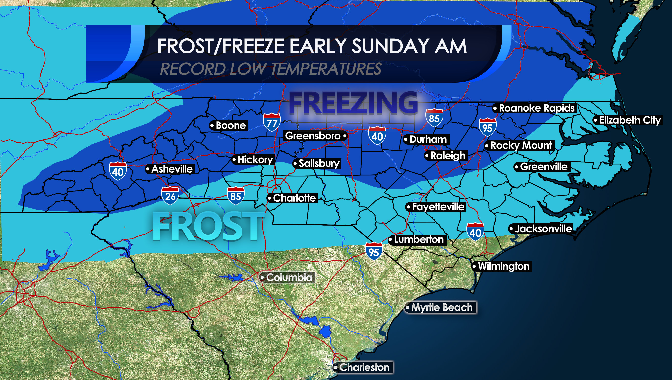
In the dark blue, temperatures will be at either 32 degrees F or below, and in the bright blue temperatures will be between 32 and 40 degrees F. Remember, frost can occur even if the air temperature is above freezing. It is due to surface objects being at or below freezing due to radiational cooling.
Take measures to protect your sensitive plants and gardens tonight! Preparations should have been made before last night.
This looks to be our last significant cold shot for a while, since next weekend is looking much closer to normal, with highs bouncing back into the 80s!
If you found this article informative, please share with your family and friends using the share buttons, thank you ~!
-CWA
You must be logged in to post a comment.